Eureka's March 2026 Was the Driest in a Century, Records Show
Eureka's March 2026 brought less than half an inch of rain, the driest in 100 years, while Trinity Alps snowpack hit near zero, sharpening wildfire risk and compressing the summer water window.

The rain gauge at the National Weather Service office in Eureka registered less than half an inch for all of March 2026, finishing at roughly one-eleventh of the city's historical March average of about 5.5 inches. The total makes last month the driest March Eureka has recorded since 1926 and only the second-driest in the 140-year period since the station began keeping data in 1886. Meteorologist Jacob Boomsma said the city's overall 12-month water year still sits at approximately 88% of normal, credit owed to an unusually wet December and January. "So we're doing pretty good this year for precipitation, but March really fell off," Boomsma said.
That fall-off is now visible in the mountains above Humboldt's watersheds. Snowpack across the northern Sierra Nevada and Trinity Alps declined to near zero in some locations after running below average for most of the water year. The mechanism is temperature: instead of snow accumulating at elevation, warmth converted precipitation into rain, yielding little stored water to release gradually as runoff through spring and into summer. For residents on systems fed by the Trinity River or smaller local streams, that missing snowpack is the more consequential number behind the March rainfall deficit.
The warmth extended well beyond the North Coast. Climate Prediction Center data showed much of the American West running 3 to 9 degrees Fahrenheit above normal last month. San Francisco recorded its first 90-degree March temperature since its observations began; Ukiah tied a historic March high. Boomsma noted that human-caused climate change is a contributing factor to the amplified warm, dry swings that produced March 2026.
The combination translates to compressed timelines for anyone managing land or water in Humboldt County. Gardens and farms that would ordinarily draw on late-season rain before turning to stored or diverted water are starting April without that buffer. Reservoir and groundwater operators face a drawdown curve that could steepen if April also runs dry. The 88% water-year figure is not a crisis, but the gap between that headline number and the depleted snowpack is where the real summer risk lives.
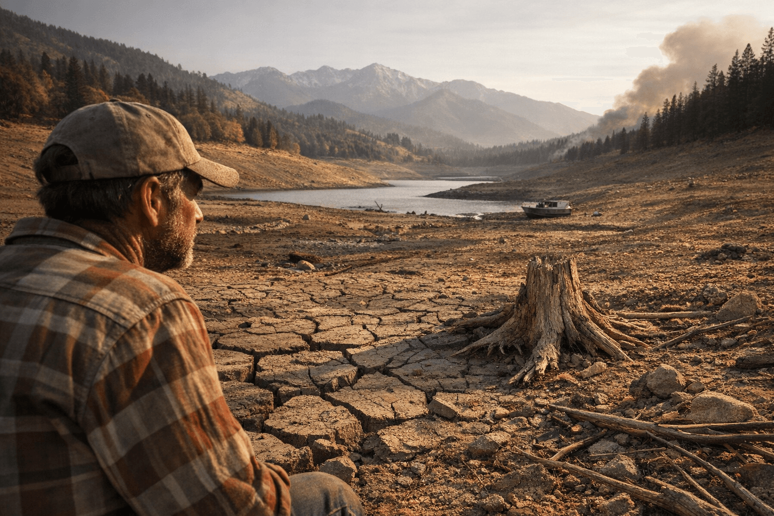
Wildfire hazard follows the same logic. Dry March soils mean vegetation is curing ahead of its typical schedule, and the optimal window for cutting defensible space is open now, before grasses go brown. California requires 100 feet of cleared defensible space around structures in designated fire-hazard zones; this spring's early drying makes completing that work in April rather than May a practical priority. CAL FIRE and the Humboldt County Office of Emergency Services both post local guidance online. Current fire-weather conditions are updated daily through the National Weather Service Eureka forecast page, and regional snowpack and reservoir levels can be tracked through the California Data Exchange Center.
If April resets to near-normal rainfall, the water year will likely close without a formal drought declaration for Humboldt. But the last time Eureka saw a March this dry was during the Coolidge administration, and the margin for error heading into summer has narrowed considerably.
This article was produced by Prism’s automated news system from verified source data, official records, and press releases, then run through automated quality and moderation checks before publishing. The system is built and supervised by the people who set the standards it runs under. Read our full AI policy.
Did this article answer your question?