Strong thunderstorms, hail threaten Iron County through Wednesday evening
A storm near Amasa threatened mainly rural northeastern Iron County with 30-plus mph winds and half-inch hail, while a separate cell hit Iron Mountain with 40 mph gusts.

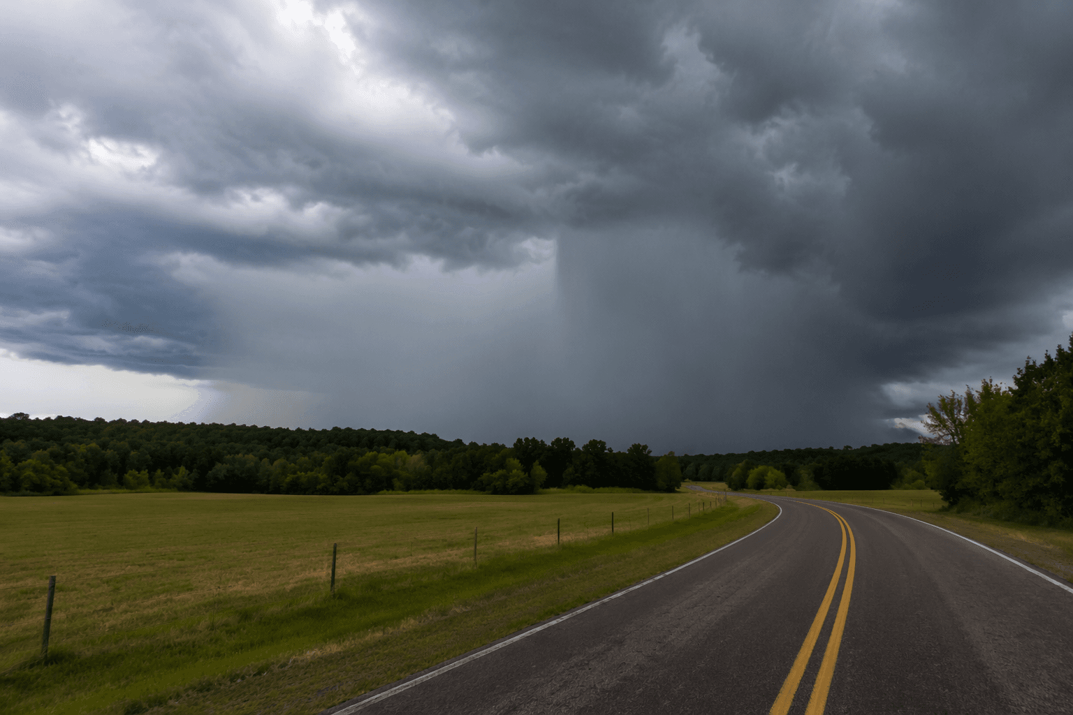
Strong thunderstorms swept across Iron County with enough force to knock down tree limbs, toss unsecured outdoor items and leave minor hail damage on vegetation as the National Weather Service tracked severe cells moving east through the western Upper Peninsula. At 4:14 p.m. CDT on June 5, Doppler radar showed a storm near Amasa, about 13 miles north of Crystal Falls, moving east at 25 mph and carrying winds in excess of 30 mph and half-inch hail.
The Weather Service said that storm was expected to stay over mainly rural areas of northeastern Iron County, limiting the immediate target but not the risk. Its warning pointed to gusty winds that could break limbs and blow around loose objects, along with hail that could damage gardens, crops and other vegetation in the storm’s path.
A separate special weather statement at 3:22 p.m. CDT warned of another strong thunderstorm over Iron Mountain, where wind gusts were forecast up to 40 mph with half-inch hail. Taken together, the two alerts showed a broader severe-weather setup across the Upper Peninsula of Michigan, with storms developing quickly enough to trigger warnings in multiple counties during the same afternoon.
NWS Marquette’s weather story had already placed the Upper Peninsula under a slight risk, level 2 of 5, for severe thunderstorms. The main threats were damaging winds, large hail, frequent lightning and possible tornadoes, with the most likely storm window running from the afternoon into the night.
For Iron County residents, the immediate concern was wind-driven damage in rural parts of the county rather than widespread structural destruction, but the hail and gusts were still strong enough to justify close attention. The Weather Service urged people to stay up to date and use multiple ways to receive warnings, a reminder that fast-moving Upper Peninsula storms can shift from a radar track near Amasa to a hazard for Crystal Falls-area roads and nearby homes in a matter of minutes.
This article was produced by Prism’s automated news system from verified source data, official records, and press releases, then run through automated quality and moderation checks before publishing. The system is built and supervised by the people who set the standards it runs under. Read our full AI policy.
Know something we missed? Have a correction or additional information?
Submit a Tip