Kauai Faces Rough Surf, Strong Winds and Heavy Showers This Weekend
A kona storm bearing down on Kauai this week is forecast to push seas to 13 feet off the northwest coast by Saturday, with a Small Craft Advisory already in effect.

A powerful kona storm developing to the northwest of the Hawaiian Islands is driving a sharp deterioration in ocean conditions around Kauai this week, with a Small Craft Advisory now in effect for Kauai Northwest Waters from Tuesday morning through early Wednesday morning and seas forecast to build as high as 13 feet by Saturday.
The National Weather Service Honolulu issued the warning Monday afternoon, describing the approaching system in blunt terms: "A powerful kona storm developing to the northwest will approach the state on Tuesday bringing a period of wet unsettled weather and strong southerly winds to coastal waters through the forecast period." High pressure far to the northeast of the state is drifting east through the week, allowing the storm to tighten its grip on the island chain.
Local surf and weather briefings published March 9 had already flagged an unsettled transition for Kauai's surf through March 10-11, with trade-wind shifts, returning west-northwest swells and a chance for locally heavy showers and gusty southeast winds. By Monday night, the Hanalei buoy was recording swells of 6.9 feet at 10 seconds, while the Northwestern Hawaii One buoy, farther out in the open ocean, was showing 10.5 feet at 10 seconds with winds running 19 to 25 knots out of 170 degrees.
Conditions are forecast to worsen significantly through the end of the week. For Kauai Northwest Waters on Friday, the National Weather Service projects south winds building from 20 knots to south-southwest 25 to 30 knots, with seas reaching 8 to 11 feet. The dominant wave component will be a south swell of 11 feet at 8 seconds, layered on top of a west-northwest component of 4 feet at 9 seconds and a north swell of 3 feet at 13 seconds. Thunderstorms are expected through Friday night, with heavy showers and isolated thunderstorms persisting through the day.
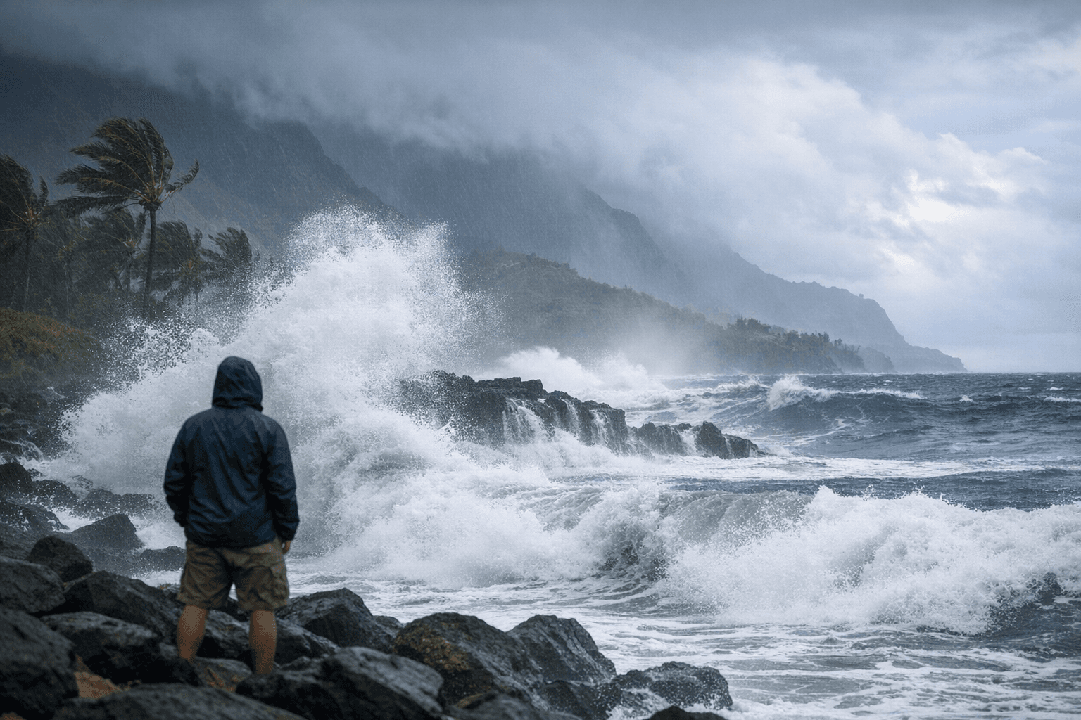
Saturday brings the worst of it. The forecast calls for southwest winds of 25 to 30 knots easing only slightly to 20 to 25 knots after midnight, with seas climbing to 9 to 13 feet. Wave detail shows a south-southwest component of 11 feet at 8 seconds, a west-northwest component of 5 feet at 10 seconds and a north component of 3 feet at 12 seconds. The National Weather Service added a specific caution: "Winds and seas higher in and near tstms."
The Small Craft Advisory also covers Kauai Leeward Waters beginning Tuesday, though the full leeward forecast was not available in the advisory text released Monday. The forecast applies to Hawaiian coastal waters within 40 nautical miles, including the Hawaiian Islands Humpback Whale National Marine Sanctuary. Anyone planning to launch from Nawiliwili, Port Allen or any small-boat facility on Kauai should check for advisory updates directly with the National Weather Service Honolulu before heading out.
Know something we missed? Have a correction or additional information?
Submit a Tip