NWS Issues High Surf Warning for North, West Shores of Niʻihau, Kauaʻi
NWS warns of dangerous 20-30 foot surf on north- and west-facing shores of Niʻihau and Kauaʻi, raising coastal flooding and navigation risks for residents and mariners.

The National Weather Service in Honolulu has issued a High Surf Warning for north- and west-facing shores of Niʻihau, Kauaʻi, Oʻahu and Molokaʻi, with surf expected to surge well above warning thresholds and pose hazards to shoreline communities. The warning is in effect until 6 p.m. HST Saturday, Jan. 31, and a broader Coastal Flood Statement remains active through Monday afternoon.
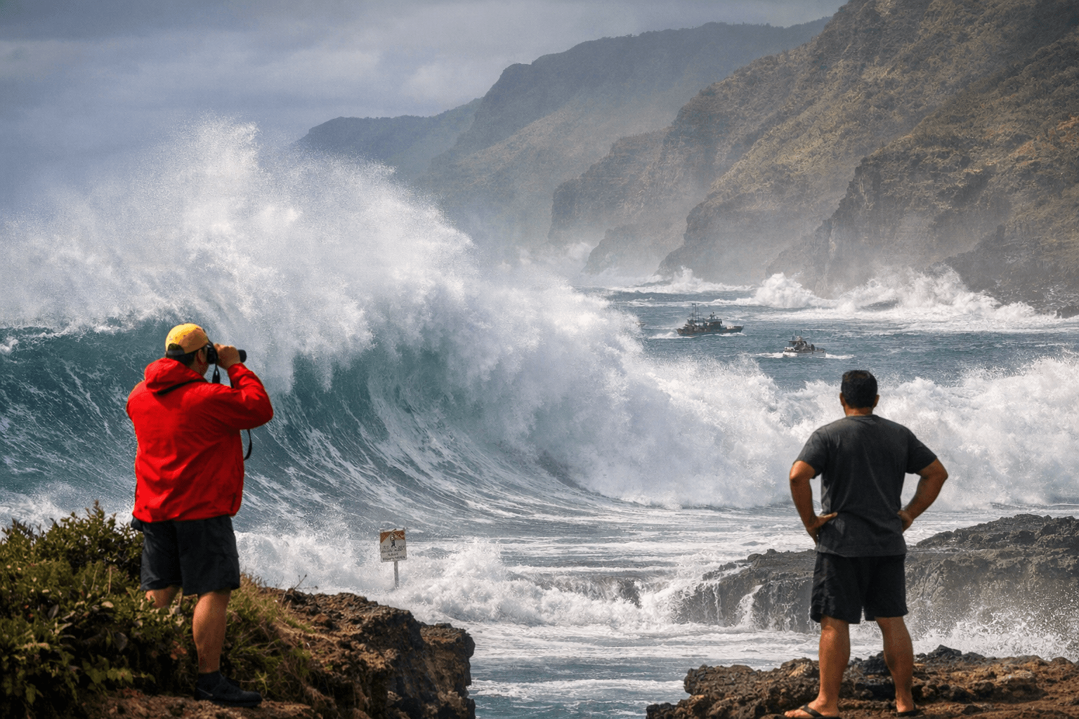
NWS product language underscores the severity: “HIGH SURF WARNING IN EFFECT UNTIL 6 PM HST SATURDAY FOR NORTH AND WEST FACING SHORES OF NIIHAU KAUAI OAHU AND MOLOKAI...” Forecasts call for north-facing shores to build to 20 to 30 feet and west-facing shores to 20 to 25 feet by Friday afternoon into the evening. Localized sequencing on Kauaʻi and Niʻihau shows lower breaking heights earlier in the day - north-facing waves rising to 10 to 16 feet and west-facing waves 8 to 12 feet - before climbing into the higher ranges by Friday and peaking late Friday into Saturday as a second, larger long-period northwest swell arrives.
The warning stems from two overlapping northwest swells. Forecasters reported a moderate-to-large swell already peaking early Friday morning and a larger long-period swell building later in the day that will push surf higher through Saturday before gradually subsiding over the weekend. The NWS also cautioned that a “combination of large surf and higher than predicted water levels will lead to flooding of beaches that typically remain dry, especially at and around the peak daily tide during the early morning hours between midnight and sunrise.” Communities should expect nuisance coastal flooding, erosion risk, and elevated wave run-up during those tide windows.
Public-safety guidance is direct and repeated across official products: “Stay away from the shoreline along the affected coasts. Be prepared for road closures. Postpone entering or leaving channels affected by the high surf until the surf subsides.” Kauai Now’s advisory adds a plain message for locals: “when in doubt, don’t go out.” Lifeguards and harbor operators will likely emphasize those precautions as small craft advisories are already in place for many surrounding waters because of strong winds and rough seas.
For Kauaʻi residents, the immediate impacts are twofold: hazardous conditions for swimmers and surfers and potential disruptions to ocean-dependent businesses and recreation. Boats and canoes stowed on beaches face risk from powerful waves; the NWS product specifically warns about impacts to watercraft. Road access near low-lying coastlines could be affected during peak tides, and channel navigation may be dangerous while waves break at entrances.
The weather pattern also includes a weak cold front moving across the islands through Saturday and a stronger front expected late Sunday, which could bring heavier rain and gusty winds next week. For now, focus is on marine safety and protecting shoreline property ahead of the peak surf late Friday into Saturday. Heed ocean-safety officials, secure beach equipment, and avoid wet rocks or areas showing recent wave coverage, since those are where waves can knock people over or sweep them out into the water. What happens next will be determined by swell decay and official updates from NWS Honolulu; residents should monitor notices and prepare for lingering coastal flooding into Monday.
This article was produced by Prism’s automated news system from verified source data, official records, and press releases, then run through automated quality and moderation checks before publishing. The system is built and supervised by the people who set the standards it runs under. Read our full AI policy.
Did this article answer your question?