Idaho Panhandle National Forests Plan Prescribed Burns to Protect Communities
Prescribed burns launched across Idaho Panhandle National Forests will bring smoke to Kootenai County valleys this spring, with operations near 4th of July Pass and the Fernan saddle area already underway.
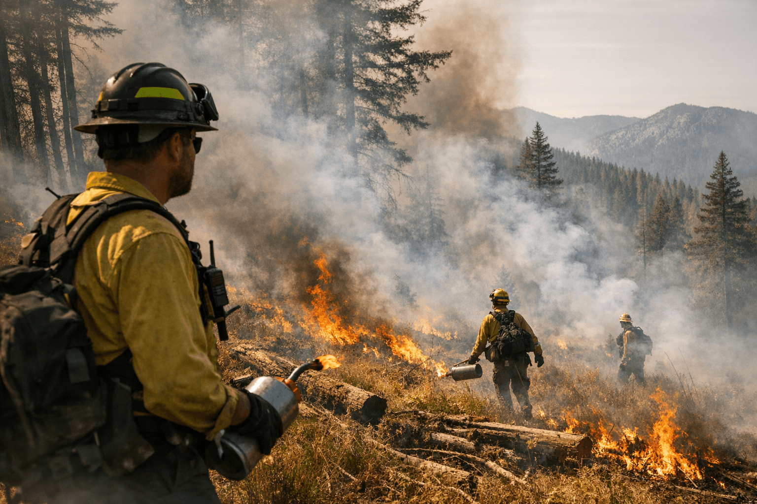
Smoke rising from the ridgeline east of 4th of July Pass is not a wildfire. The U.S. Forest Service launched a series of prescribed burns across the Idaho Panhandle National Forests on April 7, activating multiple units simultaneously as conditions aligned for the first time this spring.
The Coeur d'Alene River Ranger District, whose lands sit directly adjacent to populated eastern Kootenai County, is among the most active fronts in this effort. Burn units span the Fernan saddle area running to Burn Cabin summit, the Mason Creek drainage east of 4th of July Pass, the Short Creek drainage, and multiple drainages within the Upper North Fork Coeur d'Alene River Basin. Additional operations are underway in the Ridge Creek project area, covering the Chilco, Conie, East Fork Hayden, Middle Fork Hudlow, and West Fork Hudlow Creek drainages, along with sites near Prichard and the Burnt Cabin drainage.
Elsewhere in the forest, the Priest Lake Ranger District is burning near Jasper Mountain north of Priest River, while the Bonners Ferry Ranger District is treating the Boulder, Snow, Hellroaring, and Twentymile Creek drainages. The St. Joe Ranger District has operations along the St. Joe Divide near the historic Red Ives Ranger Station, in Marble Creek, and in the Malin Creek drainage south and east of Avery.
The Forest Service confirmed it evaluates weather conditions in the hours immediately before each ignition. Wind, humidity, and fuel moisture thresholds must all fall within prescription before a burn proceeds, and any scheduled operation can be canceled if conditions shift. That built-in caution is part of why the burns are staged in smaller units rather than lit all at once.
Affected areas will close to the public for several days during active operations. Warning signs will be posted along roads near each unit. Residents downwind, particularly those in valley bottoms and low-elevation neighborhoods across Kootenai County, should expect intermittent smoke. The Forest Service is directing anyone monitoring air quality to fire.airnow.gov for real-time conditions. Drivers encountering smoke on roads are urged to slow down and turn on headlights.
People with respiratory conditions, livestock concerns, or outdoor plans tied to trails near the Fernan Saddle, the North Fork Coeur d'Alene corridor, or the 4th of July Pass recreation area should check current closure notices before heading out. The Forest Service noted that operations will continue through spring as favorable weather windows appear, with no fixed end date.
The prescribed fire program is a long-term strategy to reduce the dense, overgrown vegetation that has accumulated across North Idaho forests over decades of fire suppression. Removing that fuel load now, under controlled conditions, is designed to limit the scale and intensity of wildfires that would otherwise threaten Kootenai County communities during peak summer fire season.
This article was produced by Prism’s automated news system from verified source data, official records, and press releases, then run through automated quality and moderation checks before publishing. The system is built and supervised by the people who set the standards it runs under. Read our full AI policy.
Did this article answer your question?
