Post Falls ranks among fastest-growing U.S. cities again
Post Falls reached 46,715 residents in July 2025, up 21% since 2020 and No. 84 nationally. City leaders are already updating plans for housing, traffic and services.

Post Falls reached 46,715 residents on July 1, 2025, a 21% jump from 38,620 in April 2020, and that growth put the city at No. 84 among nearly 1,900 U.S. places with more than 20,000 people. The pressure is already visible in planning work that stretches from Post Falls to the rest of Kootenai County.
The Census Bureau’s Vintage 2025 estimates use July 1 as the reference date. In the same set, Coeur d’Alene was estimated at 58,179 residents, up 6.5% from 54,649 in 2020, a much slower pace than Post Falls. Kootenai County also saw housing-unit increases of at least 2.5% between 2024 and 2025.
City leaders have already responded by updating the Post Falls Comprehensive Plan. The City Council approved the 2025 Comprehensive Plan Update on March 18, 2025, and the document is a long-range, 20-year plan that guides growth, infrastructure, services and quality of life. The update will include a Housing Needs Assessment and a Fiscal Impact Analysis, two tools meant to show where new homes can go and what they will cost the city to support.

That fiscal question is not theoretical. Post Falls held a workshop on the impact analysis process with Urban3. The work ties directly to zoning and development regulations, which means the census numbers are now feeding into the rules that will shape what gets built next in Post Falls.
Traffic is another immediate concern on the Rathdrum Prairie. The Idaho Transportation Department and the Kootenai Metropolitan Planning Organization are holding a fifth public meeting in July 2026 for the Rathdrum Prairie Area Transportation Study, which is focused on improving safety, traffic flow and system reliability. KMPO was formed in 2003 after Coeur d’Alene, Post Falls and Hayden passed a combined population of 50,000, triggering federal transportation planning requirements.
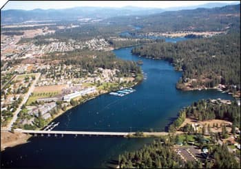
Kootenai County covers 1,237.8 square miles and is Idaho’s 24th largest county by total area, so every new subdivision, road project and utility extension has to be matched to a wide and still-growing footprint.
This article was produced by Prism’s automated news system from verified source data, official records, and press releases, then run through automated quality and moderation checks before publishing. The system is built and supervised by the people who set the standards it runs under. Read our full AI policy.
Did this article answer your question?