Bouse Wash Reaches 100-Year Flood Level, Inundating Homes and Streets
Properties west of Evans Avenue sat under 2-4 feet of flowing water as Bouse Wash hit a 100-year flood level Thursday, reaching the Main Street bridge.
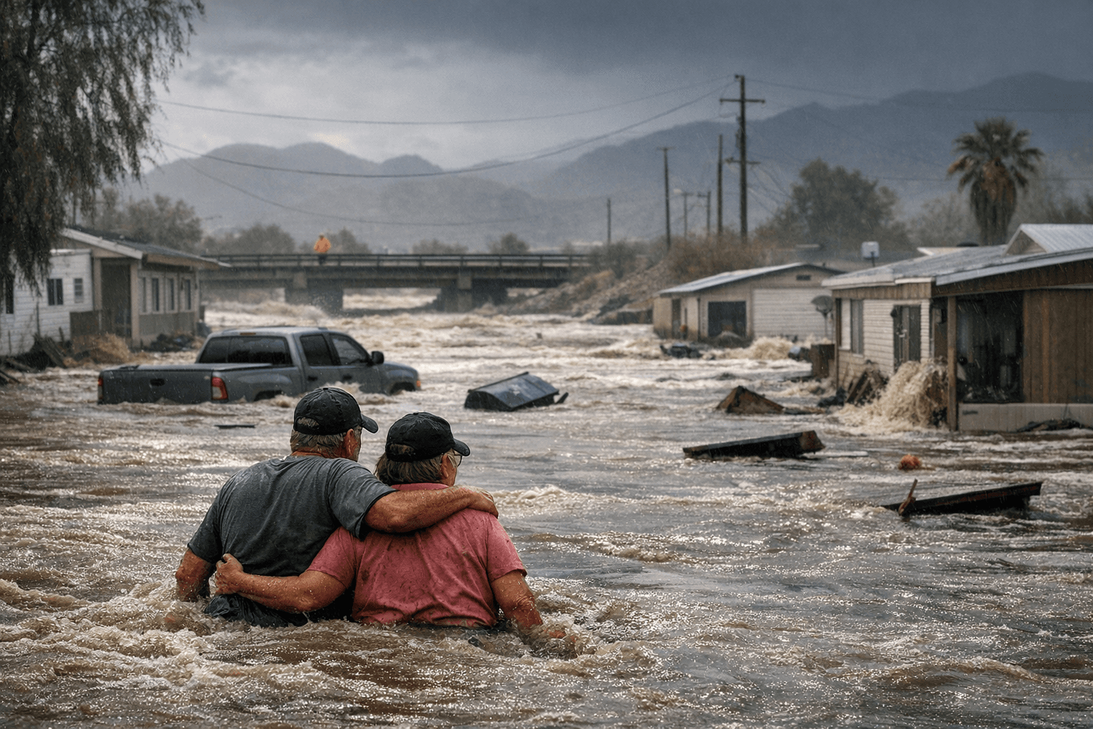
The low cord of the Main Street bridge in Bouse was reached Thursday evening as Bouse Wash surged to a 100-year flood level, sending 2 to 4 feet of flowing water into properties west of Evans Avenue and triggering what federal monitors described as widespread flooding throughout the community.
The U.S. National Water Center's streamgage for "Bouse Wash at Bouse" recorded the sharp stage rise and issued official flood-impact statements at 7:20 p.m. MST on March 26. The federal gauge, part of NOAA's National Water Model network, translates raw hydrograph readings into plain-language impact descriptions, the kind of operational text local emergency managers use to prioritize road closures and request state assistance when conditions exceed local capacity.
A 100-year flood carries a one-percent probability of occurring in any given year, meaning events of that magnitude are rare enough to strain infrastructure not designed to handle them. In Bouse, Thursday's peak brought bridge low-cord contact on Main Street and inundated homes and mobile homes west of Evans Avenue.
Do not attempt to drive through flowing water in or near Bouse. Even a few inches of moving flow can disable a vehicle and endanger occupants. The NWS Phoenix office is issuing correlated flash-flood warnings, and the Arizona Department of Transportation's Arizona 511 service carries updated road-condition reports for affected corridors across the region.
Anyone who experienced property damage should document losses with time-stamped photographs and contact La Paz County emergency management and their insurance carrier as soon as possible. A documented event at the 100-year level can affect FEMA flood-insurance designations, future premiums, and lending conditions on properties within the floodplain.
Thursday's event raises infrastructure questions that extend well past the immediate emergency. County and regional planners typically use major episodic floods to re-evaluate floodplain maps, assess bridge and culvert capacity, and weigh mitigation investments such as bridge raising or buyouts for parcels that flood repeatedly. How La Paz County responds in the coming weeks, including any public-meeting notices about post-flood assessments, will signal how seriously officials treat the scale of what Bouse absorbed Thursday night.
This article was produced by Prism’s automated news system from verified source data, official records, and press releases, then run through automated quality and moderation checks before publishing. The system is built and supervised by the people who set the standards it runs under. Read our full AI policy.
Did this article answer your question?