Lafayette County Tables CR 418 Dirt Mine Permit, Demands Defined Site
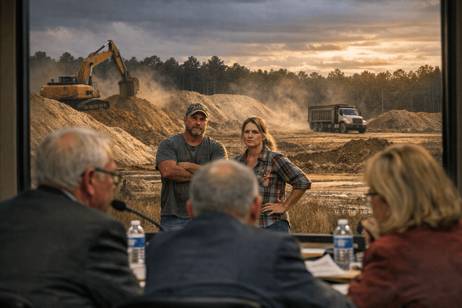
Ste-Bil Grading couldn't tell commissioners where on a 165-acre CR 418 tract it planned to dig, and a "hard no" from the bench put the dirt mine permit on hold.

A dirt-mining permit for County Road 418 ran into a hard stop when Ste-Bil Grading could not tell the Lafayette County Commission exactly where it planned to break ground. Commissioners voted March 23 to table the conditional-use application, demanding the company return with a clearly mapped 4-acre excavation footprint before any approval moves forward.
The permit would have allowed soil excavation across the full 165-acre tract owned by JW McCurdy that Ste-Bil leases, with the stated purpose of supplying fill material for the Highway 7 widening project. The problem: company representatives said they need to drill test holes, potentially as deep as 25 feet, before they can pinpoint where usable material actually lies. That answer left commissioners unmoved.
Commissioner Ray Garrett said he would be a "hard no" without specifics, and the board broadly described granting a permit over the entire 165 acres as "cart before the horse." Director of Planning Services Joel Hollowell backed that position, telling commissioners his office could not recommend approval without knowing the precise 4-acre area Ste-Bil intends to work.
Neighbors who packed the hearing pressed questions the company could not fully answer: which roads would carry truck traffic, what hours excavation would run, and how dust, noise, and drainage would be controlled. Setback concerns surfaced as well. Those questions took on a sharper edge when a Ste-Bil representative admitted the company's crews had already crossed a property line, cut trees, and removed a fence on adjacent land before any permit was granted. The company owner promised to repair the damage.
The tabling is not a denial, but it raises the bar for what Ste-Bil must produce before the application comes back for a vote. Commissioners directed the company to conduct only limited, controlled testing so a precisely mapped site can be submitted for review. County planning staff will then evaluate that report alongside traffic management proposals, erosion and sediment controls, and mitigation plans before the item returns to the board.
For the Highway 7 project, that sequence means a potential delay if suitable soil cannot be confirmed quickly. Contractors have argued that locally sourced fill cuts hauling costs and keeps heavy trucks off more distant routes; neighbors along CR 418 counter that a working mine trades one traffic burden for another, one far closer to home.
The commission's stance sets a clear procedural marker for Lafayette County's handling of extractive-use applications: bring a defined site, a transparent plan, and answers to neighbor concerns, or don't expect a vote.
This article was produced by Prism’s automated news system from verified source data, official records, and press releases, then run through automated quality and moderation checks before publishing. The system is built and supervised by the people who set the standards it runs under. Read our full AI policy.
Did this article answer your question?