Severe thunderstorm watch issued for Lafayette County until 10 PM
Quarter-size hail, 70 mph winds and frequent lightning were in play in Lafayette County, with the watch set to expire at 10 p.m.
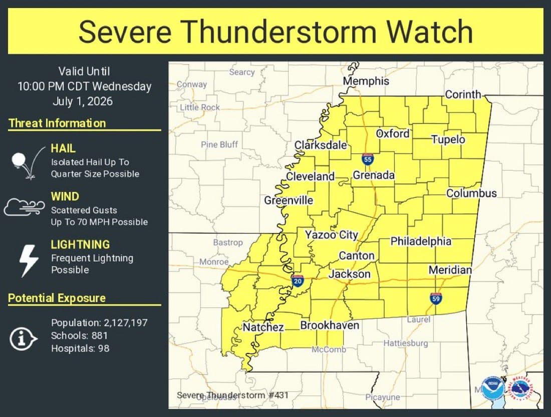
National Weather Service Memphis put Severe Thunderstorm Watch 431 over Lafayette County until 10 p.m. CDT Tuesday, covering 22 north Mississippi counties and including Oxford. The watch brought a risk of quarter-size hail, wind gusts up to 70 mph and frequent lightning.
Lafayette County Emergency Management urged residents to secure loose items, avoid outdoor activities and go indoors when thunder is heard. That warning carried extra weight in Lafayette County, where heat index values reached 106 degrees earlier in the week, adding strain for anyone outside and making it harder for residents and responders to stay safe while storms moved through.
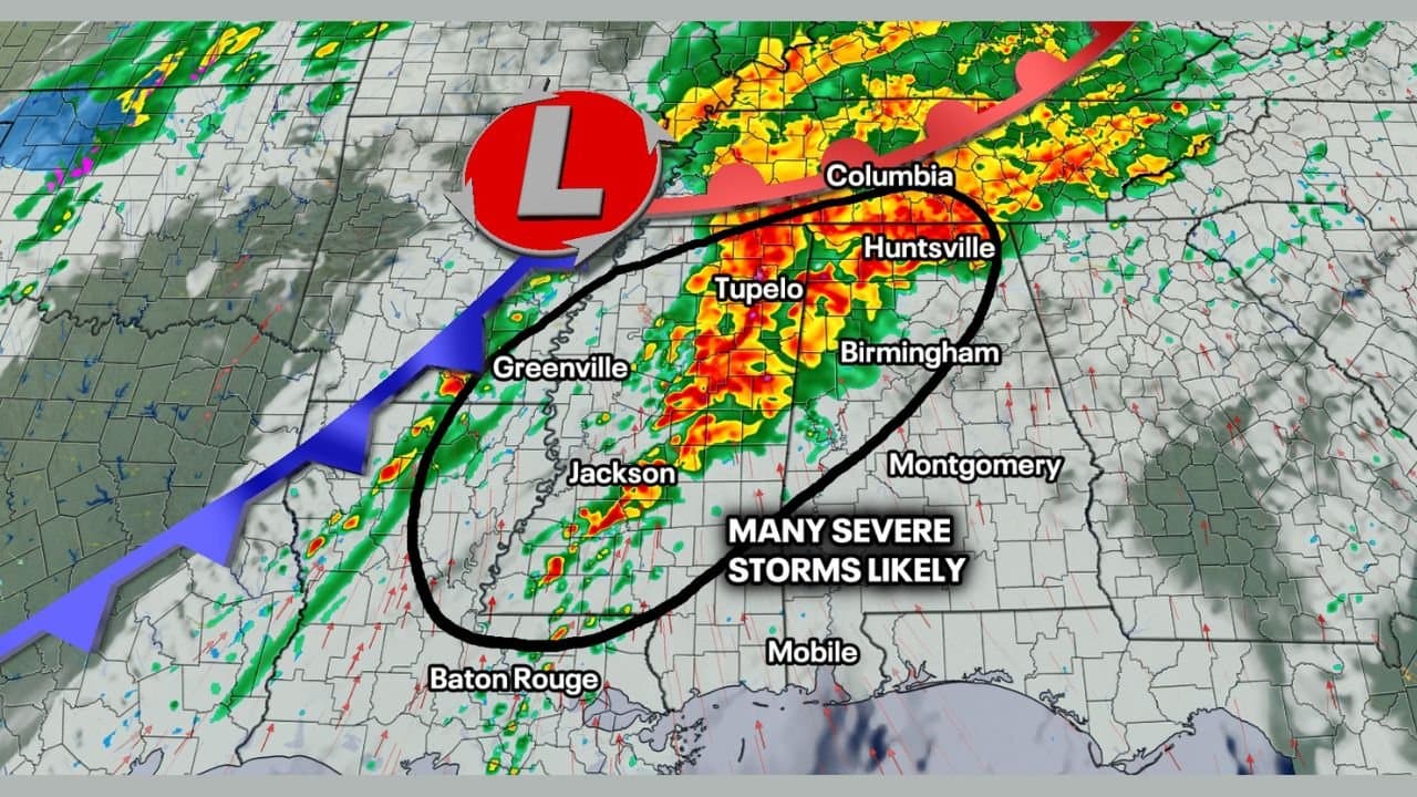
The county was part of a broader Mid-South severe-weather setup that National Weather Service Memphis tracked through its decision-support pages and live watches map on July 1. Forecasts for north Mississippi also carried a heat advisory-level message, with heat index values in the 105 to 109 degree range and a slight risk for severe weather across much of the same area.
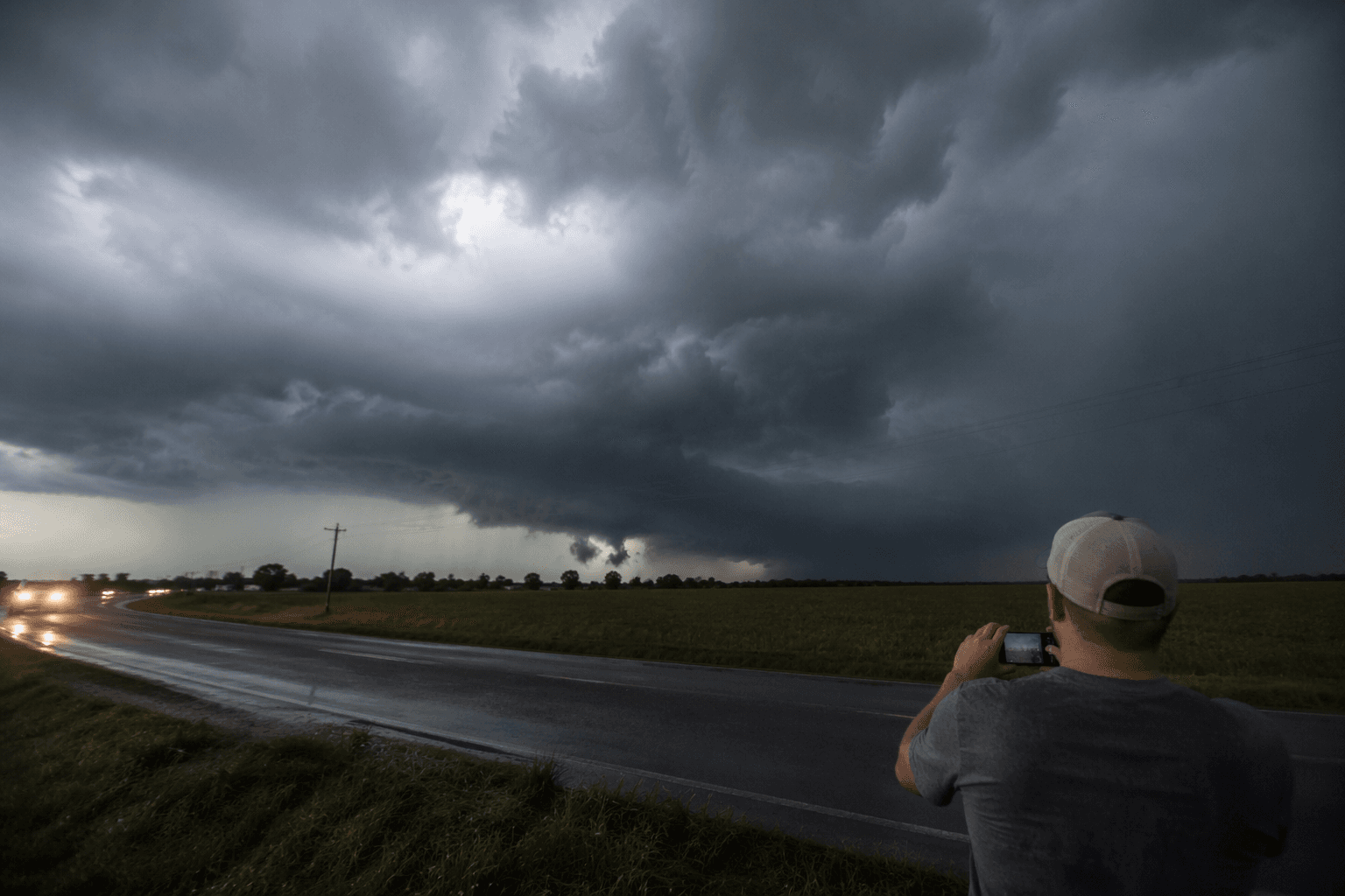
For families in Oxford and across Lafayette County, the immediate task was to bring in patio furniture, trash cans and anything else that could become debris once the wind picked up. Drivers had to watch for sudden downpours, lightning and the kind of gusts that can shove high-profile vehicles, especially on open stretches outside town. Outdoor workers faced the hardest choice of the day: finish essential work early or get to a sturdy shelter before thunder arrived.
Lafayette County Emergency Management, based at 72 F.D. “Buddy” East Parkway, Suite 102 in Oxford, says its mission covers preparedness, mitigation, response and recovery for emergencies and disasters. Beau Moore serves as the agency’s public information officer. With Oxford serving as the county seat, the watch placed the county in the center of a fast-moving weather threat that demanded quick decisions before the 10 p.m. deadline.
This article was produced by Prism’s automated news system from verified source data, official records, and press releases, then run through automated quality and moderation checks before publishing. The system is built and supervised by the people who set the standards it runs under. Read our full AI policy.
Did this article answer your question?