Grand Marais harbor project advances with public review of shoreline plans
Grand Marais is weighing shoreline fixes that could protect the harbor, preserve public access and shape future costs. One proposal will move to 30% design after public input.
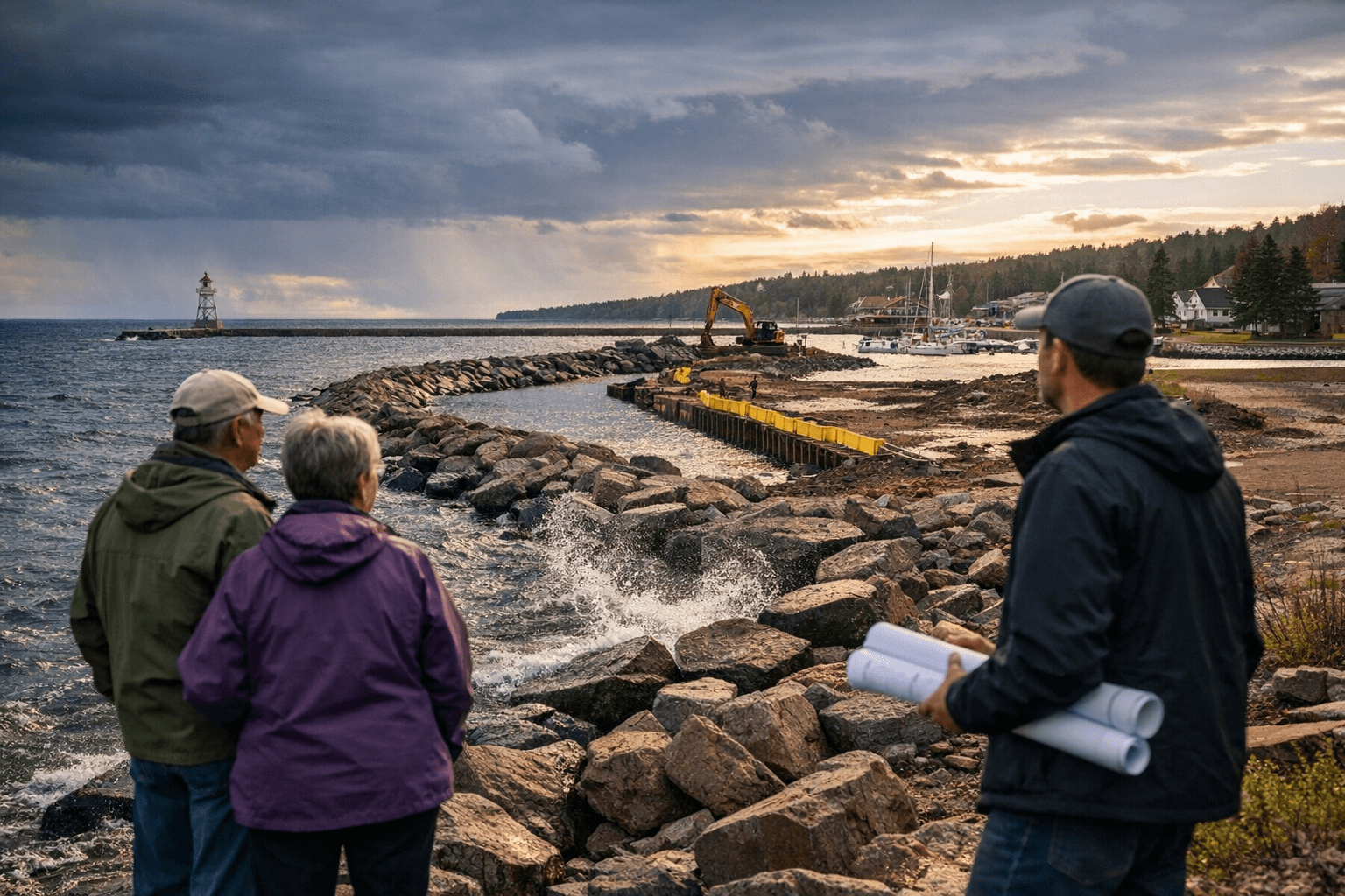
Grand Marais moved a major shoreline decision into public view Monday, opening review of harbor plans that could determine how well the city protects Lake Superior’s edge while keeping the waterfront usable for boats, visitors and nearby businesses.
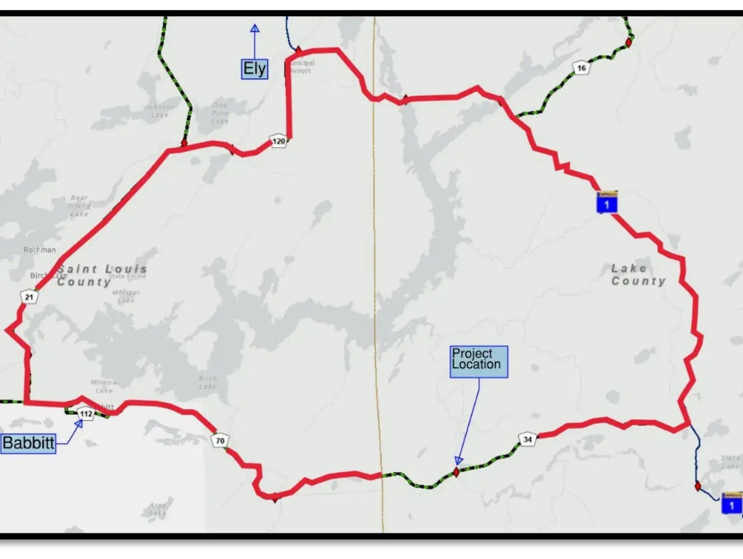
The Harbor Resilience Project was presented at 5 p.m. at Grand Marais City Hall, where residents and property owners got their first look at engineering ideas for the harbor’s eastern edge. City officials say the work is becoming increasingly urgent because the aging sheet-piling wall that separates Lake Superior from public land around the harbor faces erosion and high-water events that could affect infrastructure, access and the long-term function of one of the North Shore’s most visible public spaces.
Grand Marais received a $120,000 grant in December 2024 through the Resilient Coastal Projects Initiative, a program of the Great Lakes and St. Lawrence Cities Initiative, with the grant period beginning in January 2025. City sustainability coordinator Shane Steele said the project team has already reviewed three possible treatments for replacing the sheet-piling wall, and one will advance to a 30% design level by the end of this phase. That step usually marks the point when a community moves from broad concepts into more detailed engineering and cost planning.
The choices carry more than an architectural impact. Grand Marais’s stormwater plan lists aging infrastructure, flooding, public safety, property damage, pollutant loads to Lake Superior and beach closures as concerns in the watershed. It also notes that the city’s public water intake sits within half a mile of the harbor stormwater outlets, a reminder that shoreline and drainage decisions reach beyond the immediate harbor.
The city has already tied this work to a broader resilience push. Its sustainability materials say Grand Marais adopted a Climate Action Plan and added a sustainability coordinator as part of its effort to reduce its carbon footprint. The harbor project fits into that larger strategy by focusing on how the city manages a shoreline that must serve both protection and public use.
The harbor’s role is unusually broad for a town of this size. U.S. Army Corps of Engineers materials describe Grand Marais Harbor as an important harbor of refuge for charter fishing and recreational navigation, and say local infrastructure generates income from harbor users and visitors while also supporting law enforcement, research and search and rescue access.
The shoreline itself has changed before. Trust for Public Land notes that Grand Marais’s harbor front was once a commercial and industrial waterfront in the late 19th and early 20th centuries, when thousands of pulpwood logs were stacked along the harbor side. That history now meets a new round of decisions about how much the city can spend, how much storm damage it can prevent and how much of the waterfront can remain open, visible and active for the next generation.
This article was produced by Prism’s automated news system from verified source data, official records, and press releases, then run through automated quality and moderation checks before publishing. The system is built and supervised by the people who set the standards it runs under. Read our full AI policy.
Did this article answer your question?