Lane County’s covered bridges blend history, engineering and daily life
Lane County’s 20 covered bridges still carry traffic, tourism and access from Westfir to Cottage Grove, and closures show how much residents would lose without them.
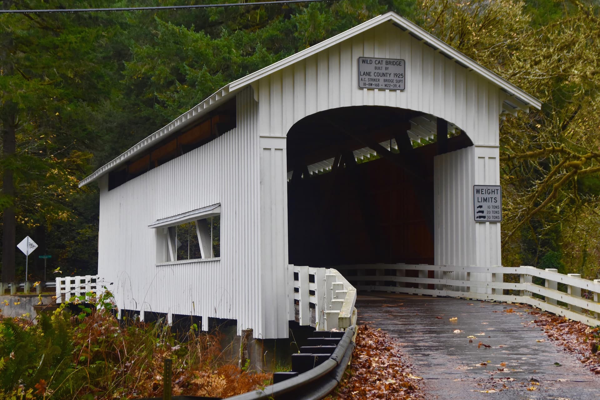
From Westfir to Vida and Cottage Grove, Lane County’s covered bridges still move local traffic, steer visitors onto the Covered Bridges Scenic Byway and Covered Bridges Scenic Bikeway, and force real detours when maintenance starts. The county says it has 20 covered bridges, more than any county west of the Mississippi, and those spans still matter for access, business traffic and the historic identity that draws people into the McKenzie, Row River and foothills corridors. Lose them to neglect or closure, and residents lose commute routes, lifeline access and one of the county’s most visible travel assets.
A county map of working infrastructure
Lane County’s official historic covered bridges page and its ArcGIS StoryMaps bridge map treat these structures as part of the county’s active transportation system, not just roadside scenery. That matters because the bridges still organize how people move through western Oregon: some route local drivers around rivers and canyons, while others anchor tourism in places that depend on passing visitors.
The county’s own materials make the point clearly. These bridges are old, but they are also functional assets that require repairs, traffic control and periodic closures. In Lane County, preservation is not an abstract heritage project. It is road management.
Westfir’s Office Bridge: the county’s signature span
The Office Covered Bridge in Westfir is the most distinctive of Lane County’s spans for sheer engineering and setting. Lane County identifies it as the county’s longest covered bridge, a timber through-truss bridge spanning the North Fork, and the only covered bridge in Oregon with a separate covered pedestrian bridge.
That combination gives Westfir a rare place in the county’s bridge system. It is useful as a crossing, memorable as a landmark, and important to anyone mapping the county’s covered-bridge route by car or on foot. For travelers heading through the Upper McKenzie area, the bridge is not only a photo stop. It is part of the local landscape that helps define the town.
Older than a single era: Mosby Creek and the 1938 group
Lane County’s bridge brochure shows that the county’s covered-bridge story stretches across decades of road building, not one nostalgic moment. Mosby Creek Bridge, constructed in 1920 and restored in 1990, is listed as the county’s oldest covered bridge. That date makes it the clearest reminder that preservation in Lane County has been happening for generations.
The brochure also identifies a cluster of bridges built in 1938 by Lane County: Wendling, Pengra, Goodpasture and Ernest. That group matters because it shows how covered bridges were still part of county road construction well into the 20th century. They are not isolated artifacts. They are part of an evolving public-works system that had to meet the needs of rural travel, river crossings and timber-country geography.
Goodpasture: a bridge that still functions as a lifeline
Few Lane County spans show the daily stakes more clearly than the Goodpasture Covered Bridge near Vida, about 20 miles east of Springfield. Lane County says the bridge crosses the McKenzie River and provides sole access for more than 80 residences. An engineering case-study summary describes it as a 72.5-meter, 238-foot, five-span timber structure that provides lifeline access.
That is the heart of the Lane County story. Goodpasture is not simply preserved because it looks good in photographs. It matters because people live beyond it and depend on it. If the bridge is out, residents do not just lose a scenic drive. They lose their route home.
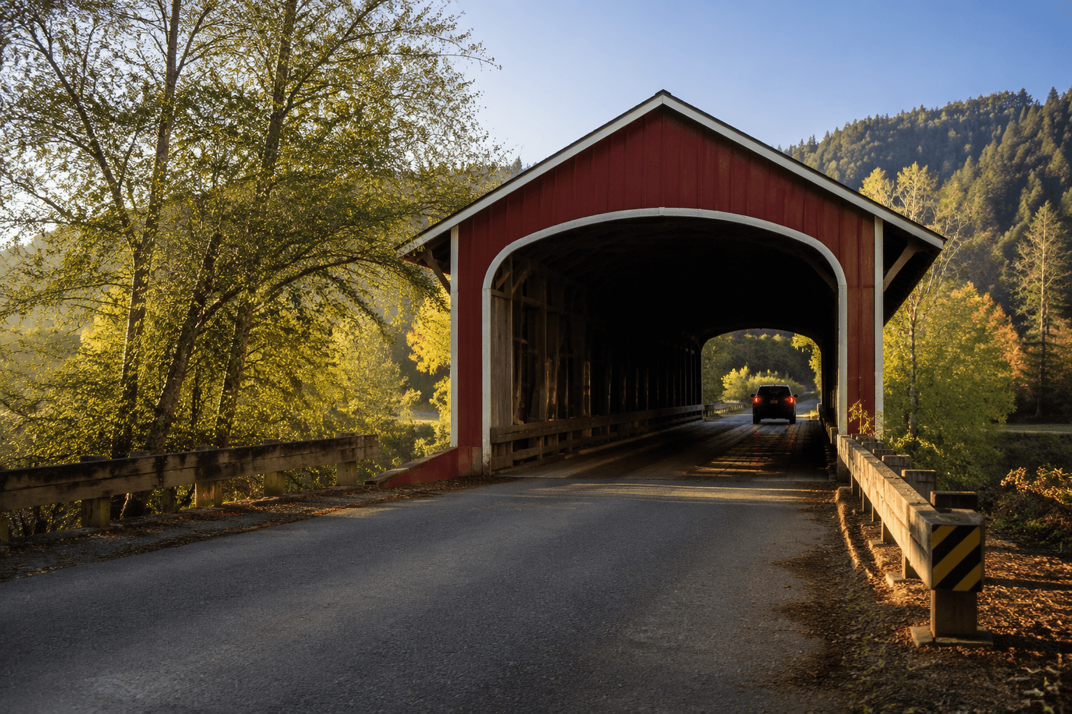
The bridge also sits in a corridor where geography and infrastructure meet every day. Along the McKenzie River, access, emergency response and routine errands all depend on road links that can be expensive to repair and difficult to replace. Goodpasture shows why maintenance on a covered bridge is really maintenance on a community’s connection to the outside world.
Belknap: preservation with detours and deadlines
Lane County’s road closure notice for Belknap Covered Bridge shows what preservation looks like on the ground. Work was scheduled between 7:30 a.m. and 4:00 p.m., Monday through Thursday, from June 22 through August 3, with scaffolding installation and painting as the stated purpose. Drivers were directed to use Cougar Dam Road to West King Road as the alternate route.
That kind of schedule can be inconvenient, but it is also how county assets stay usable. A 2014 Lane County Board memo went further, saying West King Road could be temporarily closed for up to six months for the Belknap Covered Bridge Preservation Project. The scale of that planning shows how much traffic management can be tied to a single bridge job. When Lane County maintains these spans, it is managing access, worker safety and public inconvenience at the same time.
Cottage Grove’s bridge district and tourism draw
If the McKenzie corridor is about access, the Cottage Grove area is about identity and tourism. Cottage Grove says six Lane County covered bridges are located in or around the city, and the city brands itself the Covered Bridge Capital of Oregon. That claim is not just marketing language. It reflects a real concentration of bridges that draws visitors into town and into the surrounding countryside.
The Chambers Railroad Bridge is the standout in that cluster. Cottage Grove identifies it as the last remaining covered railroad bridge west of the Mississippi River, says it is listed on the National Register of Historic Places and notes that it was fully restored in 2011. For the local economy, that means more than a historical marker. It means a destination that supports fuel stops, restaurants, lodging and the everyday circulation of travelers through the Row River area.
Travel materials also point to the Covered Bridges Scenic Byway and the Covered Bridges Scenic Bikeway in the Cottage Grove area. Those routes give the county a broader recreational economy, linking motorists and cyclists to the bridge network while spreading visitor spending across the towns and roads that host the spans.
Why the bridges still matter now
Lane County’s covered bridges survive because they serve two purposes at once. They are durable pieces of engineering that still carry people, and they are cultural landmarks that shape how outsiders and residents see the county. Westfir, Vida, Springfield, Cottage Grove and the rural roads between them all benefit from the traffic, attention and identity these bridges generate.
The cost of that value is ongoing maintenance, closures and planning. The benefit is just as concrete: access for more than 80 homes at Goodpasture, a working crossing at Office Bridge, detours managed at Belknap, and tourism that continues to support the communities around Cottage Grove. In Lane County, the bridges are not leftover scenery. They are part of how the county functions day to day.
This article was produced by Prism’s automated news system from verified source data, official records, and press releases, then run through automated quality and moderation checks before publishing. The system is built and supervised by the people who set the standards it runs under. Read our full AI policy.
Did this article answer your question?