Winter Storm Warning Issued for Lane County Cascades, Up to 18 Inches Expected
NWS Portland upgraded Lane County Cascades to a Winter Storm Warning, with snowfall rates topping 1 inch per hour expected tonight on a pass that has closed for 33 miles before.
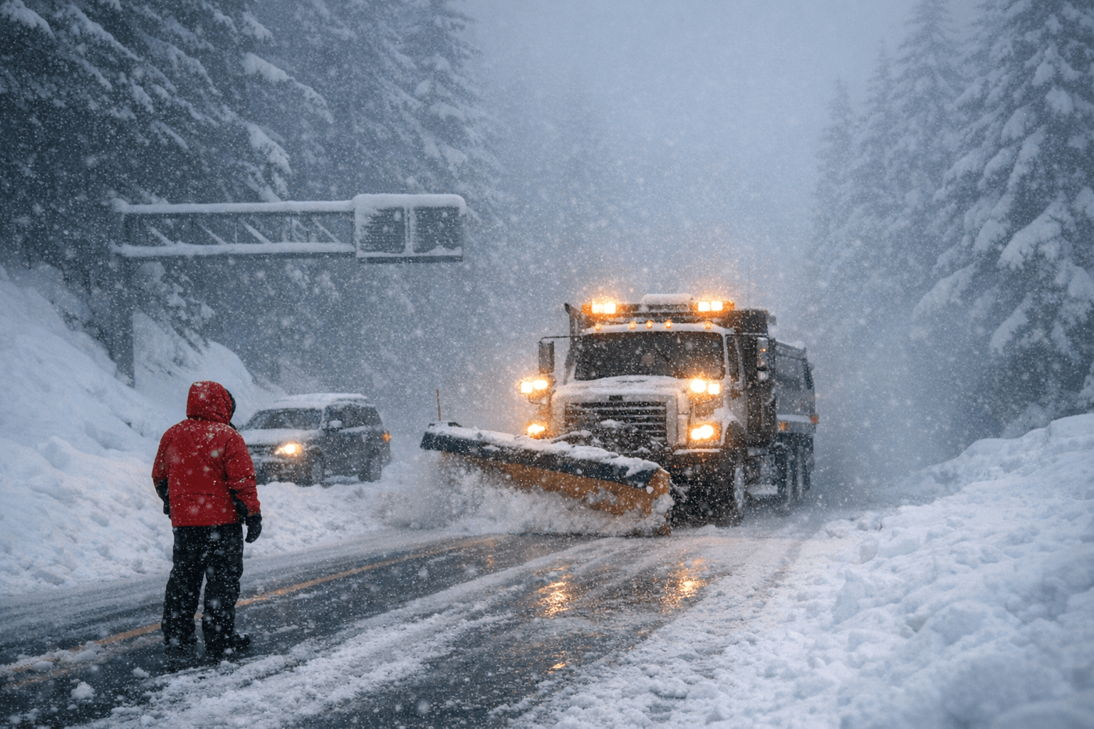
Anyone planning to cross Willamette Pass on Highway 58 after 4 p.m. Wednesday is betting against a forecast that calls for snowfall rates exceeding 1 inch per hour for the following 16 hours, on a road that has, under similar conditions, been shut for 33 miles between Oakridge and Crescent Lake.
The NWS Portland office upgraded a Winter Storm Watch to a full Warning for the Cascades of Lane, Marion, and Linn counties early Wednesday, with the advisory running from 5 a.m. Wednesday through 5 p.m. Thursday. Forecasters project snow totals of 10 to 18 inches at higher elevations, with locally heavier amounts along the peaks. NWS Portland noted the heaviest accumulations will be concentrated on the Cascades from Marion County south through Lane County.
The 4 p.m. Wednesday to 8 a.m. Thursday window is the period NWS Portland flagged as most intense, with rates that could occasionally exceed 1 inch per hour. Willamette Pass sits well above the storm's primary snow level: accumulation is possible as low as 2,500 feet, but the bulk will fall above 4,000 feet. The pass, at roughly 5,100 feet, will see the full force of those totals, compounded by wind gusts of 40 to 45 mph along exposed ridgetops that will drive blowing and drifting snow.
Highway 58 is not the only corridor at risk. Highway 22 at Santiam Pass, McKenzie Pass, Tombstone Summit, and Santiam Junction all face significant impacts. Roads, bridges, and overpasses throughout the warning area are expected to become slick and hazardous. Chain requirements can be imposed on any of these routes with little advance notice; ODOT's TripCheck service, reachable by dialing 5-1-1, provides current conditions and chain control status.
The clearest decision point for drivers: be over the pass before 4 p.m. Wednesday or hold until after 8 a.m. Thursday, when the most intense snowfall is projected to taper.
The storm arrives as Oregon's Cascades snowpack stands at a critically low level. Snow water equivalents statewide have fallen to 30% or less of normal, with many river basins registering below 10% of normal. This late-season system could provide short-term relief to a snowpack that has alarmed water managers ahead of the summer irrigation season.
The warning expires at 5 p.m. Thursday. A separate winter weather advisory covers the southwest Washington Cascades, forecasting 6 to 11 inches above 3,000 feet and gusts to 35 mph.
This article was produced by Prism’s automated news system from verified source data, official records, and press releases, then run through automated quality and moderation checks before publishing. The system is built and supervised by the people who set the standards it runs under. Read our full AI policy.
Did this article answer your question?


