NWS High Wind Warning Includes Trinidad, Prompts Travel and Safety Concerns
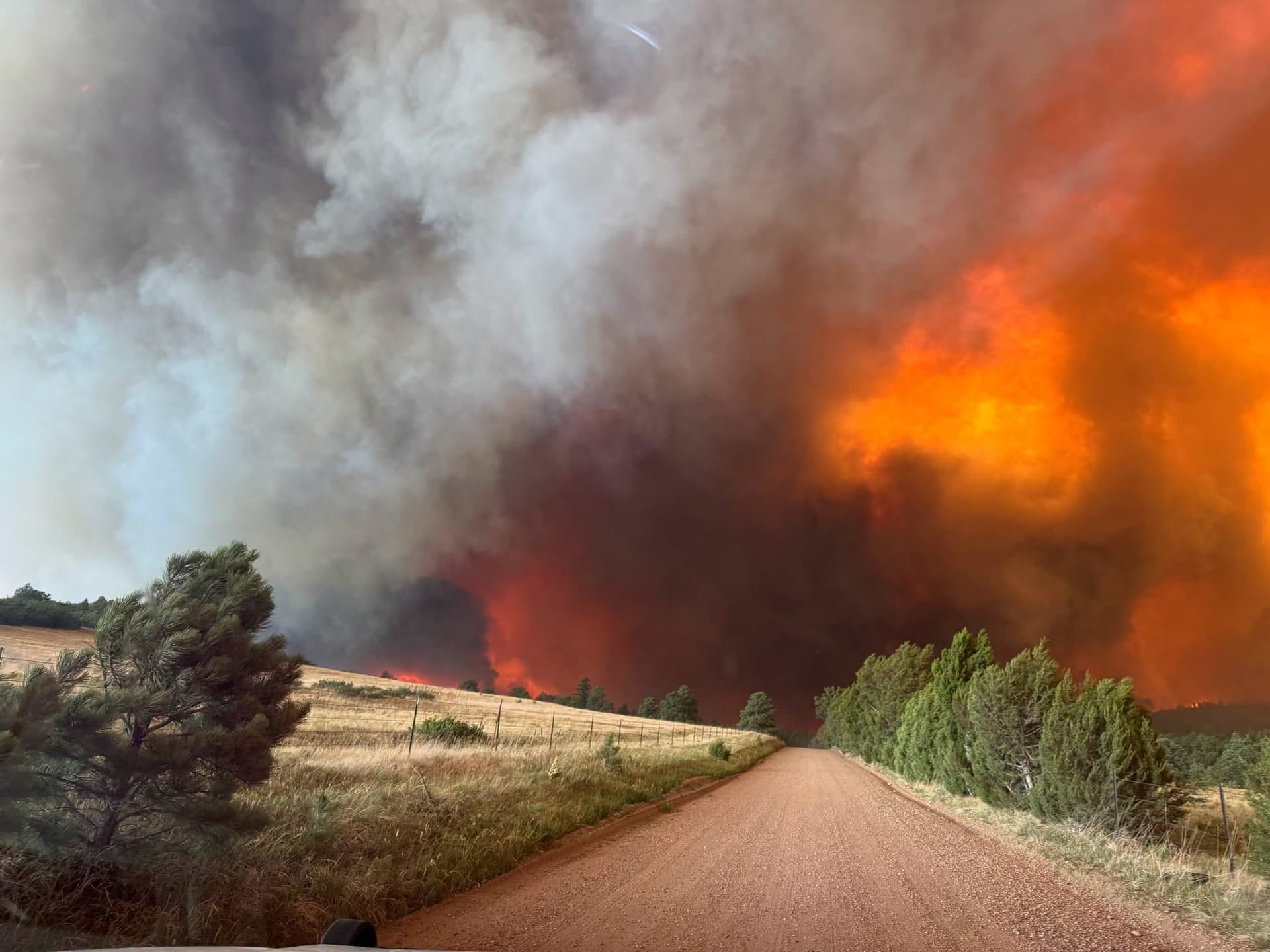
The National Weather Service in Pueblo issued a High Wind Warning that included the Trinidad vicinity, with advisories running into Feb. 17 and later Red Flag fire-weather warnings listing western Las Animas County.

The National Weather Service in Pueblo issued a High Wind Warning that included the Trinidad vicinity in western Las Animas County, prompting travel and public-safety concerns as the advisory extended into Feb. 17, 2026. The warning for Trinidad, CO was followed by additional NWS fire-weather products later in the week that again named Western Las Animas County, including Trinidad and Thatcher.
NWS Pueblo fire-weather messaging on Feb. 18 carried the product header “URGENT - FIRE WEATHER MESSAGE National Weather Service Pueblo CO 701 PM MST Wed Feb 18 2026 COZ227-228-230-233-191815” and an affected-area line listing “Western Las Animas County Including Trinidad and Thatcher.” That package included Red Flag language that remained in effect for the region; the NWS text reads in part, “...RED FLAG WARNING REMAINS IN EFFECT FROM 10 AM TO 7 PM MST THURSDAY FOR GUSTY WINDS AND LOW RELATIVE HUMIDITY FOR FIRE WEATHER ZONES 227, 228, 230, AND 233...”
A Hazardous Weather Outlook issued at 351 AM MST Thu Feb 19, 2026 reiterated the Trinidad listing, noting “Trinidad Vicinity/Western Las Animas County Below 7500 Feet” among the zones covered. The same NWS products tie the elevated fire danger to “gusty westerly” winds and low relative humidity across portions of Fremont, El Paso, Pueblo, Huerfano and Las Animas counties, increasing the risk window during the stated Red Flag effective period.
The research also includes separate high-wind alerts for the island nation of Trinidad and Tobago and should not be conflated with Trinidad, Colorado. The Trinidad and Tobago Meteorological Service issued a Yellow-level High Wind Alert on Wednesday, January 29, 2025 at 12:42 PM, effective for Trinidad from 1:45 PM through 3:00 PM that day. TTMS warned of a “high potential (70%) for wind gusts in excess of 55km/h,” and observed sustained winds up to 20 km/h with gusts between 40 km/h and 50 km/h since 8:00 AM. TTMS also warned that “waves reaching above 2.5 m in open waters” could agitate seas and disrupt marine activity.
The Guardian (Trinidad & Tobago) coverage referenced an active tropical wave and an NHC assessment that “Environmental conditions appear conducive for slow development once the wave reaches the western Caribbean late this week,” with development chances quoted as “near zero per cent over the next 48 hours and at 20 per cent over the next seven days.” The Guardian article also described a separate effective window expressed as “10:00 PM Monday through noon on Tuesday.”
For residents of Las Animas County, the immediate local step is to monitor updates from NWS Pueblo and Las Animas County emergency channels for changes to travel advisories and Red Flag expirations. Given NWS identification of fire-weather zones 227, 228, 230 and 233 and the Red Flag effective window of 10 AM to 7 PM MST Thursday in the Feb. 18 product, avoid outdoor burning and activities that could spark fires during that period and secure loose items if winds are gusty. For maritime and coastal communities in the Caribbean, follow advisories from the Trinidad and Tobago Meteorological Service noting the 70% probability of gusts above 55 km/h and the forecast of waves above 2.5 m.
This article was produced by Prism’s automated news system from verified source data, official records, and press releases, then run through automated quality and moderation checks before publishing. The system is built and supervised by the people who set the standards it runs under. Read our full AI policy.
Did this article answer your question?