Perry Stokes Airport Serves Las Animas County With Key Aviation Services
Perry Stokes Airport, 5,761 feet up and 10 miles northeast of Trinidad, is Las Animas County's aviation lifeline for medical flights, ranching, and a modernization push through the late 2020s.

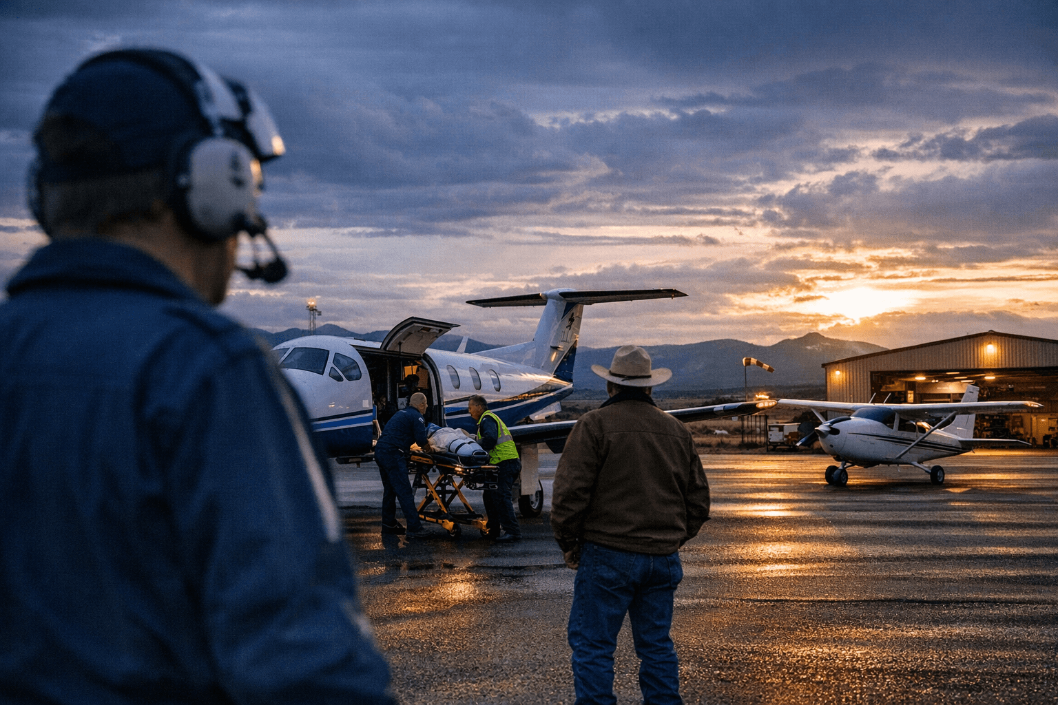
Sitting at 5,761 feet on roughly 650 acres of southeastern Colorado high plains, Perry Stokes Airport is the kind of infrastructure that most residents never think about until they need it urgently. The publicly owned field, identified in FAA records as TAD and by its ICAO code KTAD, serves Trinidad and Las Animas County as the region's only general-aviation gateway, handling everything from agricultural flights and business travel to medical evacuations when ground transport isn't fast enough.
Runways, Layout, and What the Field Can Handle
Perry Stokes operates two runways, each approximately 5,500 feet long. Runway 03/21 is paved asphalt, the primary surface for instrument approaches and heavier aircraft. Runway 09/27 is a gravel and dirt surface that extends the airport's utility for lighter piston aircraft and agricultural operators accustomed to unimproved fields. At those lengths and at that elevation, the field is well-suited for a broad range of piston and turboprop general-aviation aircraft and can accommodate limited business jets under typical weight and temperature conditions. The airport is located 10 to 11 miles northeast of Trinidad, making it accessible to county residents without requiring a long drive to Pueblo or Colorado Springs.
The 650-acre footprint gives the airport room to grow, a fact that figures prominently in the county's current capital planning.
Pinnacle Jet Centers and Pilot Services
Day-to-day airport operations are handled by Pinnacle Jet Centers, the commercial fixed-base operator listed as the airport operator in current aviation directories. The field supports fuel and transient services, weather reporting, and a Common Traffic Advisory Frequency (CTAF) for pilot self-announce operations, the standard safety protocol at non-towered airports. A remodeled pilot lounge provides a rest and planning space for transient aviators, and hangar space is available for private and agricultural tenants. Las Animas County's airport finance and leasing staff manage the county side of hangar agreements and infrastructure planning; their contact information is posted through the county's official airport page.
Pilots planning a flight into KTAD should pull current NOTAMs, check AirNav or SkyVector for runway surface conditions, and monitor the published CTAF before entering the pattern. High elevation and afternoon density altitude in summer months are standard considerations for any Colorado mountain-adjacent field.
A Modernization Push Through the Late 2020s
Over the past one to two years, Las Animas County commissioners and airport partners have been assembling the funding framework for a significant upgrade program. The county pursued Economic Development Administration funding to cover water and sewer upgrades, infrastructure that is a prerequisite for private investment and for meeting FAA standards tied to certain grant streams. Commissioners have also sought federal support for a targeted taxiway extension and a hot-fuel pad, two improvements that would lower costs for transient aircraft, reduce ground time for fuel stops, and signal to potential hangar tenants that the facility is ready for expanded use.
The county's airport Capital Improvement Plan lays out a multiyear sequence of work with priorities extending through the late 2020s:
- Septic and sewer system upgrades
- Pavement repair and seal coat on existing surfaces
- Taxiway and apron improvements
- New hangar development
- Fuel infrastructure expansion
Each phase builds on the last. Getting water and sewer infrastructure in place unlocks the ability to support hangar construction; a new hot-fuel pad and improved taxiway make the airport more competitive with larger regional fields for transient business jets and turboprops. The county's planning framework is explicit that none of these development goals should come at the cost of the airport's core safety function, particularly its role in medical evacuations and emergency response.
Why the Upgrades Matter Beyond Aviation
Perry Stokes is the kind of asset that shows up in conversations about ranching logistics, outdoor recreation access, and economic resilience for rural southern Colorado. A hot-fuel pad and short taxiway addition are not glamorous projects, but they represent the difference between a transient pilot diverting to Pueblo and one who stops in Trinidad, rents a car, and spends money locally. Hangar development could attract aviation-maintenance businesses, charter operators, or flight-training outfits that don't currently have a presence in Las Animas County.
For ranching and agricultural operators, the gravel runway 09/27 and existing hangar space already provide a functional base. Expanded fuel infrastructure and improved pavement would make those operations cheaper and more reliable year-round. For the county's emergency-services network, a well-maintained field with reliable fuel and a functional apron is not optional. Medical evacuation flights, search-and-rescue support, and wildfire response all depend on the airport being operational when conditions are most demanding.
The economic case is straightforward: rural airports that fall into deferred-maintenance cycles become less useful precisely when regions need them most. The county's CIP is an attempt to interrupt that pattern before it sets in.
Background and Historical Context
Perry Stokes Airport has served Las Animas County since the 1930s, later renamed to honor Perry F. Stokes, a figure of local significance. Decades of general-aviation use have shaped the field's current footprint, and the two-runway configuration reflects both the terrain and the diverse operator mix the county has historically needed to serve. That history also means the county inherits aging infrastructure alongside the asset itself, which is precisely why the current modernization roadmap focuses so heavily on basics like sewer, pavement, and fuel systems before moving to higher-profile additions.
Residents tracking the airport's development should note that project timelines depend heavily on federal and state grant cycles, and contractor availability in rural southeastern Colorado can add variability. The county commission minutes and Las Animas County's official airport page are the most reliable sources for current project status as funding decisions and construction schedules evolve. The field's trajectory through the late 2020s will say a great deal about whether rural Colorado counties can use aviation infrastructure as a genuine economic development tool, or whether geography and funding gaps continue to limit the potential.
This article was produced by Prism’s automated news system from verified source data, official records, and press releases, then run through automated quality and moderation checks before publishing. The system is built and supervised by the people who set the standards it runs under. Read our full AI policy.
Did this article answer your question?