Wildfire near Piñon Canyon forces evacuations in Las Animas County
A 125-acre fire near Piñon Canyon pushed rural residents out of their homes as crews used engines and aircraft to protect three threatened structures.

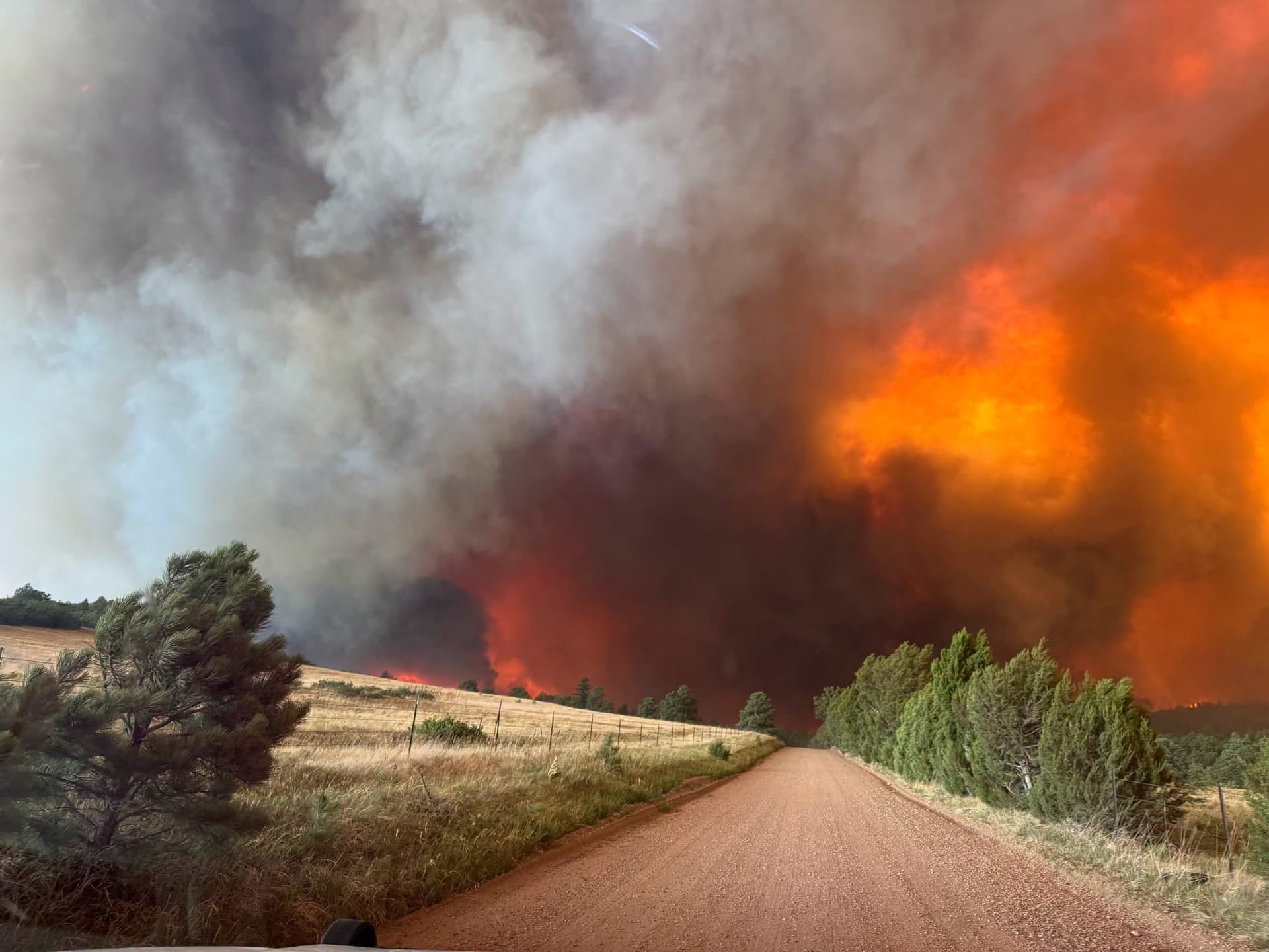
A fast-moving wildfire a few hundred feet north of the Piñon Canyon Maneuver Site forced rural evacuations in Las Animas County on Wednesday, putting Bear Springs Road and County Road 78, also identified in notices as County Road 78.9, under immediate public-safety scrutiny. By early response reports, the blaze had reached about 125 acres, and county officials were already managing the fallout for residents with limited routes out of the area.
Las Animas County emergency manager Darren Kolakowski confirmed the evacuation area, underscoring that the response was not just a fireline operation but a county emergency-management effort. The National Interagency Fire Center said about 87 personnel were working the fire, with engines and aircraft assigned to the incident, and that three structures were threatened.

The fire was discovered around 1 p.m., and early coverage identified it as the Bear Fire or Bear Springs fire. Smoke was visible from Huerfano County, a sign of how quickly the incident became more than a local ranchland problem and how widely the plume and response were being watched across southeastern Colorado.
The stakes in this part of Las Animas County are shaped by geography. Rural roads around Piñon Canyon can leave residents with only a narrow window to get out if a fire moves with wind across open country, and any delay in evacuation notices can turn a grass fire into a life-safety event. The immediate challenge for county officials was not only clearing residents from Bear Springs Road and County Road 78 but also keeping access open for crews trying to hold the line around homes and outbuildings.
Piñon Canyon itself adds to the concern. Fort Carson describes the maneuver site as a 235,000-acre training area, while historical and official references place it at about 235,896 acres. The U.S. Department of Defense acquired the land in 1983 for the training site, and the surrounding landscape is semi-arid shortgrass prairie with sandy, well-drained soils that are vulnerable to erosion where vegetation is sparse. That combination of open terrain, dry grass and wide exposure helps explain why a fire near the site can spread quickly and draw countywide attention.
Even before the smoke cleared, the fire had already raised the questions Las Animas County now has to answer: how fast alerts reached rural residents, whether road access was enough for a timely exit, and how local, state and air resources were coordinated around the Piñon Canyon perimeter.
This article was produced by Prism’s automated news system from verified source data, official records, and press releases, then run through automated quality and moderation checks before publishing. The system is built and supervised by the people who set the standards it runs under. Read our full AI policy.
Did this article answer your question?