Search and rescue sent to MacDonald Pass after hiker medical emergency
A 50-year-old hiker used satellite contact to summon help south of MacDonald Pass, sending crews into steep, wooded country as temperatures fell. The rescue hinged on fast coordination near Highway 12 and Rimini.

Search and rescue teams were sent into a heavily wooded area south of MacDonald Pass just after 6 p.m. Tuesday after a 50-year-old hiker reported a medical emergency and was able to make contact by satellite.
Lewis and Clark County Sheriff Leo Dutton said the call came in as daylight was fading and crews were preparing for a cold evening. Temperatures were expected to fall into the teens and twenties, turning what might have been a routine backcountry assist into a time-sensitive operation in remote terrain where access is limited and conditions can change quickly.
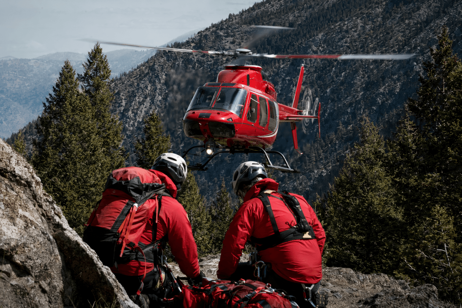
Baxendale Fire and other emergency services staged near Highway 12 and Rimini while Lewis and Clark County Search and Rescue moved toward the incident area. The sheriff’s office said the wooded ground south of the pass was difficult to reach, which is why county search and rescue was the appropriate response. In that part of Lewis and Clark County, responders often have to coordinate before they can even reach a patient, especially when roads are few and the terrain is dense.
The satellite call was the critical detail that made the rescue possible. In an area where cell coverage can be weak or nonexistent, being able to send a signal from the trail gave responders a location and a starting point for the operation. That kind of connection can mean the difference between a manageable response and a much more dangerous delay, especially when a medical problem hits in cold weather.
The MacDonald Pass corridor has repeatedly shown how quickly outdoor emergencies can escalate. The National Weather Service’s Upper Blackfoot and MacDonald Pass forecast has recently included snow, rain-snow mix, gusty winds and lows in the 20s and 30s, underscoring how quickly shoulder-season weather can turn in the mountains west of Helena. Lewis and Clark County Search and Rescue was also called recently to help a family stranded south of Lincoln during a snowstorm, another reminder that volunteers are regularly tapped for remote terrain across the county.
A wildfire south of MacDonald Pass also recently forced closures near Rimini Road and the Minnehaha Creek drainage area, highlighting how access, fire risk and rugged topography all shape emergency response in the corridor. Tuesday’s callout showed the same reality from a different angle: in rough country south of MacDonald Pass, a fast rescue often depends on a hiker’s ability to make contact before the weather and darkness take over.
This article was produced by Prism’s automated news system from verified source data, official records, and press releases, then run through automated quality and moderation checks before publishing. The system is built and supervised by the people who set the standards it runs under. Read our full AI policy.
Did this article answer your question?