Los Alamos day trip traces Manhattan Project history along NM 502
NM 502 leads to a day trip where Los Alamos still wears its Manhattan Project past, from the visitor center to Otowi Crossing and Edith Warner’s teahouse.
Start with the road that still carries the story
The drive into Los Alamos still follows the path of a wartime secret. From Santa Fe, head north on U.S. 84/285, then turn west on NM 502, the same corridor that once drew scientists, Army personnel, and support staff into the Secret City.
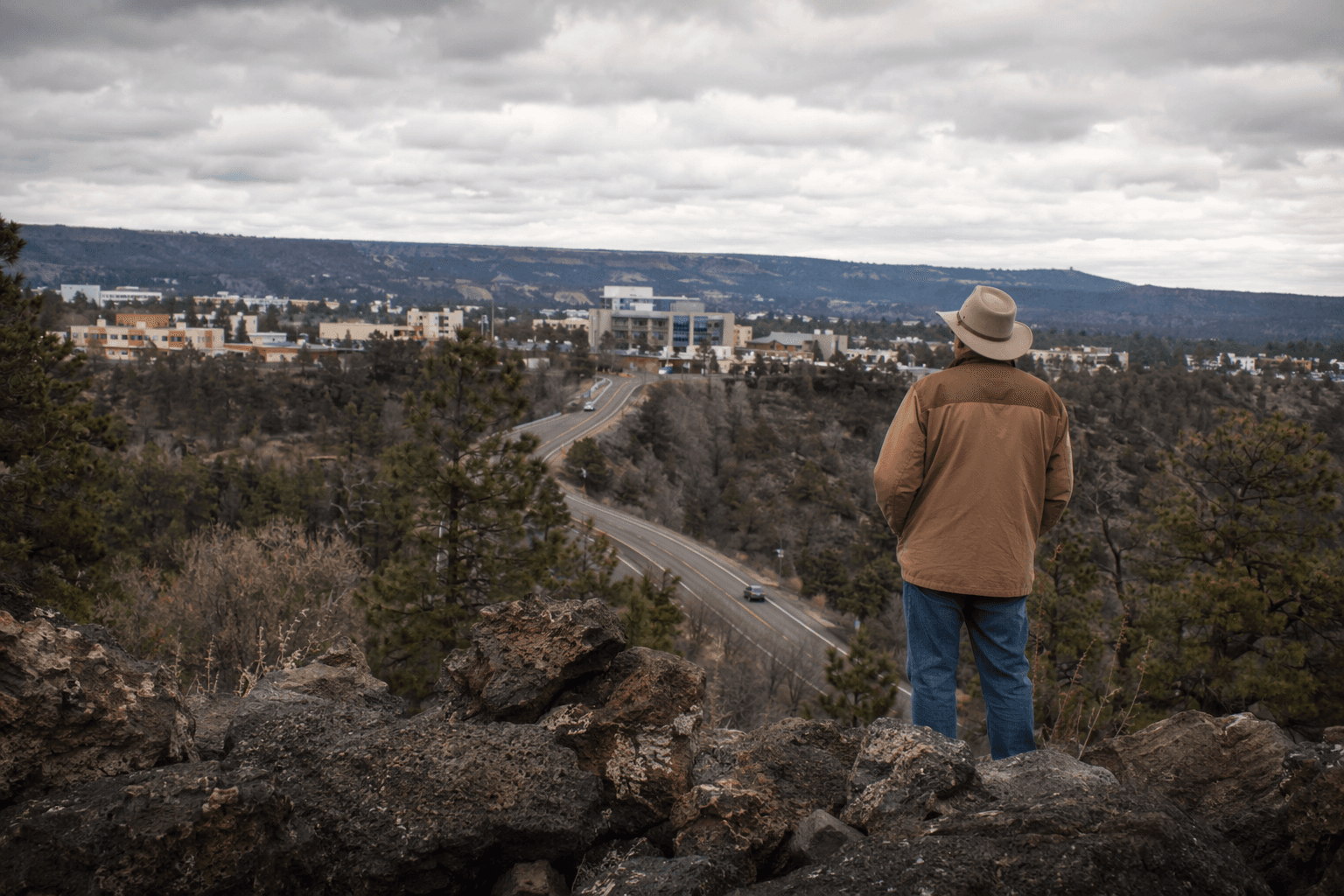
That route matters because it is not just a scenic approach to town. It is part of Los Alamos life today, a highway many county residents use every day, and it doubles as a living map of how the Manhattan Project changed northern New Mexico.
What made Los Alamos the Secret City
During the Manhattan Project, Los Alamos was known as “Site Y” or “The Hill,” and the secrecy was total enough to shape even the mail. The entire town had one mailing address, PO Box 1663 in Santa Fe, and everyone, including children, wore government-issued identification badges.
That level of control helps explain why the town still carries such a strong sense of identity. Visitors do not come here for one monument alone; they come to understand how an isolated mesa became the center of one of the most consequential efforts in American history, and why the landscape still reflects that period in roads, landmarks, and stories.
J. Robert Oppenheimer arrived in Santa Fe on March 15, 1943, after planning and construction were already underway. The Army had selected M. M. Sundt Construction Company on December 6, 1942, sealing the deal with a handshake, a reminder that the laboratory’s creation moved quickly from paper to physical ground.
A practical half-day route through town
A good day trip keeps the emphasis on movement, not just destinations. Start at the Los Alamos Visitor Center, then work your way along NM 502 and into the places where the Manhattan Project still shows through the landscape.
- Morning, Los Alamos Visitor Center: Begin here to orient yourself before heading farther into town. Official park material points visitors here first, and it is the easiest place to connect the modern town with its role in Manhattan Project history.
- Late morning, the drive through town: Follow NM 502 as it bends west toward the historic crossings and the spaces that once funneled traffic into the secret laboratory. The road itself is part of the story, because it links the everyday Los Alamos route with the wartime corridor that built the town.
- Lunch stop, Otowi Crossing: Pause where the Rio Grande, the old bridge, and Edith Warner’s tea house turn the history into something you can still recognize on the ground.
- Afternoon, guided landmarks and historic stops: If you want the broader picture, look for the town’s Manhattan Project landmarks. Los Alamos National Laboratory says the town is home to 30 official Manhattan Project landmarks, and some are accessible only on guided tours.
That rhythm works because Los Alamos is not a place where the past sits behind glass and stays there. The town is still organized around the legacy, and the best route through it is one that lets you see how history, access, and daily life overlap.
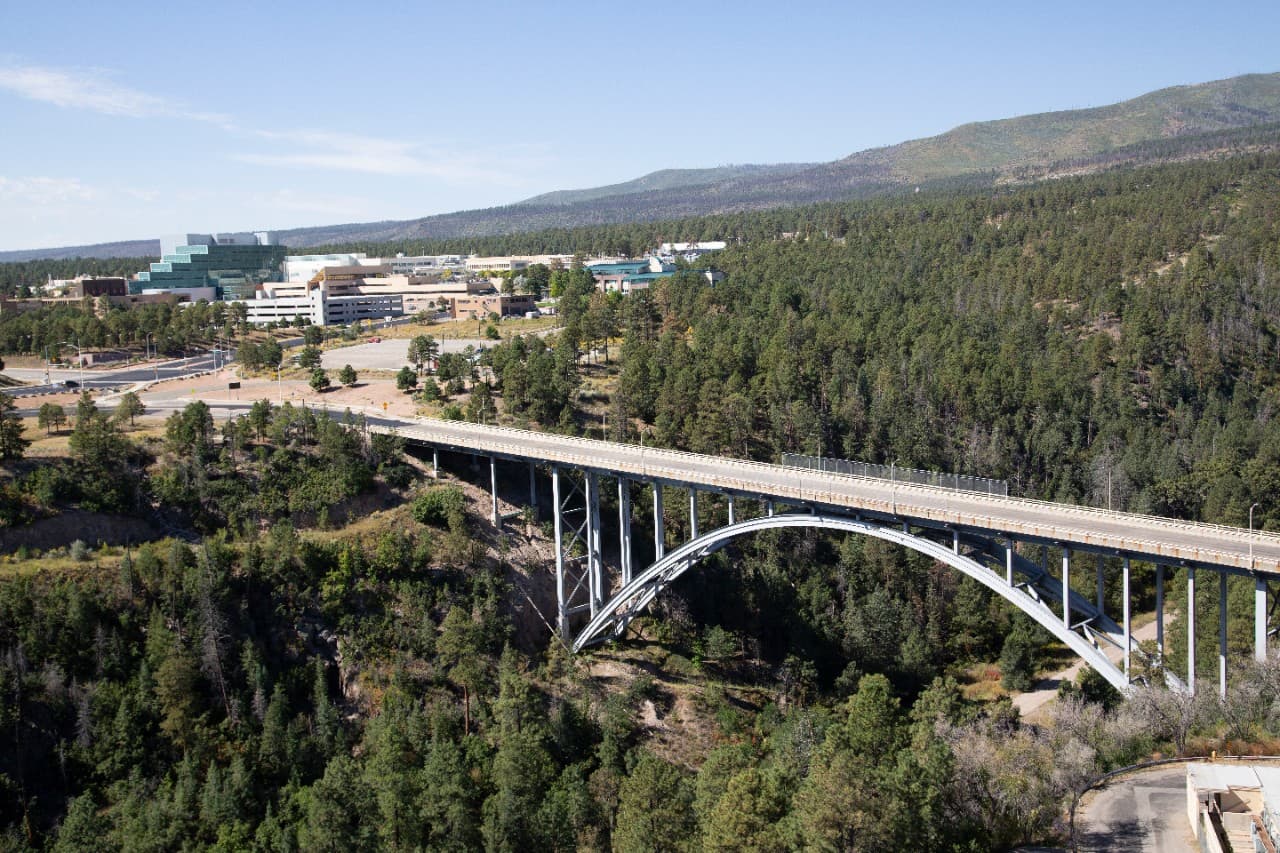
Otowi Crossing is where the story feels most visible
Otowi Crossing gives the day trip its clearest sense of place. The Otowi Suspension Bridge was built in 1924, sits on San Ildefonso Pueblo land, and is described in National Register documentation as the only suspension bridge associated with a public highway remaining in New Mexico.
The bridge was later closed to vehicular traffic in the late 1940s, after a two-lane steel bridge was built to handle the growing number of trips into the secret city and laboratory. That shift marks the moment when a quiet crossing became a boundary between the known world and the Atomic Age.
Edith Warner’s tea house nearby became a popular stop for scientists and their families, and it was famous for chocolate cake. Oppenheimer and other Manhattan Project scientists even used pseudonyms when reserving there, which added another layer to a place where secrecy and hospitality existed side by side.
Warner’s role did not end with tea and dessert. Oppenheimer later arranged for her to host dinners for people living behind the fence in Los Alamos, a detail that shows how the social life of the project stretched beyond the laboratory gates and into the homes and gathering places of the region.
Why this history still shapes what visitors see
Los Alamos is one of three units in the Manhattan Project National Historical Park, along with Oak Ridge, Tennessee, and Hanford, Washington. The park was established in 2015 and is jointly managed by the National Park Service and the Department of Energy, which gives the town a rare status as both a working community and a nationally interpreted historic landscape.
That arrangement still shapes the way Los Alamos presents itself. The visitor center, the marked landmarks, and the guided-tour structure all channel visitors toward places where the wartime past can still be read in the streets and overlooks, while keeping the town’s present-day routines intact.
For residents, that legacy is more than heritage branding. It influences who comes to town, what they expect to find, and how the community tells its own story, from the road signs on NM 502 to the preserved crossings tied to Oppenheimer’s arrival and the buildout that followed.
The result is a day trip that feels unusually complete. You can trace the route in the morning, stand at the bridge where the Atomic Age crossed into view, and leave with a clearer sense of why Los Alamos remains one of the most distinctive places in New Mexico.
This article was produced by Prism’s automated news system from verified source data, official records, and press releases, then run through automated quality and moderation checks before publishing. The system is built and supervised by the people who set the standards it runs under. Read our full AI policy.
Did this article answer your question?