McCauley Springs Fire grows to 708 acres, triggers forest closures
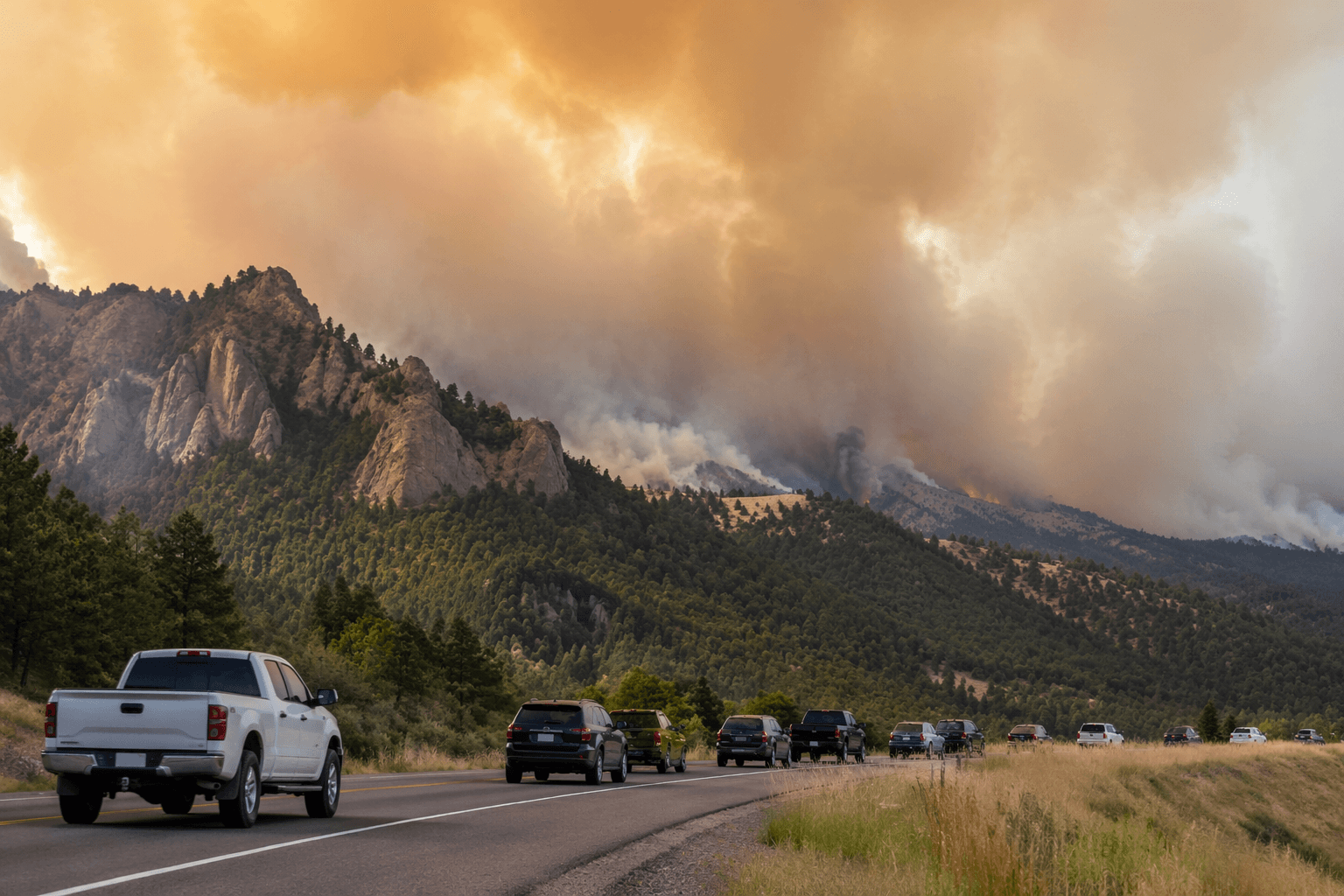
The McCauley Springs Fire jumped to 708 acres with no containment, closing Highway 4 and nearby trails east of Battleship Rock. Smoke now threatens weekend plans across the Jemez corridor.

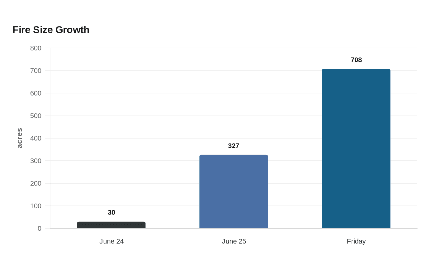
The McCauley Springs Fire had grown to 708 acres and remained 0% contained Friday morning, tightening closures along Highway 4 and the Jemez Mountains recreation corridor east of Battleship Rock. The Santa Fe National Forest also imposed Emergency Stage II Fire Restrictions and a temporary area closure over the fire area, cutting off roads and trails through at least July 11.
The fire was detected June 24 on the Jemez Ranger District near Battleship Rock and had already jumped from about 30 acres on the first day to 327 acres by June 25. Northern New Mexico Type 3 Incident Management Team Incident Commander Luke McLarty took command Wednesday evening, and the Southwest Complex Incident Management Team 3 later assumed command as the incident drew 171 personnel.
Crews focused on holding lines after strategic firing operations the night before, using four divisions and six interagency hotshot crews from American River, Blue Ridge, Midewin, Sacramento, Santa Fe and Wolf Creek. Additional engines, crews and aircraft were ordered ahead of hotter, windier weekend conditions, as managers tried to keep the fire from making a run toward Highway 4 and the corridor from the Jemez Falls Trailhead to Redondo Campground.
Smoke was visible from Albuquerque, U.S. 550, Jemez Springs and surrounding communities, and it could affect areas of Highway 4. For Los Alamos County residents headed west for the weekend, that meant the usual route into the Jemez ran into closures, smoke and changing access.

The closure order, effective at 8 a.m. June 26 through 8 a.m. July 11, barred entry into the closed area and prohibited travel on roads and trails inside it. Highway 4 between mile markers 27 and 40 remained closed, along with Battleship Rock Campground, Jemez Falls Campground, Redondo Campground and Trail 137.
Sierra de los Pinos and Jemez Falls Campground were under evacuation actions, with evacuation centers at Mountain Baptist Church in La Cueva and the Jemez Senior Center. The National Interagency Fire Center listed National Preparedness Level 3.
This article was produced by Prism’s automated news system from verified source data, official records, and press releases, then run through automated quality and moderation checks before publishing. The system is built and supervised by the people who set the standards it runs under. Read our full AI policy.
Did this article answer your question?