NMED launches interactive StoryMaps showing Grants District uranium cleanup progress
NMED launched interactive StoryMaps showing cleanup progress at abandoned uranium sites north of Milan, giving nearby residents clearer, up-to-date information on remediation work.
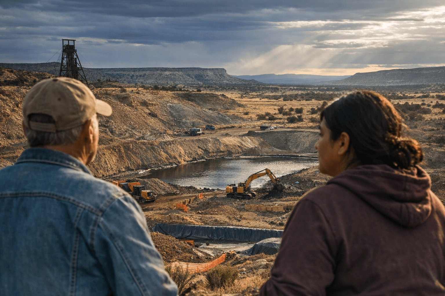
The New Mexico Environment Department launched interactive online StoryMaps to show cleanup progress at abandoned uranium mine and mill sites in the Grants Mining District north of Milan. The initiative, announced Jan. 15, uses a $12 million portion of a $20 million legislative appropriation to target legacy sites that lack a viable responsible party, and is intended to increase transparency and public engagement for communities near the work.
NMED said site selection prioritized proximity to residences, physical hazards, and readiness for partnership. The department is coordinating with the Energy, Minerals and Natural Resources Department and contractors to conduct site assessments and remediation work. The StoryMaps catalogue work already completed, planned activities, and resources that residents and local governments can use to better understand cleanup timelines and site conditions.
For residents of Los Alamos County and neighboring communities, the maps provide a way to track specific projects and to see where state-funded activity is concentrated. Abandoned uranium mines and mills in the region have long been a local environmental concern; the new online tools aim to make progress visible rather than buried in technical reports. Transparency is intended to help people assess potential exposure risks, changes to land access, and the outlook for long-term monitoring and reuse.
The funding framework matters because it focuses state dollars on sites without a viable responsible party - locations where private or corporate responsibility for cleanup cannot be assigned. By dedicating $12 million to these orphaned sites, the state intends to accelerate removals of physical hazards and to complete assessments that can guide future remediation work. Coordination between NMED, EMNRD, and contractors is central to that push, and the StoryMaps are designed to document each step from assessment through cleanup.
Beyond immediate safety concerns, the initiative carries economic and community implications. Visible cleanup activity can influence property perceptions, local planning, and recreational access in areas long shaped by mining infrastructure. The maps also aim to provide resources for affected communities, helping residents find contact points, timelines, and descriptions of planned activities rather than relying solely on periodic public meetings.
The launch of the StoryMaps is an operational step in a larger, ongoing effort to address legacy uranium contamination in the Grants District. For local readers, the new online tools mean easier access to where work is happening, what has been completed, and what is scheduled next. Expect the state to update the StoryMaps as assessments and remediation proceed, giving residents a clearer view of progress and next steps in cleaning up these longstanding sites.
This article was produced by Prism’s automated news system from verified source data, official records, and press releases, then run through automated quality and moderation checks before publishing. The system is built and supervised by the people who set the standards it runs under. Read our full AI policy.
Did this article answer your question?