Sago Fire Near Mescalero Reaches 53% Containment at 300 Acres
The 282-acre Sago Fire near Mescalero reached 53% containment Wednesday as Red Flag conditions loom this week across the same piñon-juniper terrain surrounding Los Alamos.
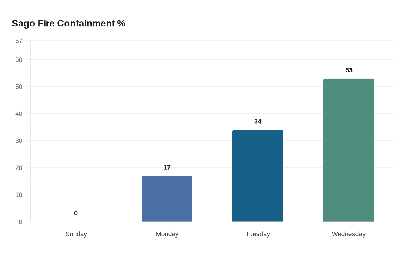
The Gila Las Cruces Type 3 Incident Management Team, under Incident Commander Marcus Cornwell, held 53% containment around the 282-acre Sago Fire on the Mescalero Apache Reservation as of Wednesday morning, April 1, a dramatic reversal from zero containment on the fire's first weekend, though the forecasted return of Red Flag conditions could test every foot of that progress before the week is out.
The fire started March 26, three miles south of Cow Camp Facilities, 19 miles east of Mescalero, and tore through tinder-dry piñon, juniper, grass, and brush as high winds drove it to 300 acres by Sunday. With 103 firefighters on the ground, crews could not close a single mile of secured perimeter. From there, containment climbed: 17% by Monday morning, 34% by Tuesday, and 53% by Wednesday after rainfall aided mop-up efforts and 95 personnel worked to extinguish hotspots along handlines, dozer lines, and retardant lines.
That 53% figure means a physical control line has been built around roughly half the fire's outer edge. The remaining 47%, about 130 acres of open perimeter, is unsecured. That boundary is the one that matters when conditions tighten: minimum relative humidity values across the Mescalero area reached the teens and low 20s last week, and the National Weather Service flagged the possibility of Red Flag Warning conditions returning to the region. High wind gusts over dry, cured fuels are what pushed the Sago Fire through zero containment in the first place, and the same fuel load remains on either side of every line crews have built.
No Northern New Mexico mutual-aid resources or aircraft that typically serve the Los Alamos area have been reported committed to the Sago Fire. Command rests with the Gila Las Cruces Type 3 team from southern New Mexico, which took over March 27 and coordinated large air tanker retardant drops during the fire's most aggressive phase.
The broader fire environment presses closer to home. The Santa Fe National Forest announced Stage 1 fire restrictions effective Thursday, joining Class III High Fire Danger restrictions on the Mescalero Reservation and Bureau of Land Management orders across Lincoln County as part of the same statewide pattern of above-average temperatures and drying winds expected to persist across Northern New Mexico this week.
Los Alamos residents tracking smoke should monitor fire.airnow.gov or the air quality stations that Los Alamos National Laboratory operates in Los Alamos and White Rock, which measure fine PM2.5 particulate matter that can spike from a distant fire even when no smoke is visible from the Pajarito Plateau. For evacuation readiness, the Sago Fire's trajectory is a useful benchmark: ignition to 300 acres with zero containment in under 72 hours, burning the same piñon-juniper mix that covers the Jemez Mountains above town.
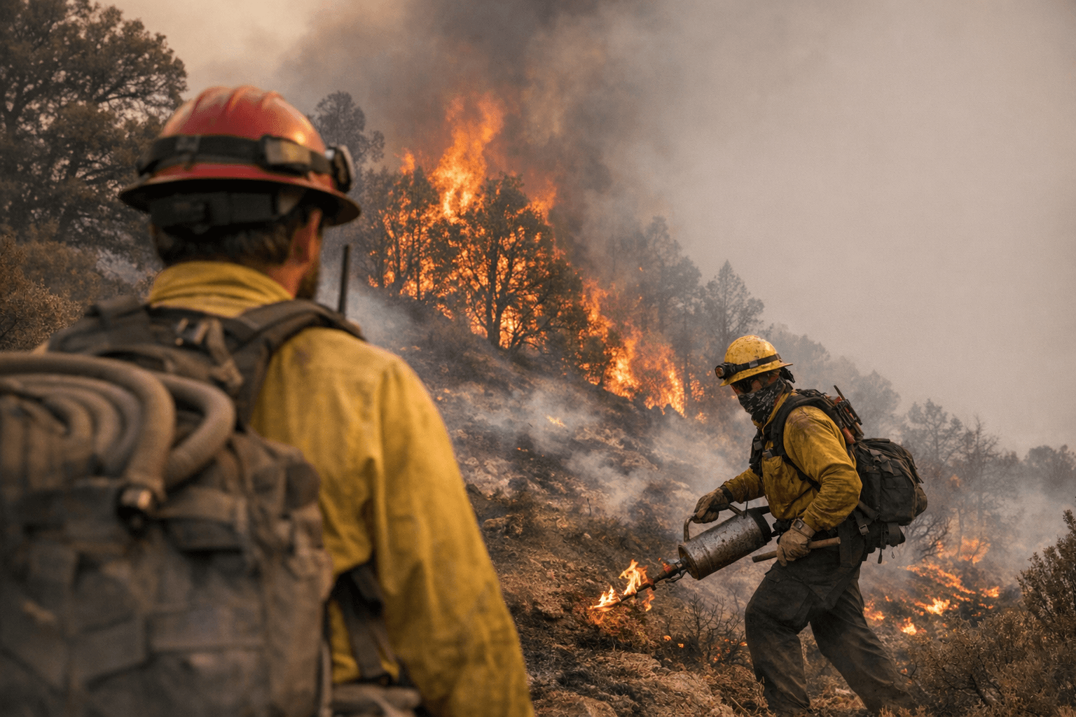
During a morning briefing Tuesday at the fire camp, Horace Comanche, the first Apache smokejumper and now a tribal elder serving as engine boss on the Three Rivers Engine, sang an honor song for firefighters past and present. A Mescalero and Chiricahua Apache member, he described it as a tribute to those who came before and those still doing the work.
This article was produced by Prism’s automated news system from verified source data, official records, and press releases, then run through automated quality and moderation checks before publishing. The system is built and supervised by the people who set the standards it runs under. Read our full AI policy.
Did this article answer your question?