Gallup Sun explains New Mexico's monsoon season and its impact
Monsoon season can flood arroyos, close I-40 near Gallup, and leave storms changing by the minute. Here’s how to read the forecast and get ready before the sky turns.
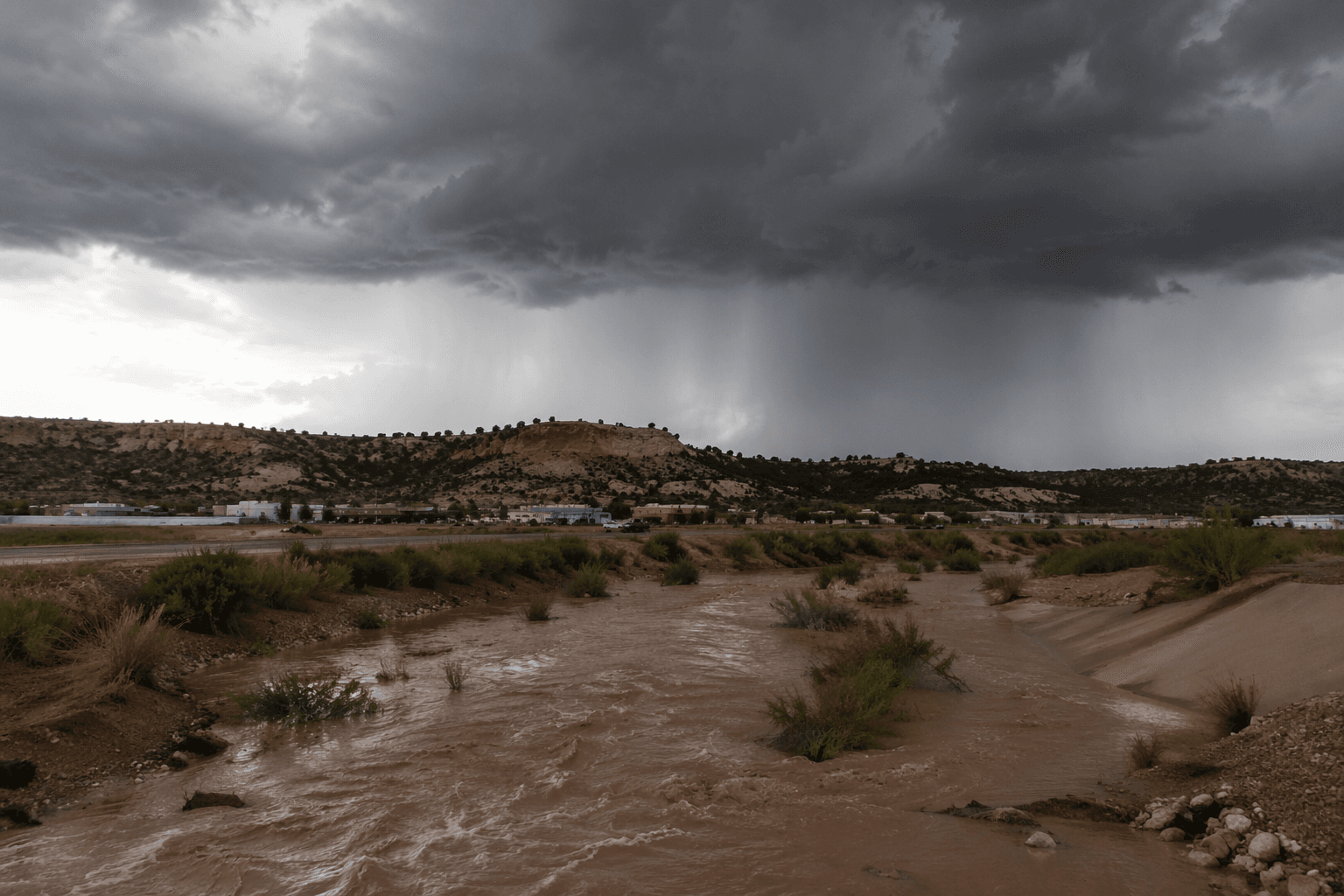
In McKinley County, monsoon season can turn a clear afternoon into a flooded arroyo, a stalled commute on Interstate 40 near Gallup, or a sudden dust storm that drops visibility in seconds. The official season runs June 15 through Sept. 30, and lightning or downburst winds can knock out power just as quickly as the rain arrives. Here is what to watch for, and how to get ahead of it.
What the monsoon really is
The North American Monsoon is not one storm or one rainfall event. It is a seasonal shift in winds that pulls heavy moisture into the Southwest United States and Mexico, and monsoon literally means “seasonal winds.” As the jet stream moves north and strong upper-level west winds relax, showers and thunderstorms become more common across New Mexico.
Monsoon moisture can deliver 30 to 60 percent of New Mexico’s annual precipitation. In Gallup, the effect is dramatic from year to year: Gallup Airport’s wettest monsoon on record brought 9.87 inches in 1999, while the driest brought just 1.23 inches in 1979. The 1991 to 2020 average at the airport was 4.91 inches.
Why forecasters expect an active pattern
The Albuquerque forecast office points to a very dry winter, above-normal sea-surface temperatures in the Gulf of California, and a transition toward El Niño conditions as ingredients for a wetter-than-normal setup that can help push tropical moisture into the Southwest. That does not guarantee a storm on any given day, but it does raise the odds of a pattern that can swing quickly from useful rain to dangerous weather.
There is a strong link between dry winters and wetter summers. Winters with snowpack below 50 percent are generally followed by summers with above-average precipitation, and the recent record wet monsoon in New Mexico, in 2006, followed an exceptionally dry winter.
The hazards that hit McKinley County fastest
Flash floods are the most urgent risk. They usually occur within six hours of heavy rainfall, can rise in minutes, and can reach heights of 30 feet or more. They are especially dangerous for people in vehicles, and flash-flood-producing rain can also trigger catastrophic mudslides. In McKinley County, that danger runs through dry arroyos, low spots in paved roads, canyon edges and wildfire scars that can turn from dry ground to rushing water in moments.
Dust storms bring a different kind of danger, and they often show up early in monsoon season. They are more common near agricultural areas and around Gallup on Interstate 40 in McKinley County. If you are caught in one, pull off the road immediately, because driving into a wall of dust can be deadly when visibility disappears in seconds.
The season also brings heat stress, lightning and downburst winds. Those hazards often travel together, and a storm can create more than one problem at once. A burst of rain may cool the air for a few minutes, then leave behind muggy heat, wind damage and the risk of power disruptions.
How to read forecasts without getting caught off guard
The most useful monsoon forecast is not just whether rain is possible, but whether conditions are ripe for fast changes. Near-to-above-normal precipitation can still arrive in bursts, which means one part of McKinley County may stay dry while another gets hit hard. That is why local weather alerts matter more than a general summer outlook once storms begin to build.

Monitor NOAA Weather Radio or local media during monsoon season, and pay attention to flash flood watches and warnings. A watch means conditions are favorable for flooding, while a warning means flooding is happening or imminent and you need to move fast. If a flash flood warning is issued, get to higher ground immediately. Do not wait to see whether water starts moving in your area.
What to do at home and on the road
Preparation in McKinley County starts with knowing where water moves when it rains hard. If your home, work site or usual route sits near an arroyo, a low-water crossing or a burn scar, treat that spot as a problem before the first storm arrives. The same storm system that helps crops and cools the landscape can also cut travel between communities, strand drivers on local roads and leave neighborhoods dark if winds damage lines.
Before you head out, keep these habits in place:
- Keep NOAA Weather Radio on or check local weather alerts before leaving home.
- Never drive or walk through flooded roadways, even if the water looks shallow.
- If dust closes in on Interstate 40 or a local road near Gallup, pull off the road and stop.
- Move quickly to higher ground when a flash flood warning is issued.
- Pay close attention near arroyos, canyon rims and wildfire scars, where water and debris can move fast.
The Albuquerque forecast office issued 278 flash flood warnings in 2024, including 109 tied to burn-scar flooding. New Mexico also finished 2025 as the second-warmest year on record, which adds heat stress to a season already built around sudden downpours, wind and lightning.
This article was produced by Prism’s automated news system from verified source data, official records, and press releases, then run through automated quality and moderation checks before publishing. The system is built and supervised by the people who set the standards it runs under. Read our full AI policy.
Know something we missed? Have a correction or additional information?
Submit a Tip
