Lightning sparks small Hausner Fire in Zuni Mountains, smoke visible west of Grants
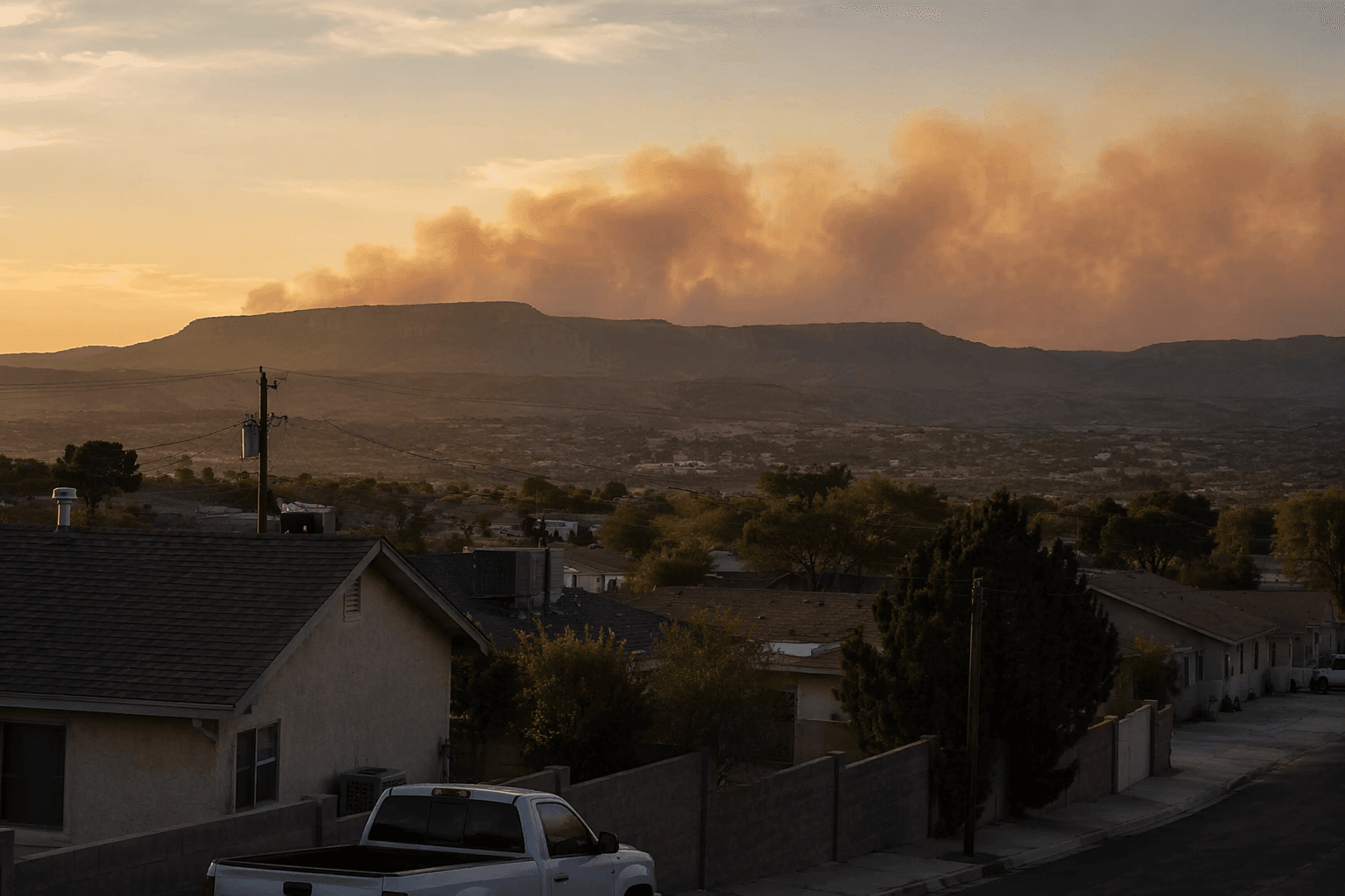
Smoke from a 2-acre Hausner Fire drifted west of Grants after a June 8 lightning start in the Zuni Mountains, with crews responding in Cibola County.

Smoke from a small wildfire in the Zuni Mountains was visible west of Grants and Milan after lightning sparked the Hausner Fire in Cibola County. The blaze was first reported about 4:54 p.m. June 8 on the Mt. Taylor Ranger District, and incident-tracking data listed it at 2 acres as U.S. Forest Service crews responded.
The fire drew attention because New Mexico is already in a high-risk fire-weather pattern. Stage I fire restrictions are used when hot, dry or windy conditions raise the odds of accidental ignitions, and the National Weather Service in Albuquerque has continued to flag drought as a fire concern across the state. In a forest where one spark can become a fast-moving threat, even a fire measured in acres can matter to people living near the burn area, traveling through the region or recreating in the Cibola National Forest.
The Hausner Fire also fit a broader pattern on the forest this spring. Local reporting described it as the latest in a series of relatively small wildfire starts on the Cibola National Forest, following recent responses to the La Mosca Springs Fire and Seco Fire. That pattern has kept attention on the Cibola National Forest’s restriction environment, where federal and state limits are meant to reduce the chances that a dry lightning strike, campfire or other spark turns into a larger incident.
Incident-tracking data on June 8 listed the fire’s cause as undetermined, even as local reporting described the start as lightning-sparked. By that evening, the fire was still being tracked at 2 acres in Cibola County, and smoke remained the most visible sign of the blaze to communities west of Grants. The Southwest Area Fire Restrictions Dashboard is the place officials use to identify current federal, state and, in some cases, county fire restrictions as the region stays locked in drought and dry weather.
This article was produced by Prism’s automated news system from verified source data, official records, and press releases, then run through automated quality and moderation checks before publishing. The system is built and supervised by the people who set the standards it runs under. Read our full AI policy.
Know something we missed? Have a correction or additional information?
Submit a Tip