Key Largo flood plan seeks to raise Winston Waterways roads, improve drainage
Winston Waterways keeps flooding on sunny days, and Monroe County’s $51 million fix still depends on homeowner approval before crews can raise roads and build new drainage.

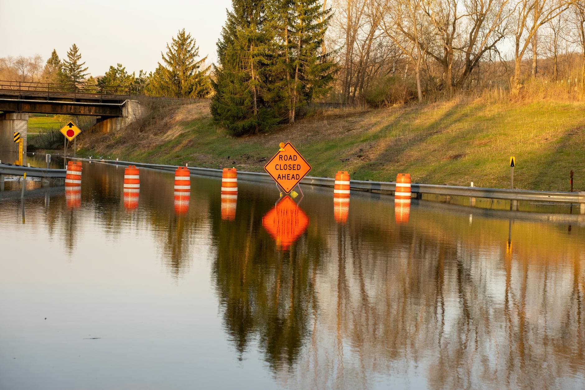
King tides and rising groundwater have turned Winston Waterways in Key Largo into a neighborhood where getting home can mean driving through water. Monroe County is now pushing a $51 million road elevation and drainage plan that officials say is meant to keep access to homes and properties in the area through 2045, but the project still needs support from at least 51% of property owners before work can begin.
The proposal covers 17 roads stretching from Michelle Drive and Gale Place on the west side to Valencia Road on the east. County materials say sections of those roads would be raised by 0 to 24 inches to reach a minimum design elevation of 2.26 feet NAVD 88, based on the county’s two-year Roads Vulnerability Study and water-level projections through 2045. Monroe County has already undertaken engineering design and permitting for the project, but the plan also depends on driveway changes, utility relocation and property-by-property coordination to make the new road heights work with private access.
The drainage work is as important as the roadwork. County documents describe a modern stormwater system built around inlet structures, piping, a treatment unit, a pump station, a force main and pressurized injection wells. The county says that existing gravity drainage features such as roadside swales, exfiltration trenches and gravity injection wells are losing effectiveness as groundwater rises. The pump station would include an elevated emergency generator designed to keep operating during a storm event other than a hurricane.
County Commissioner Holly Raschein has backed the project and urged residents to do the same, saying she saw the flooding firsthand during more than a decade living nearby. Consultant Erin Deady told residents the Keys are seeing more tidal flooding as sea levels rise, while engineer Julianna Ortiz said the road elevations are being designed to meet 2045 flood projections. Greg Corning, the WSP engineer on the project, said the system is intended to collect rainfall and reduce the impact of king tides, underscoring how much engineering and neighborhood cooperation will be required.
Monroe County has grouped Winston Waterways among 82 neighborhood road-project areas identified in its Roads Vulnerability Study, placing it in the 2025 round of projects. The county says it is refining elevation data for about 300 miles of county roads with mobile LiDAR as it tries to predict where sea-level rise will hit next. Public engagement has already been scheduled around the Winston Waterways plan, including a Feb. 10 stakeholder meeting and an April 21 virtual project meeting, but the real test remains whether enough homeowners will sign on to let the work move forward.
This article was produced by Prism’s automated news system from verified source data, official records, and press releases, then run through automated quality and moderation checks before publishing. The system is built and supervised by the people who set the standards it runs under. Read our full AI policy.
Did this article answer your question?

