Flash flood warning issued for southeastern Morgan County, heavy rain threat continues
Heavy rain kept southeastern Morgan County under a flash flood warning, with storms capable of dumping 2 to 3 inches an hour and flooding roads fast.

A flash flood warning covered southeastern Morgan County and parts of Sangamon County, where heavy rain could turn low-water crossings and rural roads dangerous in minutes. The National Weather Service said drivers who meet flooded pavement should turn around and not drown, as storms continued to threaten central Illinois.
The warning for southeastern Morgan County was in effect until 1:30 p.m. June 8, and the National Weather Service Central Illinois page still listed a Flood Warning among active watches, warnings and advisories on June 9. Forecasters at NWS Lincoln said thunderstorms were expected through the evening and could linger past midnight, with heavy rain posing a localized flooding risk across Morgan, Sangamon and nearby counties.
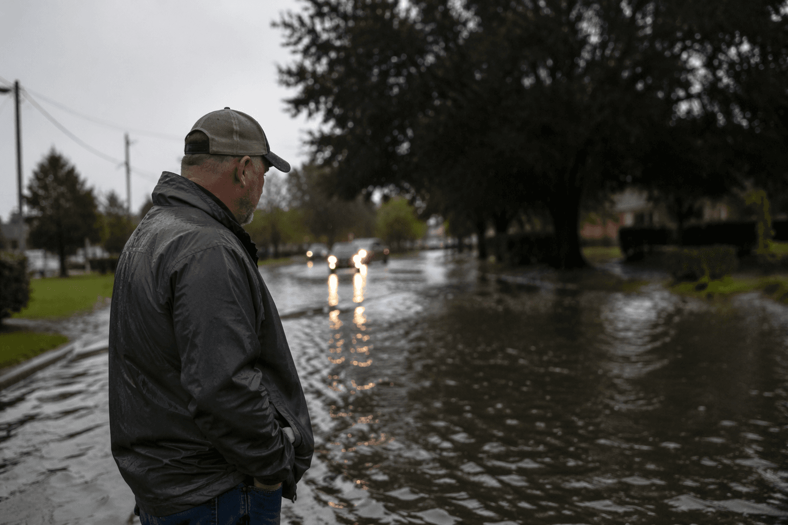
That risk was sharpened by rain rates that could reach 2 to 3 inches per hour at times. In that kind of setup, drainage ditches, low spots and shallow crossings can fill before drivers have much warning, especially in the more exposed parts of southeastern Morgan County and along routes that funnel runoff toward creeks and field drains.
Meteorologists and FOX Illinois both pushed updates as the storm threat moved through west-central Illinois, underscoring how quickly the weather could shift from thunder and rain to road closures and stranded vehicles. The National Weather Service repeated the same public safety message throughout the event: if you encounter a flooded roadway, turn around, don't drown.
Morgan County sits in the NWS Lincoln forecast area, and the office tracks storms in real time with flood-monitor and local storm-report tools that help document both immediate impacts and the damage left behind. That matters in a county that has taken hard hits before. NWS Lincoln’s storm-history pages show an EF-1 tornado struck Morgan County on June 18, 2025, tracking 3.6 miles for eight minutes with maximum winds of 100 mph. The same history also notes a tornado on April 24, 1961 that crossed southern Morgan County into Sangamon County.
Even beyond tornadoes, the county has seen hail and severe weather in recent spring outbreaks across central Illinois. With more thunderstorms in the forecast and heavy rain still a concern, the immediate hazard remained the same: keep clear of flooded roads, especially in the southeastern part of the county where water can rise faster than drivers expect.
This article was produced by Prism’s automated news system from verified source data, official records, and press releases, then run through automated quality and moderation checks before publishing. The system is built and supervised by the people who set the standards it runs under. Read our full AI policy.
Know something we missed? Have a correction or additional information?
Submit a Tip