Prudhoe Bay guide spotlights oilfield work and Arctic scenery
Prudhoe Bay is not a normal town, but an oilfield camp where access rules, rough roads, and Arctic light shape every visit. The scenery is real, but so is the industry.

Prudhoe Bay is an oilfield first, a destination second
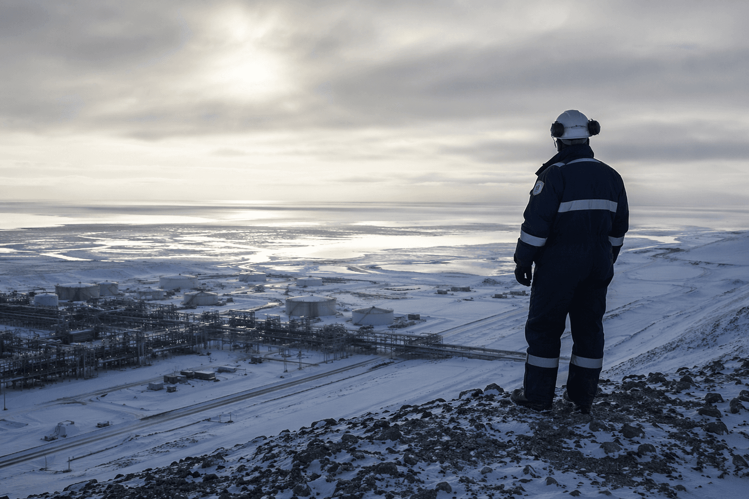
The big surprise in Prudhoe Bay and Deadhorse is how little of it feels like a traditional town. What looks like a bucket-list Arctic destination is really a work camp built to support oil development on the North Slope, with lodging, the airport, and service facilities clustered around a logistics hub rather than a walkable community. Most of the businesses there serve drilling, construction, pipeline support, maintenance, and other oil-field needs, which is why Prudhoe Bay remains one of the most economically important places in Alaska.
That industrial identity also explains the numbers. The Prudhoe Bay census-designated place had 1,310 residents in the 2020 census, down from 2,174 in 2010, even though thousands more temporary workers cycle through the oil fields. The North Slope Borough says about 4,000 people employed in North Slope oil fields are counted as residents because they work at least half the calendar year there. In other words, the place is bigger in function than it is in population count.
A place shaped by oil history and borough politics
Prudhoe Bay is not just a modern work camp. It sits at the center of Alaska’s largest oil province, where Prudhoe Bay oil was confirmed in 1968 by Atlantic Richfield Company and Humble Oil, now Exxon. That discovery quickly set off pipeline planning, and the Trans-Alaska Pipeline System began carrying oil on June 20, 1977. Since then, Prudhoe Bay has served as the northern anchor of a route that transformed the state’s economy.
The North Slope Borough was created by election in 1972 and officially incorporated on July 2, 1972, giving local communities a governing structure at the same time the oil era was accelerating. That matters because Prudhoe Bay and Deadhorse are not isolated curiosities. They sit inside a borough that has had to manage the pressures of extraction, housing, public services, and seasonal work for decades, while balancing the realities of life near the Arctic Ocean.
Why the Dalton Highway feels like the trip and the warning label
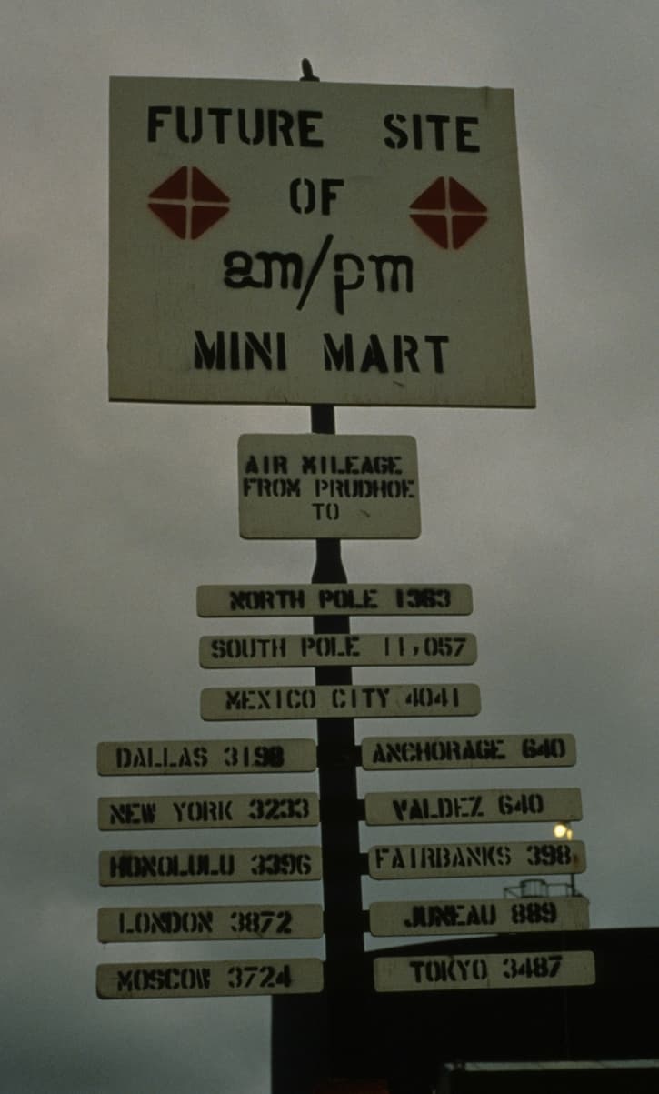
Travel Alaska puts Deadhorse 498 miles north of Fairbanks via the Dalton Highway, and that distance is only part of the story. The road is long, remote, and largely gravel, with heavy truck traffic moving supplies and equipment to the oil fields. Drivers are warned to watch for dust, potholes, rocks, ruts, and maintenance equipment, all of which can turn a summer drive into a slow, demanding run.
The route is still one of the great Alaska road trips because the scenery changes constantly. The journey passes the Yukon River crossing, the Arctic Circle sign, Atigun Pass, Gates of the Arctic National Park and Preserve, and the Arctic National Wildlife Refuge. Those landmarks make the drive memorable, but they also remind visitors that this is a working corridor first and a scenic corridor second. Travel here rewards patience, not speed.
What the light does to the landscape
The Arctic calendar changes how Prudhoe Bay feels more than any postcard image can show. In summer, Deadhorse gets nearly 64 days of midnight sun, with daylight running from May 20 to July 22. In winter, the darkness lasts 55 days, from November 24 to January 18. That kind of light pattern is not a side note. It affects travel, work schedules, wildlife viewing, and how visitors experience the place.
For first-time travelers, the nonstop summer light can be disorienting in the best way. It is easy to underestimate the distance between stops, overstay a day in a place where weather and logistics rule everything, and forget that the landscape does not behave like southern Alaska. In winter, the reverse is true: the darkness is long enough to make the area feel sealed off from the rest of the state.
What you can see, and what stays off-limits
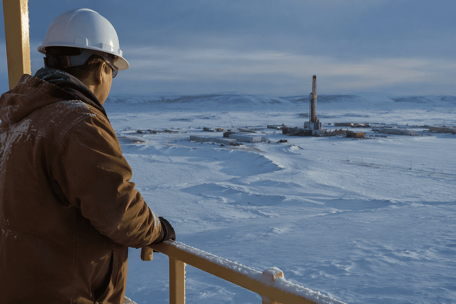
Prudhoe Bay and the Arctic Ocean draw curiosity, but access is limited. Only oilfield workers and permitted tour groups may enter certain areas, and unescorted visitors are not allowed on docks or area roads. That means the visit is not a free-roaming beach day at the edge of the world. The industrial footprint is controlled, and permission matters.
The practical takeaway is simple: plan to observe rather than wander. Publicly accessible experiences are centered on the road journey, approved visitor areas, and guided access where allowed. The surrounding infrastructure, including oil-field facilities and pipeline support zones, is not open territory. That restriction is part of the story, not an inconvenience added later.
A visitor who wants to experience Prudhoe Bay respectfully should keep a few basics in mind:
- Stay on approved routes and do not treat industrial roads like sightseeing pullouts.
- Assume active work zones have safety rules that are stricter than a normal highway stop.
- Give trucks and maintenance vehicles space, especially on gravel sections with dust and limited visibility.
- Treat guided access as the proper way to reach restricted areas.
- Pack for cold wind and sudden weather changes, even in summer.
Wildlife and scenery are part of the appeal, but not the whole point
The wildlife viewing can be extraordinary. The guide points to caribou, grizzly bears, Arctic foxes, birds, and musk oxen, all of which reinforce how alive the far North Slope can be despite its industrial image. The tundra, rivers, and wide-open sky make the trip feel larger than the oil patch around it.
That is part of why the pipeline story matters so much here. TAPS runs 800 miles from Prudhoe Bay to the Valdez Marine Terminal, crossing three mountain ranges, three major earthquake faults, and hundreds of rivers and streams. It is an engineering feat, but also an environmental and logistical flashpoint that explains why Prudhoe Bay has always been watched closely. The route is a reminder that this part of Alaska is defined by both extraction and extreme terrain.
Why Prudhoe Bay matters to North Slope residents
For people who live in the North Slope Borough, Prudhoe Bay is not a novelty stop. It is an economic engine, a work base, and a place where the borough’s finances and labor force are tied directly to oil. The fact that 4,000 oil-field workers are counted as residents because they spend at least half the year there shows how fluid the population really is.
That is the reality check travelers need. Prudhoe Bay is not built around tourism, but its remoteness, infrastructure, and Arctic setting still attract people who want to see the edge of the road and the edge of the ocean. The best visits are the ones that understand both sides of the place at once: the scenery that draws you north, and the work zone that keeps the whole corridor running.
This article was produced by Prism’s automated news system from verified source data, official records, and press releases, then run through automated quality and moderation checks before publishing. The system is built and supervised by the people who set the standards it runs under. Read our full AI policy.
Know something we missed? Have a correction or additional information?
Submit a Tip