Lower Wildrose Road reopens in Death Valley after flood damage
Lower Wildrose Road reopened after nearly three years, restoring the direct route to Wildrose and Telescope Peak but only as a narrow, unpaved detour with strict vehicle limits.
Lower Wildrose Road is open again in Death Valley National Park, restoring a key route for visitors, maintenance crews and travelers headed toward the park’s higher-elevation western side. But the reopening comes with clear limits: the road is still unpaved, only vehicles shorter than 25 feet may use it, and park managers say more stabilization work is still ahead.
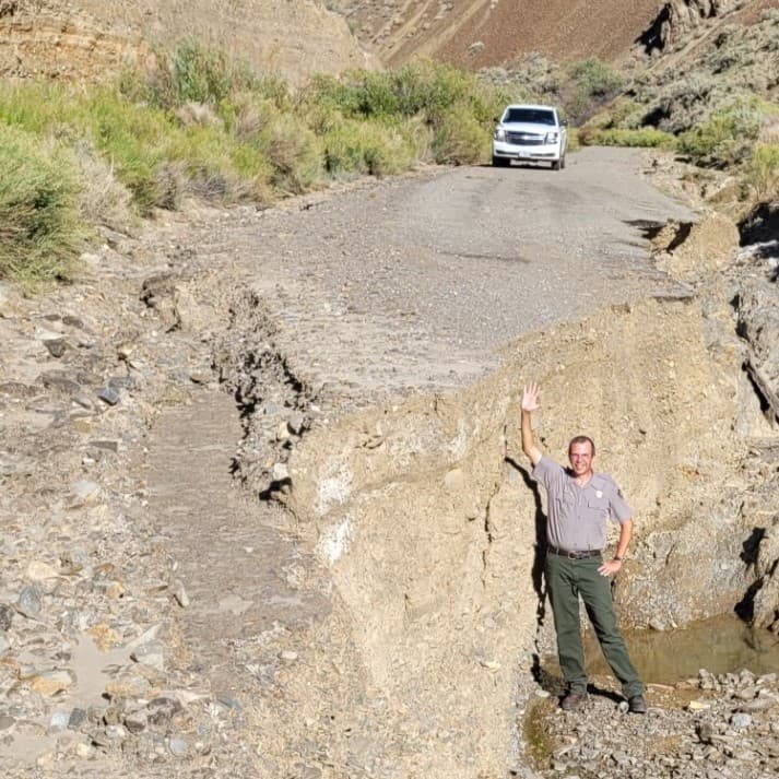
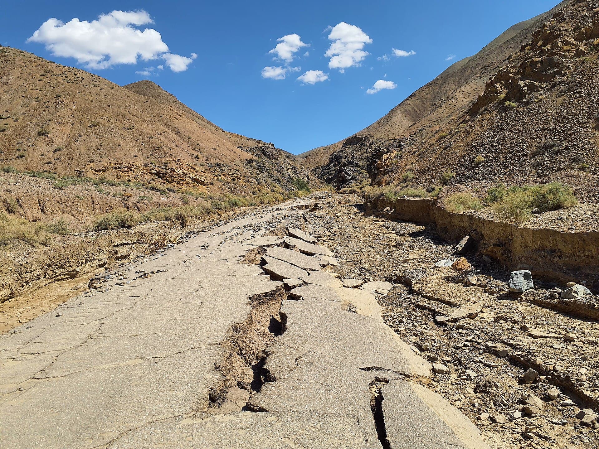
The National Park Service reopened the road June 3 after nearly three years of closure following the flash floods triggered by the remnants of Hurricane Hilary in August 2023. Floodwaters carved a 9-foot-deep drop across the roadway and destroyed much of the asphalt, leaving the corridor closed while crews focused on emergency repairs and interim recovery work.
For Nye County residents and Pahrump travelers who use Death Valley for recreation or route planning, the reopening matters because Lower Wildrose Road, also known as Trona-Wildrose Road, is the most direct route from Ridgecrest, California, into the Wildrose area. It provides access to the historic Charcoal Kilns, the Telescope Peak Trail and several backcountry campgrounds, making it one of the park’s most important connectors for the west side of Death Valley.

The park is treating the road as a work in progress rather than a fully restored highway. Planning documents call for rehabilitation of 4.8 miles of Emigrant Canyon Road, from the junction with Emigrant Canyon Road and Charcoal Kilns Road to the pipe gate at the old National Monument boundary, about one mile east of the current park boundary. The park says the route has been damaged by flooding for decades, including a major flash flood in the late 1980s, a reminder that this corridor remains vulnerable whenever desert storms hit.
That vulnerability was on full display during Hurricane Hilary, when flooding hit Death Valley from August 19 through 21, 2023. Furnace Creek recorded 2.2 inches of rain on Aug. 20, the wettest day on record there and more than the park’s annual average rainfall of 2.15 inches. In the broader recovery effort, park officials said emergency repairs covered 1,323 miles of roads and involved 152 Death Valley employees, 256 other National Park Service workers, the Timbisha Shoshone Tribe, Caltrans, the Federal Highway Administration, Inyo County and multiple contractors.
Not everything along the reopened corridor is ready. The stairs at the Wildrose Station picnic area remain unsafe because flood erosion damaged them, and the park says additional stabilization work will continue in the coming years. For now, access has returned, but so has the warning that Death Valley’s roads can change fast when the next storm arrives.
This article was produced by Prism’s automated news system from verified source data, official records, and press releases, then run through automated quality and moderation checks before publishing. The system is built and supervised by the people who set the standards it runs under. Read our full AI policy.
Know something we missed? Have a correction or additional information?
Submit a Tip