Schunnemunk State Park trails, parking and summit details in Orange County
New 1.7-mile Schunnemunk Meadows Trail opened, expanding accessible meadow access at Schunnemunk State Park; know parking, trail blazes and rail restrictions before you go.
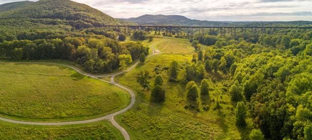
A $1.9 million multi-use trail now provides an easier gateway into Schunnemunk State Park’s 3,300 acres, offering wide crushed-stone paths across 220 acres of wildflower meadows at the mountain’s base. The Schunnemunk Meadows Trail, celebrated on September 11, was developed in partnership with the Open Space Institute, New York State Office of Parks, Recreation and Historic Preservation, and the Palisades Interstate Park Commission.
Schunnemunk rises to about 1,664 feet and contains ridge lines, glades and panoramic lookouts that make it one of Orange County’s most scenic public lands. The park hosts more than 20 miles of marked trails, including the Long Path, Jessup, Western Ridge, Trestle, Sweet Clover, Otterkill, Dark Hollow and Barton Swamp routes. Joshua Laird, executive director of the Palisades Interstate Park Commission, said, “The new Schunnemunk Meadows Trail is a beautiful location for hiking in the shadow of Schunnemunk Mountain,” and partners emphasized that “Partnerships such as the one between OSI, PIPC, and New York State Parks are essential to advancing land protection and expanding open space connectivity in the Hudson Highlands and beyond.”
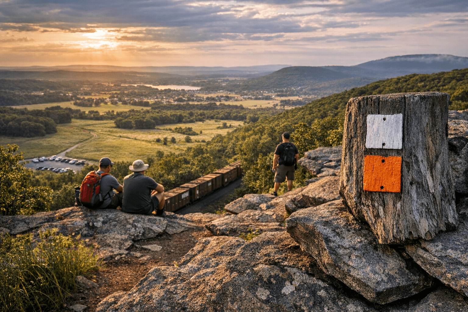
Practical route details matter for visitors. A recommended loop that many trip reports show starts from the Otterkill Road parking and follows an interconnected sequence of white, red, yellow, blue, orange and additional white-blazed trails for a roughly 6.75-mile round trip that can take about five hours. Hikers should expect strenuous sections: Otterkill Trail (red) climbs about 1,000 feet over roughly 1.6 miles; Ridge to Ridge (white with blue circle) climbs about 300 feet in 0.4 miles and includes rock scrambles; Sweet Clover (white) descends roughly 1,100 feet over 1.5 miles and follows a stream with waterfalls. The Megaliths or Megoliths area on the yellow trail reaches the highest point in Orange County and delivers uninterrupted views. One trail guide wrote, “This might be my favorite hike in the valley. Nonstop views.”
Parking and access are nonnegotiable planning points. Use the Otterkill Road parking lot to reach the west side of the park; Parks NY lists the Otterkill Road coordinates at 41 degrees 25.5450 minutes North and 74 degrees 6.1100 minutes West. Taylor Road parking at about 320 feet elevation is another option used by some visitors. Do not cross the railroad corridor. As HiketheHudsonValley warns: “Attention Jessup, Sweet Clover and Otterkill Hikers: the Metropolitan Transportation Authority forbids crossing its rail corridor in Schunnemunk State Park. Trespassers may be fined or subject to arrest by MTA police. There are currently no trail connections within the park between the east and west sides of the tracks. Please utilize the Otterkill Road parking lot to access the west side of the park.”
Additional visitor notes: the Schunnemunk Meadows Trail was designed as a four-season route for walkers, runners, cyclists, cross-country skiers and “people of all abilities.” The park is open during daylight hours only. Schunnemunk State Park permits deer hunting only; a NYS DEC hunting license and a $5 park permit are required, and Parks NY notes that “All hunting permits for the 2025 season have been purchased.” Geocaching permits are available through the Sterling Forest State Park office. Trip reports recommend downloading the state park map and using Avenza Maps for GPS navigation to find junctions that are otherwise easy to miss.
Plan ahead: download maps, park at Otterkill Road for west-side access, confirm hunting and permit status before you go, and prepare for steep climbs and rock scrambles on some ridge sections.
This article was produced by Prism’s automated news system from verified source data, official records, and press releases, then run through automated quality and moderation checks before publishing. The system is built and supervised by the people who set the standards it runs under. Read our full AI policy.
Did this article answer your question?