Severe winds, hail damage central Minnesota farm fields, including Otter Tail County
Wind gusts to 82 mph and golf ball-sized hail cut a narrow but hard-hit swath through farm fields near Wadena, putting Otter Tail County growers on alert.

Severe thunderstorms blasted across central Minnesota with enough force to snap trees, damage roofs and leave farm fields near Wadena scarred by hail, pushing Otter Tail County growers into an early-season damage assessment.
The National Weather Service issued a severe thunderstorm warning on June 10 for Otter Tail County and Grant County after storms lined up from near Fergus Falls to Melby to Kensington and moved northeast at 50 mph. Gusts to 82 mph had already been reported, and forecasters warned of 80 mph winds, flying debris, damaged windows and vehicles, power outages and the possibility that tornadoes could develop quickly.
The warning covered a wide stretch of west-central Minnesota, including Wadena, Perham, Ottertail Lake, New York Mills, Elbow Lake, Parkers Prairie and Battle Lake. For farm country, that kind of wind event can do more than bend crops. It can flatten stands, shred leaf tissue, knock hay down before a cutting is fully recovered and leave growers sorting out whether the damage is patchy enough to live with or severe enough to replant.
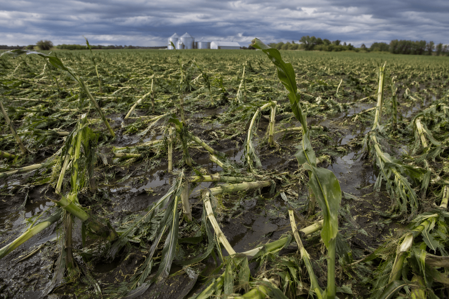
A separate agricultural storm report said the Deer Creek and Wadena area took a one-two punch later that day, with strong winds followed by golf ball-sized hail around 5 p.m. The damaged area was described as about one mile wide and 10 miles long. That kind of localized track often creates a complicated financial picture: one field edge may be nearly wiped out while another nearby parcel escapes, forcing crop-insurance decisions to be made acre by acre rather than farm by farm.
For Otter Tail County producers, the timing matters. June storms hit while many crops are still building their season-long yield potential, so losses now can translate into lower harvest expectations months later, even if plants survive the immediate blow. Replanting a damaged field means more seed, more fuel and more time, while leaving it alone may protect margins but lock in a smaller crop.

The region has seen this pattern before. The Minnesota Department of Natural Resources said a severe-storm outbreak on June 16, 2025, produced multiple tornadoes and funnel clouds in Otter Tail County. NOAA’s Storm Events Database, which tracks severe-weather records from January 1950 through February 2026, shows this week’s storm fits a long-running Minnesota risk that keeps farm financial exposure high every summer.
This article was produced by Prism’s automated news system from verified source data, official records, and press releases, then run through automated quality and moderation checks before publishing. The system is built and supervised by the people who set the standards it runs under. Read our full AI policy.
Did this article answer your question?