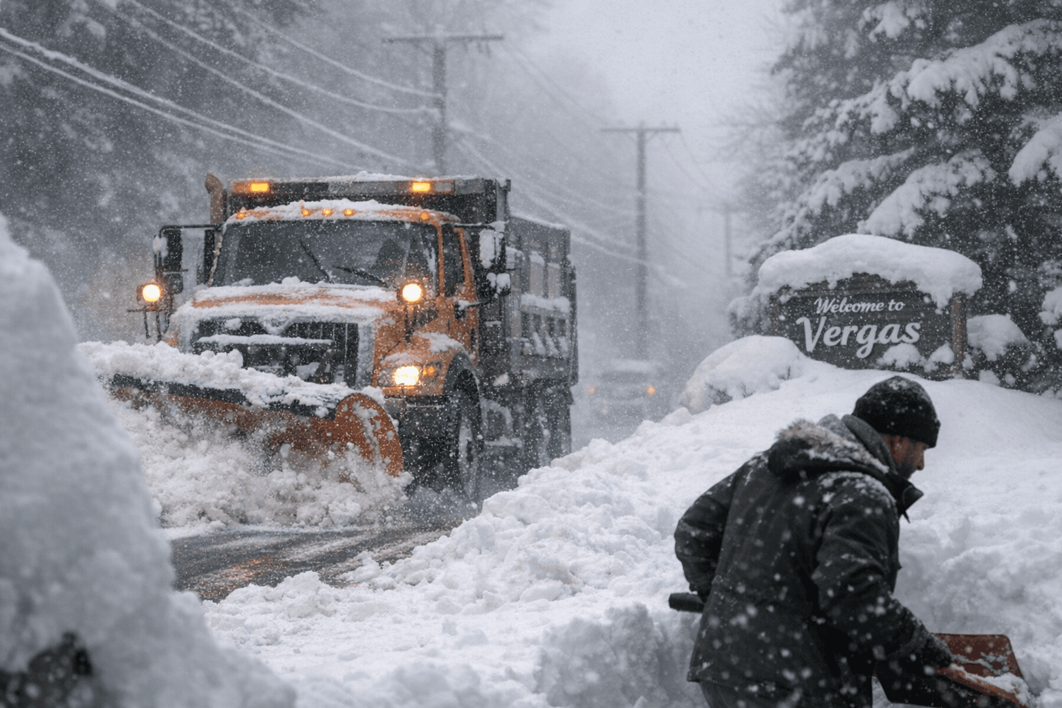
Vergas Tops Region With 17 Inches as Easter Weekend Storm Hits Lakes Area
Vergas received 17 inches while Fergus Falls got just 4 over Easter weekend, a 13-inch gap within the same county that pushed plow crews into marathon clearing shifts.
Thirteen inches separated the Vergas area from Fergus Falls on Easter weekend, a gap that meant the difference between passable county roads and a marathon push for the plow crews covering the county's hardest-hit townships.
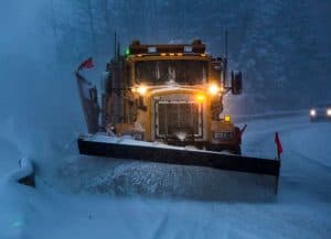
Vergas topped regional snowfall reports with 17 inches of dense, late-season accumulation while Fergus Falls logged just 4, a striking illustration of how sharply a spring storm band can divide communities within the same county. Ottertail recorded 8 inches, Battle Lake 5, and Clitherall, sitting between the two extremes, came in at 5.5. The storm moved through west-central Minnesota on Friday evening ahead of Easter Sunday, leaving behind a lopsided map that shaped the weekend differently depending on which road you live on.
Otter Tail County's 25 plow drivers cover 25 separate routes, and a significant snow event typically demands 8 to 12 hours of continuous clearing on a single shift. The routes nearest Vergas hit the top of that window. Drivers near Fergus Falls worked considerably lighter loads. Timing compounded the pressure: snow arrived as Easter weekend travel was building, putting county and township roads under holiday-level use before they had been fully treated.
Spring snow this wet and heavy carries specific hazards that midwinter storms often skip. The weight pulls branches down onto power lines. Water that cannot drain fast enough accumulates in low spots and road gutters, and when temperatures rise after the storm, the melt pushes hard against drainage systems near the lakes that define much of the county's terrain.
The accumulation band spread well beyond Otter Tail County. Detroit Lakes logged 8.2 inches, Deer Creek 6.8, and Nevis 6.5. Bemidji collected 12 inches, and Puposky in Beltrami County recorded 15 before Vergas's report came in as the regional high. Long Prairie, roughly 50 miles southeast of Vergas, saw 3.8 inches, and Hoffman 3.2, marking the outer edge of meaningful accumulation.
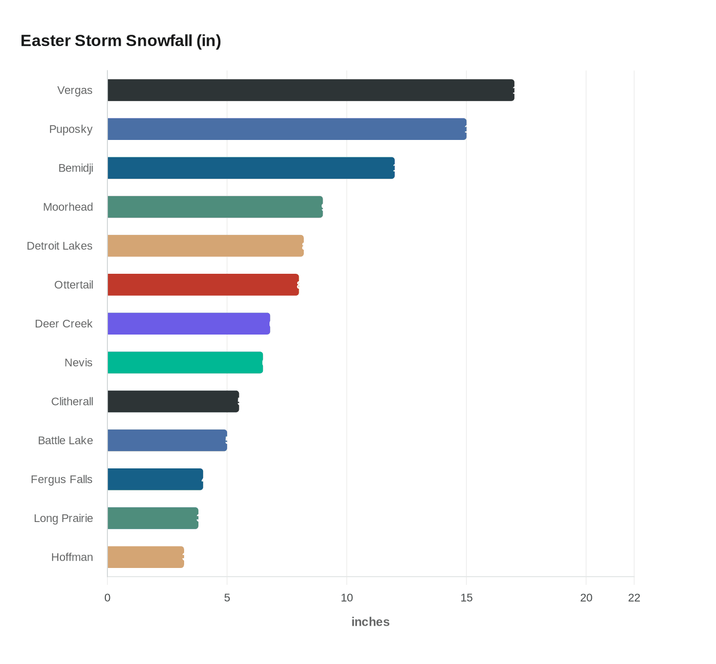
One counterintuitive number stood out: Moorhead, sitting farther west than Fergus Falls in the Red River Valley, recorded 9 inches, more than double the county seat's total. The storm's band tracked north and northeast rather than spreading evenly, which explained both Moorhead's outsized haul and Vergas's claim to the top of the regional leaderboard.
Sheriff Barry Fitzgibbons coordinates between law enforcement and the county highway department on road safety and access. Each area's group leader monitors the weather and reports to work to assess needs whenever snowfall probability reaches 20 percent or higher. That threshold was exceeded well before Easter sunrise in the Vergas area. County forecasters warned that additional rain or a follow-up snow system remained possible in the days that followed, as the region worked through its typically unpredictable late-season transition.
This article was produced by Prism’s automated news system from verified source data, official records, and press releases, then run through automated quality and moderation checks before publishing. The system is built and supervised by the people who set the standards it runs under. Read our full AI policy.
Did this article answer your question?