FEMA-funded report maps landslide risks across Owsley County, region
Owsley County is in a high-risk landslide zone, and a new FEMA-funded map now puts roads, homes and future building sites under a sharper spotlight.
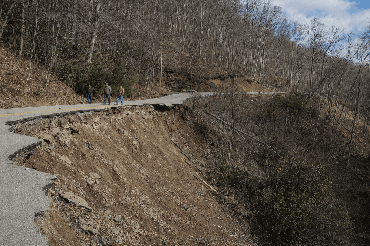
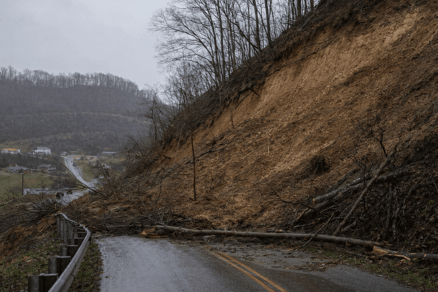
Landslide danger in Owsley County is no longer a vague hillside worry. A new 108-page plan maps where slope failure is most likely across the Kentucky River Area Development District, giving county officials a clearer picture of which roads, neighborhoods and development sites need the closest attention.
The report, “Multi-jurisdictional Hazard Mitigation Plan for Landslides for the Kentucky River Area Development District, Kentucky,” was written by Hudson J. Koch, Matt M. Crawford and Jason M. Dortch with support from FEMA Hazard Mitigation Grant Program project 4540-0013-P. It covers the eight-county district that includes Owsley, Breathitt, Knott, Lee, Leslie, Letcher, Perry and Wolfe counties, and says the region sustains relatively high landslide activity that affects several eastern Kentucky communities.
For Owsley County, the stakes are practical. The county was included in the February 27, 2022 federal disaster declaration for severe storms, flooding, landslides and mudslides tied to the late-December 2021 and early-January 2022 weather. FEMA’s preliminary damage assessment put Owsley County’s countywide per capita impact at $338.83, far above the statewide indicator of $1.63, a sign of how heavily a major storm can hit a small county with steep slopes and vulnerable roads.
The new plan is meant to help local governments do more than react after the ground gives way. It is designed to support infrastructure protection, land-use planning, situational awareness, emergency response, and recovery decisions. In plain terms, that means county and state officials now have a stronger basis for deciding where to reinforce drainage, monitor slopes more closely, prioritize road repairs, and steer new construction away from unstable hillsides.
Kentucky has long lived with this problem. The Kentucky Geological Survey says landslides are driven mainly by extreme or prolonged rainfall, and activity peaks in winter and spring. The agency also says steep slopes, weak rocks and development combine to make landslides costly, with the state spending more than $10 million each year on mitigation and repairs. Its statewide inventory tracks slides, flows, rockfalls and creep, and the new district plan builds on that work.
That effort has been expanding in recent years. In November 2024, the Kentucky Geological Survey said FEMA had awarded $98,057 to enlarge the landslide inventory database, with Matt Crawford collecting storm-linked data and Evelyn Bibbins mapping previously undocumented landslides using airborne lidar. FEMA later opened disaster recovery centers in Owsley County in March 2025 for survivors affected by severe storms, flooding, landslides and mudslides. For a county that keeps seeing the same slopes fail after heavy rain, the new map is a warning and a roadmap at the same time.
This article was produced by Prism’s automated news system from verified source data, official records, and press releases, then run through automated quality and moderation checks before publishing. The system is built and supervised by the people who set the standards it runs under. Read our full AI policy.
Did this article answer your question?


