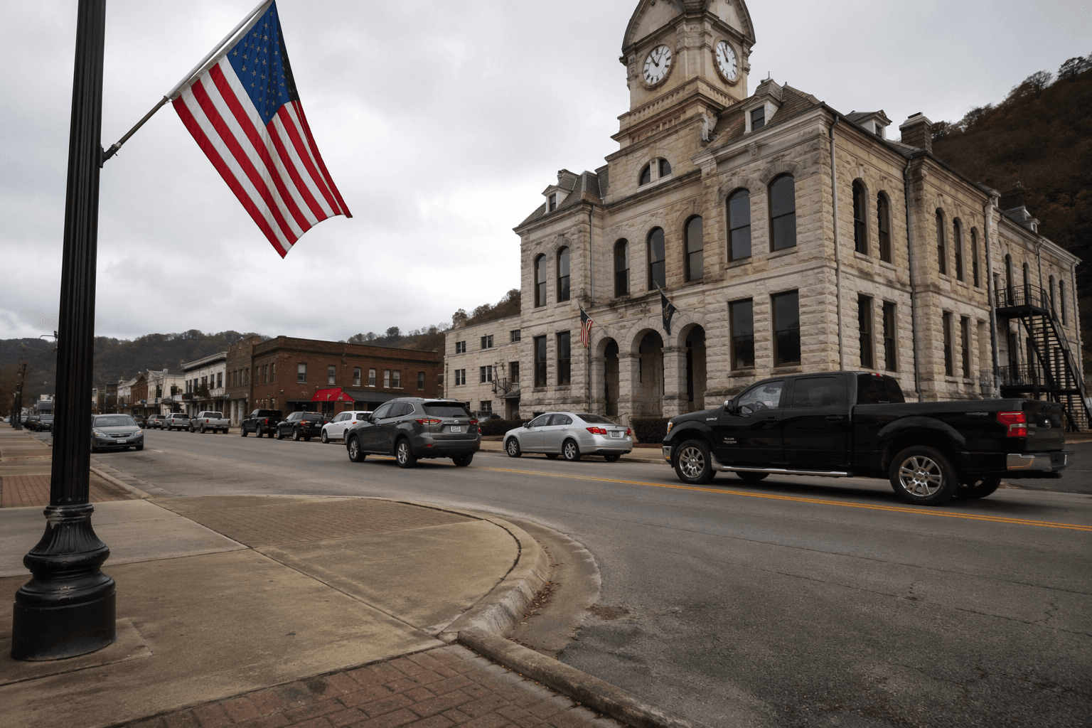
How Owsley County was formed from three neighboring counties in 1843
Owsley County was carved from Clay, Estill, and Breathitt in 1843, but its first map reached far beyond today’s borders into Lee, Jackson, and Wolfe.
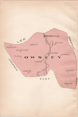
The county residents know today was drawn out of a much larger backcountry in a single move. Owsley County was organized on January 23, 1843, as Kentucky’s 96th county, carved from Clay, Estill, and Breathitt counties, and its first boundaries stretched well beyond the lines on a modern map.
How the county was assembled
Before Owsley existed, the land now inside it belonged to three older counties that had already taken shape: Clay County in 1807, Estill County in 1808, and Breathitt County in 1839. Those county lines mattered for where people went to court, where they paid taxes, and which seat of government controlled their daily business. When Owsley was formed in 1843, the new county pulled territory from each of those neighbors and created a new center of civic life closer to the South Fork of the Kentucky River.
The name came from William Owsley, born March 24, 1782, a Kentucky Court of Appeals judge who later served as governor from 1844 to 1848. That naming choice tied the new county to the state’s political leadership at the moment of its creation. It also gave the county a formal identity just as the area was shifting from scattered settlement to an organized local government.
What the first map looked like
The most surprising part of Owsley’s history is how much larger it once was. The original county included what is now all of Owsley County, most of present-day Lee County, and a considerable portion of what are now Jackson and Wolfe counties. In other words, the county that took shape in 1843 was not the compact territory people see today, but a broad district whose borders reached into land that later became three separate counties.
That earlier footprint still explains a lot about the region’s settlement patterns and family history. Owsley later gave up territory to help form Jackson County in 1858, Wolfe County in 1860, and Lee County in 1870. For anyone tracing deeds, wills, or family migration, those shifts matter because an ancestor who lived in the same hollow or along the same creek may have belonged to different counties over time without ever moving.
Before the county line, the frontier was already moving
The territory that would become Owsley County was first seen by white men in 1750, when Dr. Thomas Walker and his company passed near the junction of the three forks of the Kentucky River. Later came the McAfee brothers and Daniel Boone, whose name remains fixed in local memory at Boone’s Station and Booneville. The Boone’s Station historical marker says Boone and his party camped near what is now Booneville in 1780 to 1781, linking the county seat to the earliest frontier traffic through the area.
Settlement came slowly. Local history says a few families moved into the area between 1798 and 1810, but most of the county was still uninhabited as late as 1815. That same year, the General Assembly opened vacant lands for sale at $20 per hundred acres, a policy that helped turn remote timber and river country into land that could be bought, claimed, and settled. The county’s early growth followed that opening, not a sudden rush of town building.
Why Booneville became the seat
When Owsley County was organized, Elias Moore donated land for the county seat. The courthouse and post office opened in 1844, and the town was incorporated as Booneville in 1846. Those dates mark the point when a frontier district became a functioning county town, with a courthouse, mail service, and a formal town name.
There was also some early competition from Proctor as a possible seat, which shows that the county’s center of gravity was not inevitable. Booneville won out, and the county’s later identity grew around that decision. The Booneville courthouse lawn still carries the Boone’s Station monument, originally installed on April 17, 1963, a visible reminder that the modern county seat sits on land tied to the Boone era and the county’s own founding.
The county today still carries its old scale
Owsley County remains one of Kentucky’s smallest counties by population. The 2020 census counted 4,051 residents, while Booneville had 168. That scale gives the county’s boundary history unusual weight: changes in county lines did not just redraw a map, they reshaped where families filed records, where neighbors voted, and which courthouse held the paper trail of daily life.
That is why Owsley’s formation story still matters in practical terms. The county’s records are intertwined with Clay, Estill, Breathitt, Lee, Jackson, and Wolfe counties because the lines moved as the region developed. A family, farm, or church that seems firmly rooted in Owsley today may have passed through older county systems before Owsley even existed. The county’s history is therefore not just about an 1843 date. It is about how a mountain community was gathered from three predecessors, then gradually given the borders people recognize now.
What residents can still see in the landscape
The surviving landmarks keep that story visible. Booneville remains the county seat, the courthouse marks the center of government, and the Boone’s Station monument links the town to the river route and camp life that came before formal organization. The South Fork of the Kentucky River still anchors the geography that shaped travel and settlement, while the county’s older and newer borders help explain why neighboring communities remain so closely connected.
Owsley County was not simply created on paper. It was assembled from older counties, frontier paths, and a settlement pattern that took decades to harden into a local map. The county line that exists now is the end result of that long process, not the beginning of it.
This article was produced by Prism’s automated news system from verified source data, official records, and press releases, then run through automated quality and moderation checks before publishing. The system is built and supervised by the people who set the standards it runs under. Read our full AI policy.
Did this article answer your question?