Perry County conservation district seeks input on local resource priorities
Flood-weary landowners had a June 4 chance to push streambank work, drainage, erosion control and farm recovery to the top of Perry County’s conservation list.
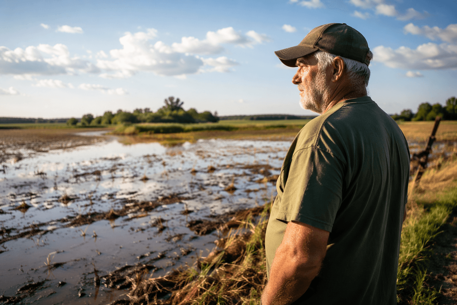
Landowners in Perry County had a June 4 chance to push the kinds of fixes that matter after repeated flooding, from streambank repair and drainage to erosion control and farmland recovery, as the county conservation district gathered public input on what should come next.
The Perry County Conservation District scheduled the Local Working Group meeting from 10 a.m. to 1 p.m. at the Kentucky River Area Development District office, 941 North Main Street in Hazard. The invitation reached beyond Perry County, opening the door to residents and producers from Knott, Letcher, Breathitt, Leslie and other eastern Kentucky counties that have had a harder time getting to meetings closer to home.
The meeting agenda was built around local ground truth. District leaders set aside time for Natural Resources Conservation Service program updates, local natural resource concerns, input from landowners and producers, conservation priorities, invasive species management, flood recovery, and forestry and agriculture concerns. Kentucky NRCS says its conservation programs are designed to reduce soil erosion, improve water quality, increase wildlife habitat and cut damage from floods and other natural disasters. The discussion also can shape future cost-share and program priorities.
That matters in Perry County, where the July 2022 floods left a long recovery trail across eastern Kentucky. Federal sources described the disaster as bringing unprecedented rainfall over several days, and FEMA later approved more than $2 million for Perry County property acquisitions so damaged parcels could remain as open space and help prevent future flood damage. A regional recovery report said Perry, Knott, Letcher and Breathitt counties accounted for a large share of homes lost to flood damage.
The county’s agricultural footprint also shaped the conversation. USDA census data show Perry County has 53 farms on 13,549 agricultural acres, but only 2,266 acres in cropland. Much of the rest is pasture, woodland or other non-cropland use, which puts grazing, forestry, hillside stability and streamside protection squarely in the mix.
The district also pointed to invasive plants such as kudzu and autumn olive, which Kentucky agencies and the University of Kentucky say can degrade habitat, reduce native biodiversity and interfere with agriculture and forestry. Under the Local Working Group model, open public discussion is meant to guide future NRCS priorities and funding, giving local producers, forest landowners, conservation district members and other residents a direct say in what gets attention next.
This article was produced by Prism’s automated news system from verified source data, official records, and press releases, then run through automated quality and moderation checks before publishing. The system is built and supervised by the people who set the standards it runs under. Read our full AI policy.
Know something we missed? Have a correction or additional information?
Submit a Tip