Storms could bring damaging winds, flooding to Perry County overnight
Damaging winds and torrential rain were expected to reach Perry County overnight, with a flood watch in effect and a brief tornado not ruled out.

Perry County was in the path of an overnight severe-weather setup that carried the highest risk between midnight and 6 a.m. EDT, when a line of potentially strong to severe thunderstorms was expected to move across eastern Kentucky. The National Weather Service in Jackson said damaging wind gusts and torrential downpours were the main hazards, and its flood watch covered Perry County through Thursday morning.
The weather service said gusts of 30 to 40 mph were probable even outside the strongest storms, with stronger bursts possible near and north of I-64. In its Hazardous Weather Outlook, the office raised that range to 35 to 45 mph and said a brief tornado could not be ruled out. The storm timing mattered as much as the hazards: the strongest weather was expected during sleeping hours, when warnings can be missed and families have less time to react.
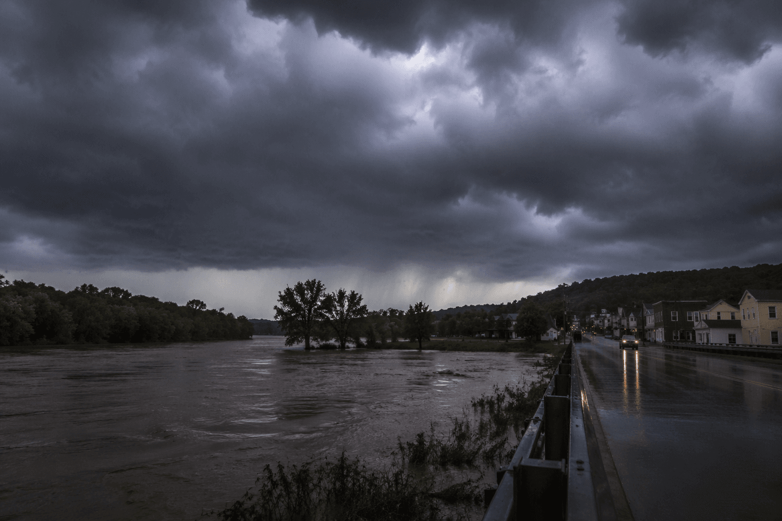
The flood threat added another layer of concern for Perry County and the rest of eastern Kentucky. Forecasters warned that repeated thunderstorms passing over the same location could cause isolated flash flooding, especially in low-lying areas and on mountain roads where runoff can collect fast. Torrential rain paired with gusty wind can also cut power, bring down tree limbs, and leave roads blocked before daylight.

That combination called for a simple overnight check before storms arrived. Charge phones and backup batteries, keep weather alerts turned on, and make sure everyone in the home knows where to go if a warning is issued. Drivers should avoid late-night travel if possible, especially through flood-prone stretches and roads lined with trees that can fail in strong gusts. Anyone planning outdoor work or events in Perry County should secure tents, signs, and loose equipment before dark.


National Weather Service Jackson’s severe-weather materials also pointed residents to threat briefings, storm outlooks, and its weather archive for a closer look at the region’s recurring overnight storm risk. With winds, heavy rain, and flash flooding all in play, the safest move was to prepare before the first round of storms reached the county.
This article was produced by Prism’s automated news system from verified source data, official records, and press releases, then run through automated quality and moderation checks before publishing. The system is built and supervised by the people who set the standards it runs under. Read our full AI policy.
Did this article answer your question?