Mississippi River Gauge at Helena Tracks Near-Real-Time Water Levels
The Mississippi River at Helena rose in mid-March, tracked by NOAA and Army Corps gauges feeding near-real-time data to the public.

The Mississippi River at Helena was on the rise as of mid-March, with federal monitoring systems tracking stage levels in near-real time and issuing forecasts through the National Oceanic and Atmospheric Administration's Lower Mississippi River Forecast Center.
The gauge data feeding public dashboards comes from two primary sources: NOAA's National Weather Service river gauge operated through the Memphis River Forecast Center, and on-the-ground observations collected by the U.S. Army Corps of Engineers. Together, those inputs produce the stage readings and short-range forecasts that river-dependent businesses, farmers, and port operators in Phillips County rely on when the Mississippi starts climbing each spring.
Mid-March is historically a pressure point for the Helena stretch of the river. Snowmelt from the upper Midwest combines with spring rainfall across the broader Mississippi basin, pushing water south through the delta corridor that runs past Helena's riverfront. The NOAA Memphis RFC page for the Helena gauge reflects those shifts as they happen, updating stage readings that measure how high the river sits above a fixed reference point.
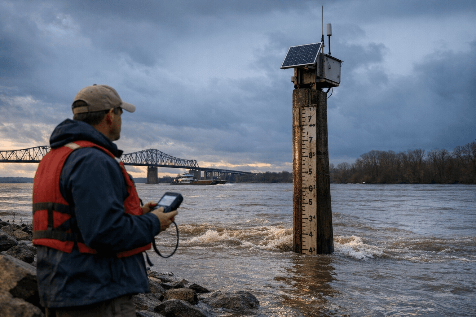
For anyone needing current conditions, the USACE and NOAA systems publish that data publicly. The Memphis RFC forecast page covers the Helena gauge specifically, giving users not just current stage but projected crests and recession timelines that inform decisions about low-lying agricultural land, river traffic, and infrastructure along the Arkansas bank.
The Army Corps of Engineers' role in the data pipeline matters because its field observations add ground-truth verification to the sensor readings, a check that becomes more important when the river moves quickly through a narrow range between nuisance flooding and more significant inundation. Helena's position along the river makes it a reference point for conditions affecting much of the lower Arkansas Delta.
This article was produced by Prism’s automated news system from verified source data, official records, and press releases, then run through automated quality and moderation checks before publishing. The system is built and supervised by the people who set the standards it runs under. Read our full AI policy.
Did this article answer your question?