Recent Rainfall Lifts Burn Bans Across Most of Arkansas
Phillips County stood alone as Arkansas's last active burn ban on March 12, while 80% of the state returned to low wildfire risk after recent rains.
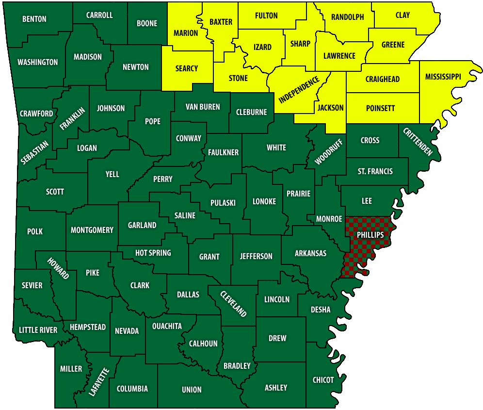
While most of Arkansas shed its outdoor burn bans last week, Phillips County remained the lone holdout on the Arkansas Division of Forestry's wildfire and burn ban map as of Thursday afternoon, March 12.
Recent rainfall eliminated wildfire-danger conditions across much of the state, and by March 12 roughly 80% of Arkansas had returned to a Low risk for wildfire. The Division of Forestry's updated map showed wildfire danger persisting in about 15 counties concentrated in the north-central and northeastern corner of the state, though only Phillips County remained under a formal burn ban as of Thursday afternoon.
The wave of relief came county by county as storms moved across Arkansas in early March. Clark County's burn ban, for instance, was lifted Monday morning, March 9, after showers and thunderstorms swept across the state's southwestern region.
The Arkansas Division of Forestry noted that its wildfire danger and burn ban map, as of March 12, 2026, is subject to change. Conditions can shift quickly depending on wind, humidity, and whether rainfall is reaching specific areas, which may explain why Phillips County in far eastern Arkansas had not yet received enough precipitation to meet the threshold for lifting its restriction.
Residents in Phillips County should verify the current status of the burn ban with local officials or the Arkansas Division of Forestry before conducting any outdoor burning, as the map reflects conditions at a specific point in time and may have been updated since Thursday's snapshot.
This article was produced by Prism’s automated news system from verified source data, official records, and press releases, then run through automated quality and moderation checks before publishing. The system is built and supervised by the people who set the standards it runs under. Read our full AI policy.
Did this article answer your question?