Levee District Holds Public Meeting as Marks Flood Maps Released
The Yazoo-Mississippi Delta Levee District will hold its Regular Monthly Board Meeting on January 8, 2026, and the agency's website includes newly accessible Marks flood maps tied to the Quitman County Flood of 2024. The meeting and maps carry direct implications for residents and local officials in Marks and surrounding communities as they address Coldwater River drainage, infrastructure priorities, and recovery planning.
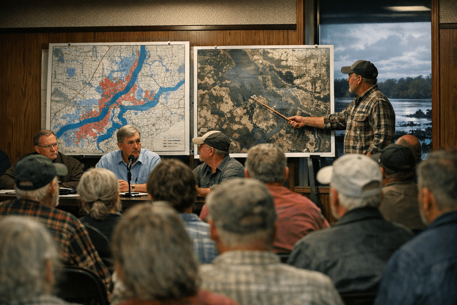
The Yazoo-Mississippi Delta Levee District will convene its Regular Monthly Board Meeting on January 8, 2026, in a session open to the public. The district has posted links to Marks flood maps within a section labeled Quitman County Flood of 2024, making technical floodplain information available to residents, property owners, and local officials ahead of the meeting.
Those flood maps are likely to shape immediate conversations about drainage and levee work tied to the Coldwater River and localized flood-control needs in Marks and surrounding areas. For Quitman County officials, the maps provide a common reference for prioritizing maintenance, identifying vulnerable stretches of infrastructure, and aligning local projects with the levee district's regional plans. For residents, the maps clarify which parcels and neighborhoods face elevated risk and can influence household preparedness and participation in civic processes.
Institutionally, the Yazoo-Mississippi Delta Levee District serves as the regional authority on levee and flood-control matters in the Delta. Its public meeting schedule and the technical materials it posts are central to how flood policy, project funding, and operational decisions are debated and set. The availability of localized flood maps signals a shift from broad planning to site-specific action items that county officials and municipal planners must consider when seeking grants, allocating local funds, or designing drainage improvements.
The timing of the meeting offers a procedural avenue for civic engagement. Public attendance at the board meeting gives community members a formal mechanism to raise concerns, request clarity on map interpretations, and press for timelines on repair or mitigation projects. Local officials working on Coldwater River and drainage issues in Marks can use the meeting to coordinate with the levee district, present local impact data, and request technical assistance tied to the 2024 flood recovery effort.
Mapping also has policy consequences beyond immediate repairs. Updated flood delineations can affect land-use decisions, municipal infrastructure investments, and the prioritization of emergency-response planning. Local decision makers will need to interpret the maps within Quitman County's broader fiscal and regulatory context when setting short- and long-term priorities.
Residents and officials who have questions about the maps or the levee district's agenda are encouraged to consult the Yazoo-Mississippi Delta Levee District's public materials and consider attending the January 8 meeting to ensure local perspectives are part of the regional flood-control conversation.
This article was produced by Prism’s automated news system from verified source data, official records, and press releases, then run through automated quality and moderation checks before publishing. The system is built and supervised by the people who set the standards it runs under. Read our full AI policy.
Did this article answer your question?

