Rockwall trail map shows over 20 miles of citywide paths
Rockwall’s trail map ties more than 20 miles of paths into one citywide system, with park, street, neighborhood and mountain bike routes all in one place.
Rockwall’s Parks & Trails Map, updated Jan. 5, 2022, shows Rockwall Parks & Recreation’s connected system of “over 20 miles of trails” across the city, with routes for walking, biking, commuting and family outings.
A citywide network built for everyday use
The map treats trails as part of daily life, not as a separate destination. The system includes park trails, street trails, neighborhood trails and even a mountain bike trail, which means the network is designed to move people across the city as much as it is to give them somewhere scenic to exercise.
The map labels the trail categories directly, so a resident can tell when a route is likely to stay within a park setting and when it is meant to connect through streets or subdivisions.
How to use the map right now
The Rockwall trail map is best used as a planning tool before you head out. Because it separates park trails from street trails and neighborhood trails, it helps you pick a route that matches your goal, whether that is a stroller-friendly walk, a dog walk, a short weekend ride or a commute that avoids driving for part of the trip.
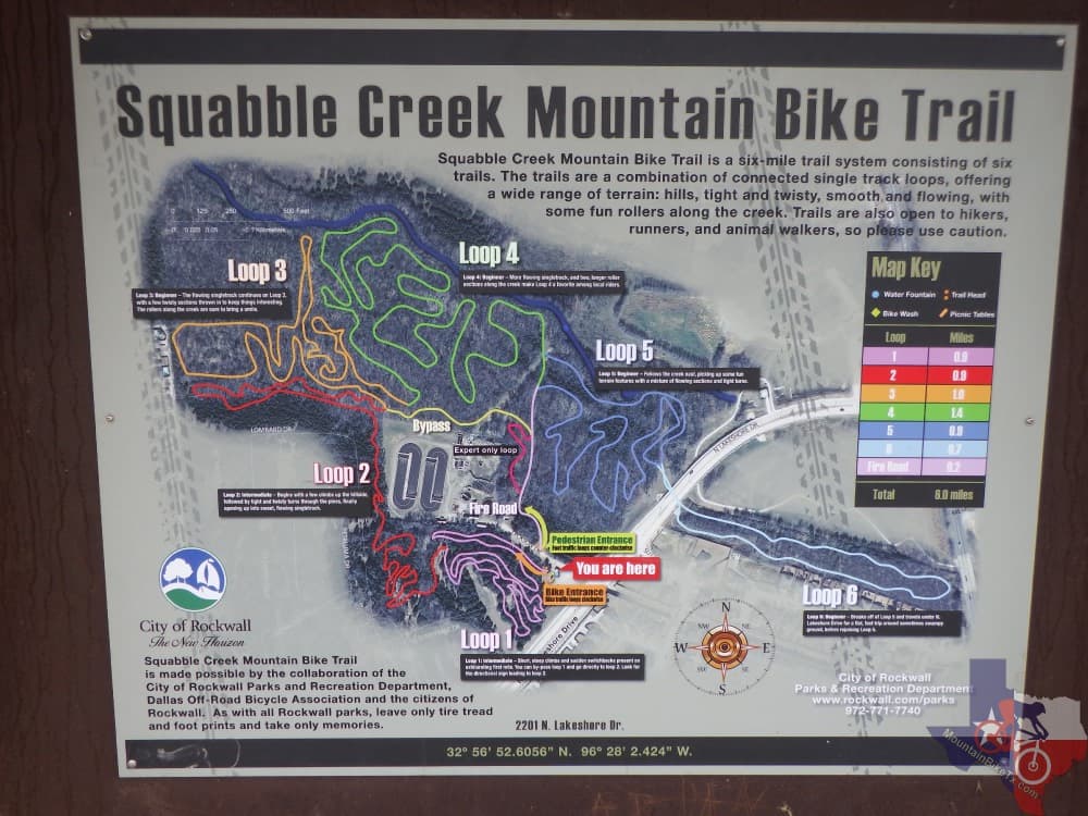
Pettinger Nature Preserve is specifically included on the city’s map, making it one of the named destinations to look for when you want a more natural setting. The map also identifies the mountain bike trail, which gives riders a dedicated option instead of forcing them to sort through the rest of the system on guesswork.
Trails that fit different kinds of outings
For family time and casual exercise, the park trails and the route around Pettinger Nature Preserve are the clearest places to start. The city’s wellness guidance says 30 minutes a day of moderate exercise for adults and 60 minutes a day for kids can bring numerous health benefits.
For a more workout-focused outing, the street trails and neighborhood trails matter because they extend the network beyond a single park boundary. That citywide structure gives you more ways to build distance into an outing without repeating the same short loop over and over.
For riders, the mountain bike trail is the key feature to note. It gives Rockwall a trail option that is not just for walkers and casual cyclists, which makes the system more useful to people looking for a harder ride.
Why the city frames trails as a public service
Rockwall’s Parks page pairs the trail system with the slogan “GO OUTSIDE. PLAY.” and places trails alongside rentals, destinations and other city resources. It also includes department contact information and staff resources, showing that this is an actively managed municipal service, not an informal path network.
The city’s parks site helps residents use the system, and the trail map appears alongside those service resources.
Health guidance backs up the local approach
Parks and trails provide places for people to enjoy the outdoors and experience the benefits of physical activity, the Centers for Disease Control and Prevention says, and the U.S. Department of Health and Human Services says regular physical activity is one of the most important things people can do to improve their health.
The trail system makes movement easier to fit into ordinary days, whether for a quick walk after work or a longer ride on the weekend.
How county and regional planning shape the system
Rockwall County’s archived Draft Rockwall County Bicycle Master Plan puts trail and bicycle connections into the broader planning conversation, not just a city parks issue. The county’s news item on the draft plan ties projected growth to communities increasingly emphasizing multi-modal transportation.
A separate Rockwall planning document says an Open Space Master Plan should include a phasing plan for construction of trails, parks, common open space and facilities. That language weaves trails into long-range growth planning, alongside parks and other public spaces, rather than treating them as an afterthought.
A larger long-term hike, bike and equestrian corridor is part of the regional picture through the NorthEast Texas Trail Coalition, and TrailLink lists Rockwall within a broader North Texas trail ecosystem.
This article was produced by Prism’s automated news system from verified source data, official records, and press releases, then run through automated quality and moderation checks before publishing. The system is built and supervised by the people who set the standards it runs under. Read our full AI policy.
Did this article answer your question?