Bates-Morse Mountain access depends on tides, parking limits in Phippsburg
A Bates-Morse Mountain day can hinge on tides and a full parking lot. In Phippsburg, access, conservation, and research rules shape every visit.
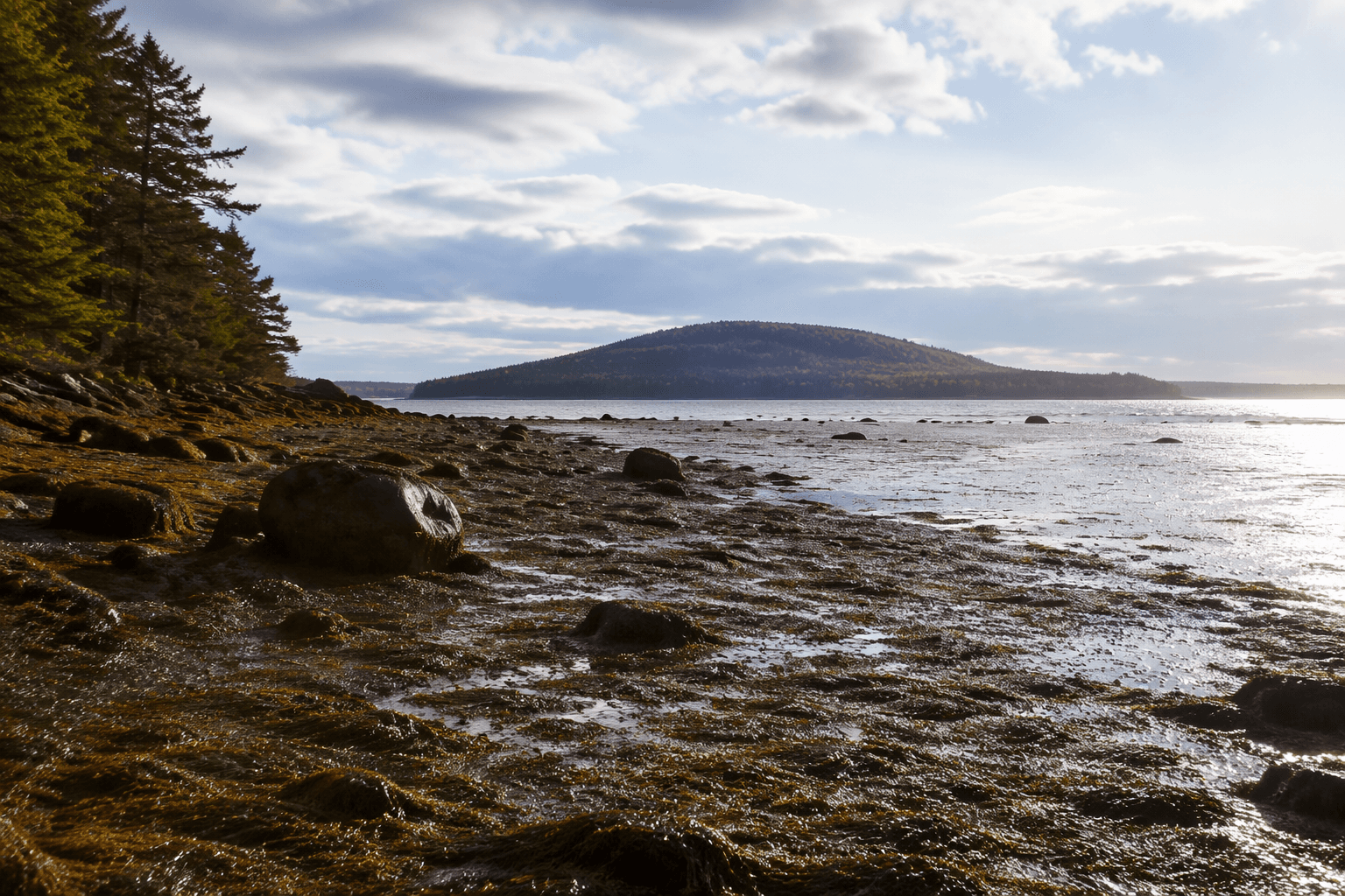
A family headed for Seawall Beach can find the day decided before it starts: the parking lot may fill, and the marsh road can flood when the tide reaches 9.5 feet or higher. At Bates-Morse Mountain Conservation Area in Phippsburg, public access is real, but it is managed alongside conservation, preservation, research, and education. That tension is what makes the place distinctive in Sagadahoc County: it is both a public outing and a working coastal landscape.
How to time the visit
Bates says visitors need to plan around two limits. First, the parking lot can close once it is full, and the parking information is updated in real time, although activity on the ground can delay those updates. Second, the marsh road can flood when tides reach 9.5 feet or higher, with water typically on the road about an hour before and an hour after high tide.
That makes timing more important here than at a typical beach. If you are aiming for a family outing, the tide chart matters as much as the weather, because the road itself is part of the access route. The safest assumption is that high tide near the threshold Bates names can make entry or exit difficult, even if the beach beyond looks inviting.
A practical visit starts with a quick check of the tide window and a realistic arrival plan. If the lot is already full, the preserve is not taking more cars, and that is built into how the site works rather than treated as an exception.
What the walk feels like
Trail summaries put the Morse Mountain to Seawall Beach route at about 3.8 to 4 miles round-trip, with moderate elevation gain. One guide notes that the road and trail are partially paved, so this is not a conventional wooded trail system from start to finish. Visitors should expect a road walk as part of the experience, which matters if strollers, young children, or limited mobility are part of the day.
That shape gives the route a different feel from a simple shore walk. The long, defined approach is part of the reason the site can stay protected while still welcoming the public, and it also means the outing takes planning rather than spontaneity. For many families, that tradeoff is exactly what separates a protected conservation area from a crowded beach access point.
Why the preserve is managed this way
Bates describes the property as managed so that public access fits its core missions of conservation, preservation, research, and education. In practical terms, that means the site is a destination, but not an open-ended free-for-all. A conservation brief included in Wildlands and Woodlands materials also describes Bates-Morse Mountain Conservation Area as a partnership in a shared conservation effort, underscoring that the land is part of a broader stewardship network.
That framework helps explain why the access rules are visible to visitors. The lot cap and tidal limits are not just inconveniences; they are part of how the landscape is protected while remaining public. On a stretch of coast as sensitive as this one, the management model is part of the story visitors encounter the moment they check the parking page.
A field site as well as a beach
The research record at Bates-Morse Mountain gives the place a deeper role than recreation alone. Bates says faculty and students have conducted coastal research there since 1977. In 1996, the college acquired the Bates College Coastal Center at Shortridge, and after renovations were completed in 2008, the combined sites had produced more than 100 publications, theses, and reports.
That history matters for visitors because it explains why the property is treated as a living field laboratory. The annual-report material has reflected that dual identity as well, including education and research sections in the 2018-2019 annual report and, in material prepared in March 2025 for 2024, sections focused on education and public visitation as well as research and monitoring. The site is not only preserved; it is actively used to study the coast.
Why the landscape matters beyond a beach day
In a 2023 WBUR report, Caitlin Cleaver, then director of the Bates-Morse Mountain Conservation Area, said, “This is one of the largest undeveloped barrier beaches in Maine.” The same reporting highlighted Seawall Beach and the Sprague River Salt Marsh as a place that helps researchers understand rising seas. That gives the area a clear civic value beyond its scenic draw: it is a place where coastal change can be seen in real time.
For Sagadahoc County, that means a visit to Phippsburg is never just about getting to the sand. It is also about moving through a landscape where tides, parking, marshes, and research all shape what a day there can be. When the lot is open and the tide window is right, Bates-Morse Mountain offers something increasingly rare on the Maine coast: public access that still leaves room for the land to be studied, protected, and understood.
This article was produced by Prism’s automated news system from verified source data, official records, and press releases, then run through automated quality and moderation checks before publishing. The system is built and supervised by the people who set the standards it runs under. Read our full AI policy.
Did this article answer your question?