Bowdoinham seeks consultant for waterfront access and resilience plan
Bowdoinham is seeking a consultant to map and redesign river access sites, with $55,000 in grant money and a June 18 deadline at stake.

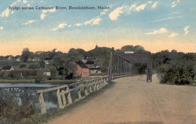
Bowdoinham has put out a request for proposals for a Waterfront Access & Resilience Plan that could shape where residents fish, paddle and reach the Cathance River for years to come. The town wants a consultant team to identify where waterfront access is strong, where it is missing, and what improvements could make the shoreline safer, more usable and better protected from flood risk.
Responses are due by 9:00 a.m. on June 18, 2026. The project is funded through a Shore and Harbor Planning Grant and is capped at $55,000, with Bowdoinham providing a 10% match of about $5,000 from the Rideout Memorial Fund.
The consultant’s job goes well beyond a basic site review. The town is asking for a needs assessment, a geodatabase inventory of formal and informal access points, hazard and climate risk evaluations, concept designs for two priority sites, cost estimates, a prioritization matrix and a legal and permitting roadmap. The plan is meant to guide public fishing access and low-impact paddle put-ins, while also addressing accessibility and long-term resilience as shoreline conditions change.
Bowdoinham said public engagement will be built into the work through two surveys, a project website and a public meeting scheduled for June 8-12, 2026. Town officials are also tying the plan to future funding, hoping a clearer blueprint will help Bowdoinham compete for implementation dollars when design and construction opportunities open up.
The effort builds on more than two decades of waterfront planning. Bowdoinham acquired the former public works waterfront property in 1998, and the site includes about 1,500 feet of shoreline on the Cathance River. The town adopted an original Waterfront Plan in 2004 and reaffirmed it in its 2014 Comprehensive Plan. After the new public works facility was completed in fall 2019, the town was able to move ahead with broader waterfront redevelopment.
That work comes as climate pressure intensifies along the riverfront. Bowdoinham said more than 70% of Riverfront Park sits in a FEMA Special Flood Hazard Area, and the town received a $15,000 Maine Forest Service Project Canopy grant in 2025 for reforestation there. Officials have also pointed to active shoreline erosion at the park, making access planning and resilience planning part of the same conversation.
The project also reflects Bowdoinham’s changing demographics and its emphasis on access for older adults and residents with disabilities. The town’s age-friendly committee was established in 2012, and a 2025 report said about one in three residents is 60 or older and about 12% report a disability. On the Cathance River, where public trails, boating and fishing already draw residents and visitors, the next consultant plan could determine how the waterfront is used, improved and protected in the years ahead.
This article was produced by Prism’s automated news system from verified source data, official records, and press releases, then run through automated quality and moderation checks before publishing. The system is built and supervised by the people who set the standards it runs under. Read our full AI policy.
Know something we missed? Have a correction or additional information?
Submit a Tip