Sagadahoc Region Conservation Blueprint Guides 12 Towns on Habitat and Planning
A 2010 blueprint covering 12 Sagadahoc County towns warns that waterways and woodlots are losing ecological function as development reshapes the region's defining "quality of place."
The smelt fishing on the Kennebec and the berry farms outside Bowdoinham share something with Brunswick's downtown storefronts that most planning documents never quite capture: they are the same place. The Conservation Blueprint for the Sagadahoc Region, a guidebook produced by the Sagadahoc Region Rural Resources Initiative (SRRRI) and authored by Steve Walker, builds its entire framework around that premise, arguing that protecting natural resources and sustaining economic vitality are inseparable goals across 12 towns stretching from Arrowsic to Woolwich.
Published in 2010 and archived through the University of Southern Maine Digital Commons as part of the Casco Bay Estuary Partnership's publications collection, the Blueprint was designed as a practical planning resource to help communities in and around Sagadahoc County balance economic development, land use, and the protection of natural resources. Its geographic scope is explicit: Arrowsic, Bath, Bowdoin, Bowdoinham, Brunswick, Georgetown, Harpswell, Phippsburg, Richmond, Topsham, West Bath, and Woolwich all fall within its guidance.
Why Ecological Services Are Declining
The Blueprint opens with a candid assessment of the problem it was built to solve. "The richness of resources that resulted in the designation of these areas as statewide conservation priorities is the same richness that has attracted human settlement activity in the Sagadahoc region for centuries," the document states. "However, human ties to the landscape have changed in modern society and so too have development patterns and land use practices. As a result, the ecological services provided by our waterways and woodlots are declining."
That sentence lands with particular weight for anyone who has watched the rural edges of Topsham or West Bath shift over recent decades. The Blueprint does not soften the diagnosis: "The functions and values of natural resources within the SRRRI study area are threatened by planned and unplanned development." Sensitive and special areas, it notes, require protection from the cumulative impacts of growth, though the full extent of those impacts is detailed in maps and data within the complete document.
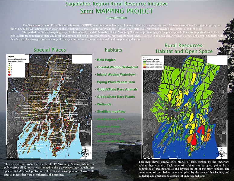
Two Focus Areas of Statewide Ecological Significance
The Sagadahoc region contains two areas that Maine has formally recognized as Focus Areas of Statewide Ecological Significance: the Kennebec Estuary and the Maquoit and Middle Bay Focus Areas. Both designations reflect a concentration of natural resource value that the Blueprint ties directly to the region's long history of human settlement. The richness that drew people here for centuries, the document argues, is precisely what modern planning must now work to preserve. While the Blueprint indicates that both Focus Areas are described in greater detail within its pages, the full ecological profiles, including habitat inventories, species data, and any mapped boundaries, are contained in the complete 2010 report.
How Priorities Were Set
The Blueprint did not arrive at its recommendations through a single author's judgment. A working group of knowledgeable scientists and state and local planners identified which types of natural resources should be treated as priorities for protection. That group then informed an analysis of mapped natural resource data examining common natural communities, significant wildlife habitats, and the degree to which those habitats intersect with large blocks of undeveloped land.
The result is a six-point framework the Blueprint calls Recommended Priorities for Local Action:
- Protect water resources and riparian areas
- Maintain large unfragmented blocks
- Maintain connections between core habitat areas
- Protect habitat for rare species and rare and exemplary natural communities
- Protect farmland and support farmers
- Protect, develop and maintain trails
Each priority addresses a distinct pressure on the region's landscape. Maintaining large unfragmented blocks and connections between core habitat areas speaks directly to the fragmentation risk that accompanies scattered residential development in towns like Bowdoin and Georgetown. Protecting riparian areas and farmland reflects the dual vulnerability of working landscapes, where water quality and agricultural viability both depend on thoughtful land use decisions. The trails priority signals that conservation here is not conceived as exclusion from the land but as sustained, structured access to it.
A Planning Resource, Not a Mandate
The Blueprint's authors were deliberate about its role. "The most challenging step in municipal conservation planning is figuring out where to begin," the document states. "This Conservation Blueprint Guidebook makes it easier to get started." Alongside its priority framework, the Blueprint offers a selection of tools that can be adopted locally, giving selectboards, planning boards, and conservation commissions in each of the 12 towns a menu of options rather than a single prescribed path. The specific tools are detailed in the full report.
That design choice reflects the political reality of a region spanning communities as different as the densely developed corridor of Bath and Brunswick and the rural quiet of Phippsburg and Richmond. A regional blueprint that read as a top-down mandate would struggle to gain traction across such varied local contexts; one that positions itself as a shared analytical foundation and lets each municipality choose its instruments has a better chance of actual adoption.
What "Quality of Place" Actually Means Here
The Blueprint's most humanizing passages describe what is at stake in terms residents of any of the 12 towns will immediately recognize. "Residents of the Sagadahoc region, whether they reside in town or out in the country, rely on the opportunity to shop, seek professional services and enjoy cultural happenings along Main Street," it reads. "Chance encounters with friends, neighbors and elected officials, when downtown, strengthen the fabric of our communities."
The rural dimension is equally specific: "Residents also value the rural parts of the region where they can celebrate the changing seasons by visiting orchards and berry farms, swimming and kayaking, hunting, cross country skiing, smelt fishing and snowmobiling." The Blueprint frames these not as recreational amenities separate from conservation policy but as the lived expression of what conservation is trying to protect. "It is the combination of vibrant, walkable downtowns and memorable rural experiences that define the Sagadahoc Region's 'quality of place.'"
Accessing the Full Document
The complete Blueprint is available through the University of Southern Maine Digital Commons, housed within the Casco Bay Estuary Partnership publications collection at item 221. The full PDF contains the complete Focus Area descriptions for the Kennebec Estuary and Maquoit and Middle Bay, the mapped natural resource data analysis, and the detailed toolkit for local adoption. Communities or planning officials seeking to apply the Blueprint's framework should consult the full report for the maps, quantitative habitat data, and implementation guidance that the summary excerpts do not capture.
The Sagadahoc Region Rural Resources Initiative and the Casco Bay Estuary Partnership remain the primary contacts for questions about how the Blueprint's findings have shaped conservation work across the region in the years since its publication.
This article was produced by Prism’s automated news system from verified source data, official records, and press releases, then run through automated quality and moderation checks before publishing. The system is built and supervised by the people who set the standards it runs under. Read our full AI policy.
Did this article answer your question?