4.9-Magnitude Quake Rattles Bay Area From Santa Cruz Mountains, No Damage Reported
ShakeAlert pinged SF phones up to 30 seconds before a 4.9-magnitude quake rolled in from the Santa Cruz Mountains; 438 city soft-story buildings still haven't completed mandatory retrofits.
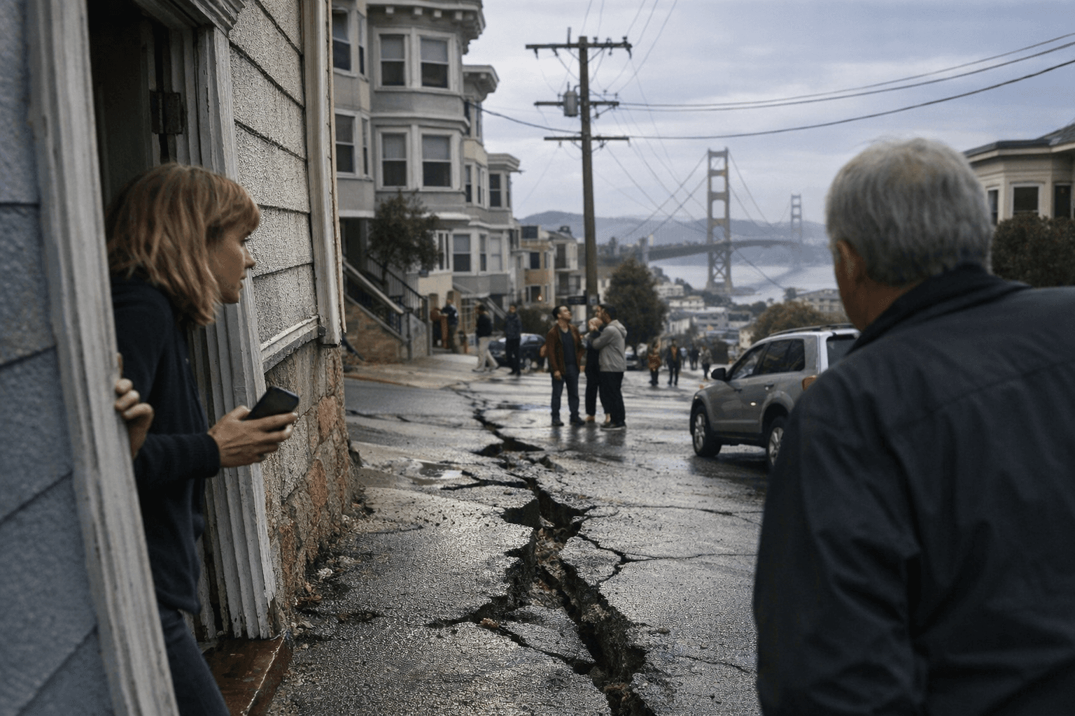
From the Richmond District to Noe Valley, San Francisco smartphones buzzed with ShakeAlert warnings at 1:40 a.m. Thursday, arriving seconds before a preliminary 4.9-magnitude earthquake rolled out of the Santa Cruz Mountains and rattled the city awake.
The quake struck at 1:41 a.m., centered less than a mile from Boulder Creek, a small community tucked off Highway 9 about 30 minutes north of Santa Cruz. By 3 a.m., the USGS had formally revised the magnitude down to 4.6. The epicenter sat roughly 14 miles northwest of where the 1989 Loma Prieta earthquake originated on the San Andreas fault system. At a depth of just 6.2 miles, Thursday's quake was shallow enough to produce the sharp, jolting character that residents across a 100-mile stretch of Northern California described, distinct from the slower rolling motion of deeper events.
Robert de Groot of the USGS ShakeAlert Operations Team confirmed the system activated and pushed alerts to personal devices across the Bay Area ahead of the arriving seismic waves. Bay Area residents reported on social media receiving their phone warnings anywhere from a few seconds to nearly 30 seconds before the shaking reached them. More than 25,000 people submitted reports through the USGS "Did You Feel It?" platform within hours of the event.
The California Governor's Office of Emergency Services reported no damage or injuries as of 8:30 a.m. CAL FIRE CZU activated its earthquake response protocol, inspected all structures in its Santa Cruz Mountains jurisdiction, and found no damage. At a general store in Boulder Creek, merchandise fell from the shelves. San Francisco, Oakland, Berkeley, Walnut Creek, and communities stretching north to Sacramento felt weak to light shaking; the strongest effects were concentrated in the South Bay, the Peninsula, and Santa Cruz County.
The USGS issued a formal aftershock forecast. "There will likely be smaller aftershocks within the next week, with up to 9 magnitude 3 or higher aftershocks," the agency said. "Magnitude 3 and higher aftershocks are large enough to be felt nearby."
For a city built largely on aging wood-frame construction and soft Bay soils, Thursday's predawn alarm exposed a persistent preparedness gap. San Francisco identified 4,941 soft-story wood-frame buildings under its 2013 mandatory seismic retrofit ordinance. Ninety-one percent have completed the work. That leaves 438 buildings still out of compliance, many of them the multi-unit apartment buildings that line the Sunset, the Richmond, and the Mission.
The San Francisco Department of Building Inspection maintains a public, searchable database where any resident can look up a building's retrofit status by address. Beyond that, apartment dwellers should locate the building's gas shutoff valve and keep an adjustable wrench accessible nearby; a shallow quake on a closer fault could rupture gas lines within the first seconds of shaking. Three days of water, shelf-stable food, and a flashlight stored somewhere reachable in the dark round out the minimum kit emergency managers specify for SF apartment life.
Thursday's quake caused no harm. The one that struck 14 miles to the southeast in October 1989 killed at least 63 people and dropped a section of the Bay Bridge. The geography of what happened at 1:41 a.m. is reason enough to pull up that database, find the wrench, and act before a louder alarm arrives.
This article was produced by Prism’s automated news system from verified source data, official records, and press releases, then run through automated quality and moderation checks before publishing. The system is built and supervised by the people who set the standards it runs under. Read our full AI policy.
Did this article answer your question?