Level 2 storm brings heavy rain, lightning threat to Bay Area
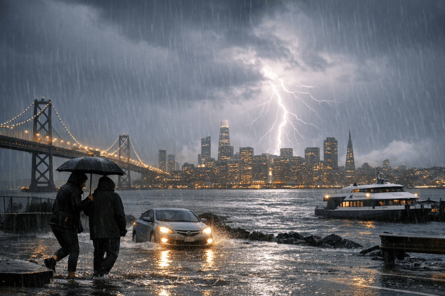
Lightning struck over San Francisco Bay as a Level 2 storm moved onshore, bringing heavy downpours that caused localized street flooding and disrupted Bay crossings and transit into April 12.

Lightning strikes clustered over the open water between San Francisco and the East Bay as a Level 2 storm moved onshore late afternoon and evening, producing heavy downpours that flooded streets and slowed commutes into April 12. Live lightning maps and local coverage recorded multiple strikes over the bay during evening hours, elevating risk for people crossing waterfronts and using Bay bridges during peak travel times.
ABC7 meteorologists Sandhya Patel and Drew Tuma used the station’s Exclusive Storm Impact Scale to classify the system as a Level 2, a moderate event that typically delivers about 0.5–1.0 inch of rain across many locations and can bring scattered power outages and nuisance flooding. Local observations and prior Level 2 pulses show isolated heavier totals are possible: earlier storms produced nearly 3 inches in parts of the South Bay during intense bursts, meaning some neighborhoods and hillside streets could see far more than the median forecast.
The National Weather Service San Francisco Bay Area office issued guidance listing hazards that included frequent lightning, locally heavy rainfall, small hail, gusty winds and the potential for localized flooding and waterspouts over open water. NWS forecasters emphasized lightning safety with the standard admonition, "When thunder roars, go indoors." That combination of lightning over open water and heavy, short-duration rain increases the chance of standing water on low-lying arterials and temporary closures on coastal routes.
Local impacts mirrored those hazards: reporting around the system and similar recent storms documented flooded streets, stranded vehicles, downed or low utility lines and targeted road closures. Highway 1 in Pacifica has closed during comparable events after downed lines, and transit agencies routinely posted advisories: BART issued service notifications, Caltrans and QuickMap listed lane and emergency closures, and PG&E and the City of San Francisco monitored outage maps for customers potentially affected. San Francisco International Airport reported the potential for flight delays tied to heavy rain and gusts.
The broader context raises stakes for urban infrastructure: Northern California experienced king-tide coastal flooding in early January and mid-February storm rounds that brought downed trees and power outages, leaving soils saturated and municipal drainage systems stressed. San Francisco’s April climatological precipitation is modest, on the order of about one inch or less, so concentrated pulses of 0.5–1.0 inch or more can trigger urban flooding, traffic disruptions and short-term power interruptions.
Expect localized travel delays on Bay crossings and waterfront routes, intermittent outages in neighborhoods with older distribution lines, and possible short-term closures on coastal highways overnight and into April 12. Monitor official agency updates from the National Weather Service San Francisco Bay Area, ABC7 Live Doppler 7, PG&E outage information, Caltrans QuickMap and BART advisories for real-time status and safety instructions.
This article was produced by Prism’s automated news system from verified source data, official records, and press releases, then run through automated quality and moderation checks before publishing. The system is built and supervised by the people who set the standards it runs under. Read our full AI policy.
Did this article answer your question?