Rio Rancho residents urged to stay alert as hail hits Northern Meadows
Hail fell in Northern Meadows as Rio Rancho storms raised concern for roof and vehicle damage, with more severe weather still possible across Sandoval County.
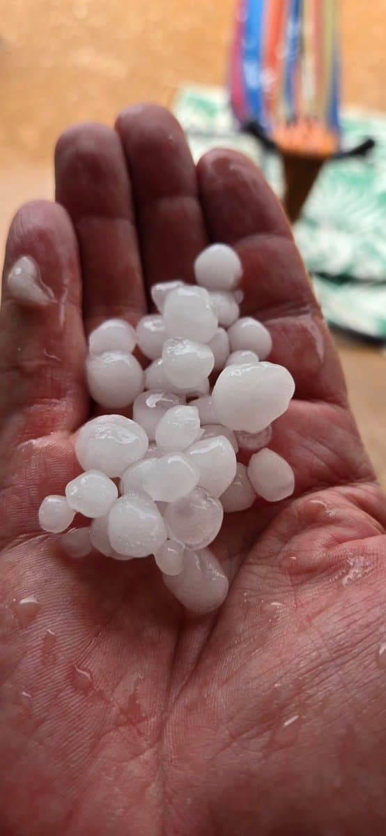
Hail fell in Northern Meadows as storms moved through Rio Rancho, and KOAT chief meteorologist Byron Morton shared photos from the neighborhood. The National Weather Service in Albuquerque warned that stronger storms could still bring heavy rain, hail, gusty winds and frequent lightning across Sandoval County, a combination that can quickly disrupt afternoon errands and commutes.
Forecasters define a severe thunderstorm as one with downdraft winds over 58 mph or hail at least 1 inch in diameter. The weather office says all 33 New Mexico counties experience severe thunderstorms at some point during the year, and it notes that the storms usually peak in eastern New Mexico from April through June before becoming more widespread statewide in July and August.

Rio Rancho has a documented hail history that puts the latest burst in context. One hail-tracking database shows 8 on-the-ground hail reports in the past 12 months near Rio Rancho, along with 56 radar-detected hail events in that same period. The same summary lists 53 hail reports within 10 miles of the city center since 2004, with the most recent hail event in the database dated May 4, 2025.
The damage risk is not limited to trees and landscaping. NOAA’s National Severe Storms Laboratory says hail can cause billions of dollars in damage to structures, crops and livestock, and its researchers note that dual-polarization radar helps forecasters distinguish rain, hail, snow and ice pellets. In practical terms, that means storms capable of producing large hail can threaten roofs, windshields, siding and the roads people use to get across Rio Rancho and the rest of Sandoval County.
Residents in Northern Meadows and nearby neighborhoods should photograph any roof dents, broken shingles, cracked windows, vehicle damage and debris before cleanup begins, then keep repair estimates, receipts and storm times together for insurance claims. If more storms move through, move indoors at the first rumble of thunder, stay away from windows and be prepared for slick roads, brief flooding and reduced visibility on local routes.
Morton, who has been KOAT Action 7 News’ chief meteorologist since December 2001, has been following a weather pattern that can turn fast across northern New Mexico. With hail already on the ground in Northern Meadows, the next round of storms could again test roofs, cars and evening routines in Rio Rancho.
This article was produced by Prism’s automated news system from verified source data, official records, and press releases, then run through automated quality and moderation checks before publishing. The system is built and supervised by the people who set the standards it runs under. Read our full AI policy.
Did this article answer your question?