Sandoval County Under Winter Storm Warning as Snow Chance Rises
Sandoval County issued a winter storm warning on Jan. 7 as temperatures fall and the Albuquerque National Weather Service predicts elevated precipitation through Friday. The system raises the risk of sleet and snow for parts of the county, with implications for travel, outdoor work and vulnerable residents.
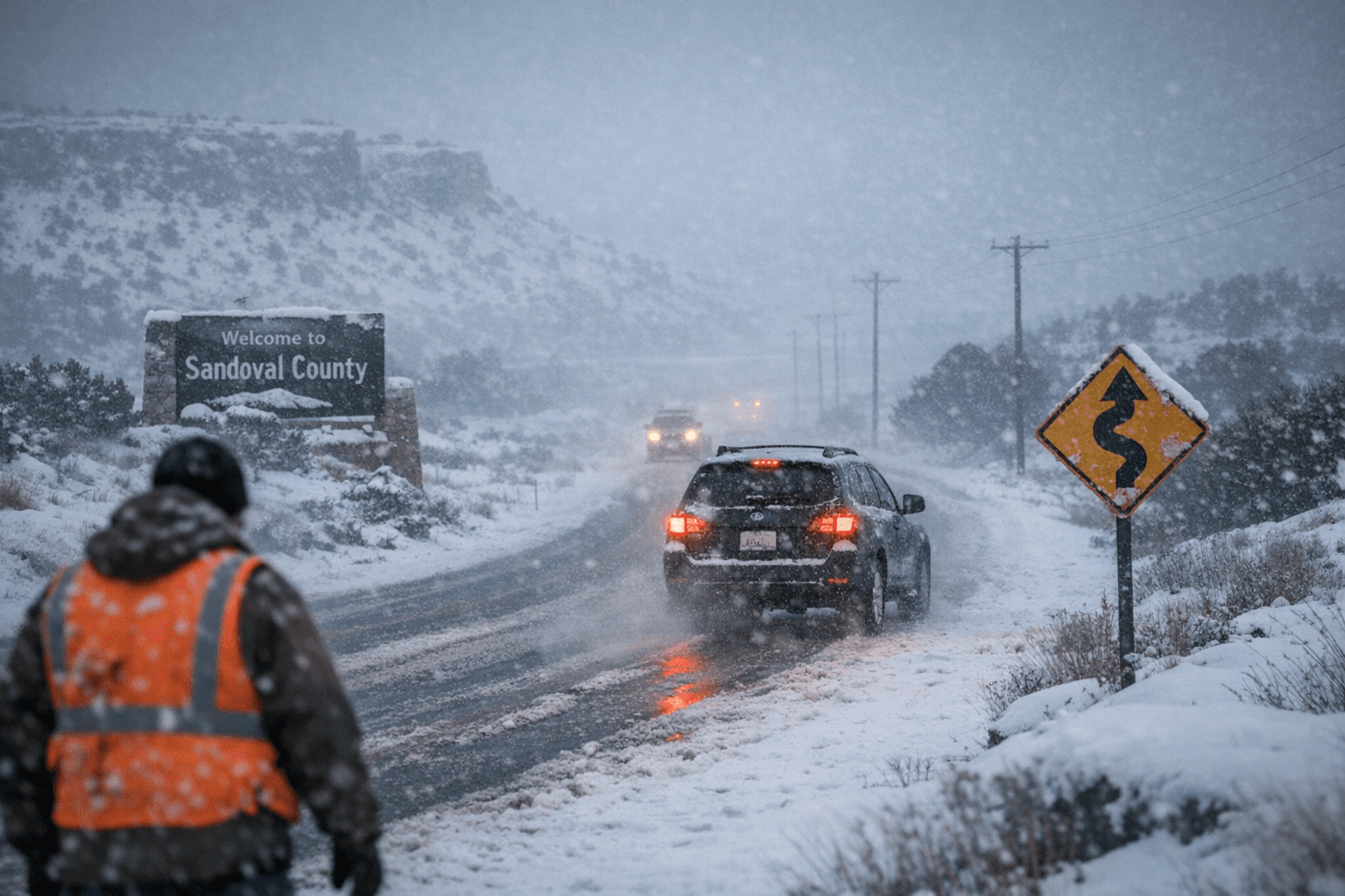
Sandoval County issued a winter storm advisory entering the week, warning residents that colder temperatures and an incoming system could produce sleet and snow across the county. County officials posted that a "Winter Storm Warning in Effect from 1/7/2026 at 11 PM to 1/9/2026 at 11 AM for Sandoval County," signaling a period of elevated precipitation and colder conditions compared with December's unseasonably warm weather.
The Albuquerque National Weather Service said the chance of precipitation began rising Wednesday evening and is expected to continue through Friday. Forecasters highlighted a mixed precipitation threat for Rio Rancho and surrounding communities. The forecast shows a 30 percent chance of showers this afternoon, mainly after 5 p.m., with a daytime high near 54. Tonight the NWS projects rain possibly mixed with snow showers, becoming all rain after 1 a.m., a low around 33 and an 80 percent chance of precipitation with little or no snow accumulation expected.
Thursday's outlook calls for a chance of rain showers before 11 a.m., then a slight chance of rain and snow showers between 11 a.m. and 2 p.m., with rain becoming more likely after 2 p.m. and a high near 49. Thursday night may see a transition back to snow, with a chance of rain and snow showers before 11 p.m. and snow showers likely afterward, and an overnight low near 26. Friday is forecast to be colder, with a 40 percent chance of snow showers, partly sunny skies, a high near 39 and northwest winds of 15 to 20 mph.
For Sandoval County residents, the primary concerns are slick roads, reduced visibility and potential impacts to commutes and outdoor work. Even when accumulation is limited, watery road surfaces that freeze overnight can create hazardous driving conditions, particularly on bridges and shaded stretches of road. Local government operations and emergency services monitor conditions during winter events; residents who rely on routine services or medical transportation should consider contingencies given the forecast window.
Because the warning remains in effect through the morning of Jan. 9, the NWS projection and the county advisory together indicate an ongoing, multi-day weather event rather than a brief squall. The timing and temperature swings, daytime highs in the 40s and 50s before a sharp drop to the 20s overnight, make precipitation type and travel conditions variable. Residents and local businesses should plan for changing conditions through Friday and check official county and NWS channels for any updates or specific advisories.
Know something we missed? Have a correction or additional information?
Submit a Tip