Strong thunderstorms bring 50 mph winds, hail to southeastern Sandoval County
Penny-sized hail and 50 mph winds lashed the Sedillo area as warnings stayed up until 6 p.m., with more storm cells possible tonight.
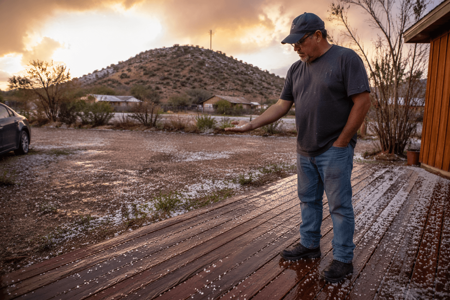
Strong thunderstorms swept through southeastern Sandoval County near Sedillo with penny-sized hail and 50 mph winds, bringing the kind of fast-moving severe weather that can turn dangerous in minutes along the Albuquerque east-mountain corridor. The storms moved through before warnings expired at 6 p.m. MDT on June 3.
The National Weather Service in Albuquerque said scattered strong to severe thunderstorms had already developed across eastern New Mexico, and the marginal risk for severe storms was expanded westward as the evening wore on. Large hail and damaging winds were the main concerns, and the office said storms would continue through the evening with locally heavy rainfall possible in some cells.
The wind report in Sandoval County fell below the National Weather Service’s high-wind warning threshold of sustained 40 mph winds or gusts of 58 mph, but 50 mph gusts were still strong enough to blow debris around and cause isolated damage. In a corridor like Sedillo, where storms can intensify as they move off the mountains, that kind of burst of wind can hit quickly and leave little time to react.
The weather pattern fit a familiar late-spring setup for New Mexico. The Albuquerque forecast office says severe thunderstorms typically peak in the east from April through June, then statewide from July through August, and hail remains a recurring hazard in Sandoval County and nearby areas. The office also said rich moisture was pushing into central and eastern New Mexico, raising the chances for showers and thunderstorms along and east of the central mountain chain, with some storms capable of producing locally heavy rainfall and flash flooding.
That means southeast county residents should keep a close watch tonight if new cells form. Hail, strong winds, and sudden downpours can return fast, especially in the eastern foothills and along the routes that connect Sandoval County with Albuquerque. The same storm setup that produced penny-sized hail near Sedillo is part of the broader severe-weather season locals watch every spring and summer, when one slow-moving thunderstorm can bring both wind damage and flash-flood risk.
This article was produced by Prism’s automated news system from verified source data, official records, and press releases, then run through automated quality and moderation checks before publishing. The system is built and supervised by the people who set the standards it runs under. Read our full AI policy.
Know something we missed? Have a correction or additional information?
Submit a Tip

