Winter Storm Watch Jan. 23-25: Sandoval County Faces Heavy Snow, Outage Risk
Heavy, wet snow and subfreezing temperatures threaten travel and power in Sandoval County during Jan. 23-25 winter storm watch.
Heavy, wet snow and a period of very cold temperatures are expected to make travel hazardous and increase the risk of power outages across the Albuquerque metro area, including Rio Rancho and much of Sandoval County, under a winter storm watch issued by the National Weather Service on Jan. 21 for Jan. 23-25.
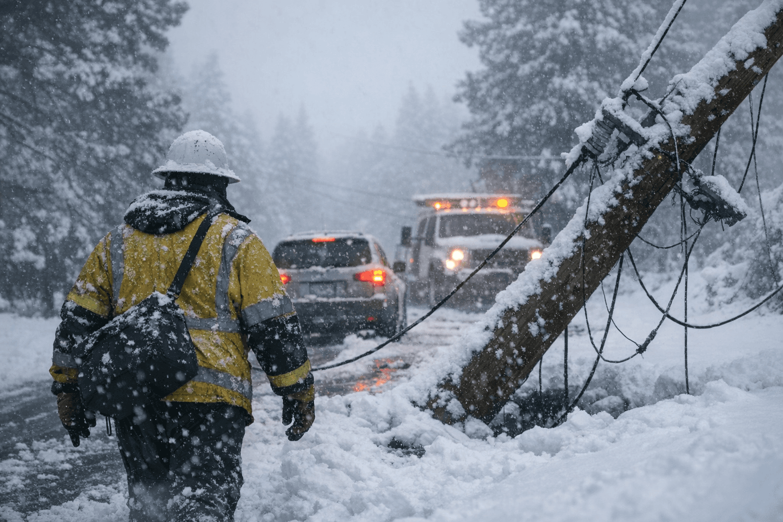
The forecast calls for roughly 2-6 inches of snow below 7,500 feet, 6-12 inches above 7,500 feet and locally higher totals above 10,000 feet. Wet, heavy accumulations combined with strong winds and falling temperatures raise the likelihood of downed trees and broken power lines. Key travel corridors such as Interstate 40 through Tijeras Canyon toward Grants could become very difficult or impossible to pass at times, creating potential isolation for rural communities and delayed emergency response.
Public health implications are immediate. Sustained subfreezing temperatures after heavy, wet snow heighten frostbite and hypothermia risks, especially for older adults, people who rely on electrically powered medical devices, households without adequate heating, people experiencing homelessness and residents in remote locations with limited road access. Power outages lasting hours or longer can degrade heating, water and medical services, compounding health risks for those with chronic conditions and limited resources.
Local healthcare and emergency planners should anticipate increased demand for emergency services and warming support. Community-based measures such as proactive outreach to elderly residents and people on home oxygen, prepositioning blankets and battery power in shelters, and ensuring clear routes for ambulance and utility crews would reduce immediate harm. The storm also underlines ongoing equity issues in disaster preparedness - low-income households and residents in outlying areas often face longer restoration times and higher costs to recover.
Residents are advised to prepare for winter-driving hazards and possible utility impacts by securing emergency supplies, charging phones and devices, gathering warm clothing and food that does not require power to prepare, and having an alternate plan for medically necessary equipment. Avoiding nonessential travel during heavy snowfall preserves road access for emergency vehicles and utility crews. Neighbors checking on older or isolated residents can be the fastest line of support when communications or power fail.
As snow begins to fall today and through Jan. 25, expect disruption to commutes, services and daily routines across Sandoval County. The coming days will test local infrastructure and social safety nets, making preparation and community coordination essential to keep vulnerable residents safe until roads clear and power is restored.
Know something we missed? Have a correction or additional information?
Submit a Tip