NWS Issues Snow Squall Warning for St. Louis County Highways
A fast-moving snow squall raced east at 70 mph through northern St. Louis County Tuesday evening, dropping visibility to under a quarter mile on Hwy 1 and 169.
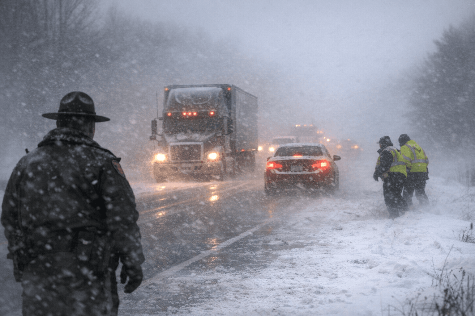
A dangerous snow squall barreled through northern St. Louis County Tuesday evening at 70 mph, prompting the National Weather Service in Duluth to issue a Snow Squall Warning for US-53, Highway 1, Highway 135 and Highway 169, with the agency warning drivers that conditions could turn life-threatening within minutes.
The warning covered Cook, Lake and St. Louis counties, where sudden whiteout conditions and strong winds threatened to significantly reduce visibility and endanger motorists. Snow Squall Warnings are an exceptionally rare product, typically issued for one hour or less for a small area and relayed as a Wireless Emergency Alert.
At 7:58 p.m. CDT, NWS Duluth pinpointed the squall along a line stretching from the Boundary Waters Canoe Area Wilderness to near Soudan Underground Mine State Park to 9 miles south of Cook. The system was screaming eastward at 70 mph, detected through radar and webcams. The warning was set to expire at 8:45 p.m. CDT.
The hazard was threefold: intense bursts of heavy snow, gusty winds producing blowing snow, and visibility rapidly falling to less than one-quarter mile. Wind gusts were measured up to 35 mph. NWS Duluth singled out Highway 1 and Highway 169 as the corridors of greatest concern, warning that "travel will become difficult and potentially dangerous within minutes especially along Highway 1 and 169."
The agency's message to anyone already on those roads was blunt: "Slow Down! Rapid changes in visibility and road conditions are expected with this dangerous snow squall. Be alert for sudden whiteout conditions."
The squall's path cut across a wide swath of the region's most-traveled recreation and commuter corridors. Communities and landmarks in the warning zone included Ely, Babbitt, Tower, Winton, Lake Vermilion, Gunflint Lake, Burntside Lake, White Iron Lake, Birch Lake, Snowbank Lake, Basswood Lake, Saganaga Lake, Sea Gull Lake, Fall Lake, Soudan Underground Mine State Park and Bear Head Lake State Park, among others.
Forecasters warned that the storm could cause visibility to drop to less than a quarter mile within minutes, creating life-threatening travel conditions. The speed of the squall, crossing the landscape at highway pace, gave drivers on remote stretches of Highway 1 and Highway 169 little time to react before conditions deteriorated.
This article was produced by Prism’s automated news system from verified source data, official records, and press releases, then run through automated quality and moderation checks before publishing. The system is built and supervised by the people who set the standards it runs under. Read our full AI policy.
Did this article answer your question?