St. Louis County closes 43 roads as flooding worsens emergency
Forty-three county roads were shut by flood damage, with 32 closures in St. Louis County’s north. The disaster declaration opens the door to state and FEMA aid and faster repairs.

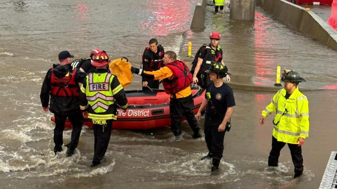
Floodwater and washouts closed 43 St. Louis County roads, with 32 of the shutdowns concentrated in the northern third of the county and several more roads vulnerable as water kept rising. The closures turned a weather emergency into a transportation crisis, cutting off rural routes, slowing emergency access and forcing drivers to rethink commutes, school runs and work trips across the county.
County officials said the emergency declaration process was in progress as damage assessment estimates were gathered, a step aimed at lining up outside help for repairs and response. In a special meeting in Virginia, the St. Louis County Board unanimously approved a local disaster declaration, giving the St. Louis County Sheriff’s Office Division of Emergency Management the authority to seek assistance from the state of Minnesota and FEMA for the county, cities, townships, unorganized areas and public utilities.
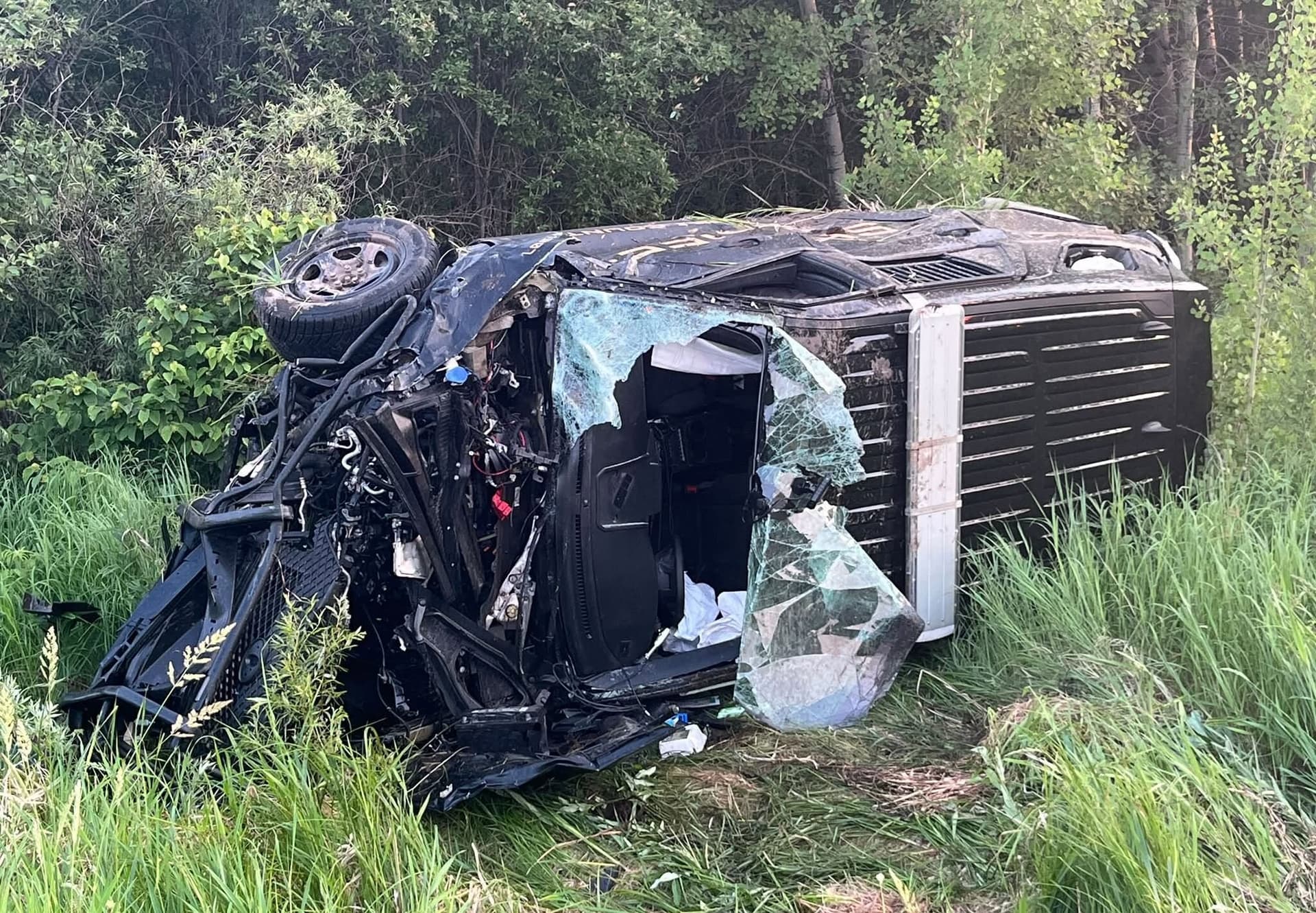
The scale of the flooding was already clear in the hardest-hit communities. Cook and Biwabik took severe damage, while Hibbing, Chisholm, Virginia, Ely and areas near Lake Vermilion also saw serious impacts. Some parts of the county received between 7 and 10 inches of rain in just a few hours, and early damage estimates were already at about $50 million and climbing. County officials said it was the worst disaster St. Louis County had seen since 2012.
The road situation changed quickly. County officials later reported that 18 roads that had been closed the day before were reopened, while 18 more newly closed as water levels rose in other areas. North Arm Road and Mud Creek Road were temporarily repaired and were expected to reopen by the evening of June 21. St. Louis County Public Works, which maintains about 3,000 miles of roads and 600 bridges, was left trying to push repairs across a network too large to absorb many failures at once.


County staff also created an online flood resource page with a road-closure map, a property-damage reporting form and safety guidance for flooded wells and septic systems. MnDOT warns that motorists must not drive around barricades or into flooded areas, where even shallow water can carry away a vehicle, and violators can be fined up to $1,000 and face 90 days in jail. For residents trying to get through the northern third of the county, the closure map has become as important as the weather forecast.
This article was produced by Prism’s automated news system from verified source data, official records, and press releases, then run through automated quality and moderation checks before publishing. The system is built and supervised by the people who set the standards it runs under. Read our full AI policy.
Did this article answer your question?