St. Louis County Outdoor Guide: Parks, Trails and Water Access for All
St. Louis County holds more than 300 miles of shoreline trails, free lakefront paths, and mine-pit paddling spots most Duluth-area residents have never tried.
Few Minnesota counties pack as much outdoor variety into a single boundary as St. Louis County. From the Lake Superior shoreline rising into the volcanic ridgeline of the North Shore, to the mine-pit lakes of the Iron Range and the deep boreal corridors edging toward the Boundary Waters, the county functions as a free-range recreation system most residents only partially use. Here is a practical, place-specific breakdown of what is out there, what it costs, and how to avoid the friction points that turn a good outing into a frustrating one.
Jay Cooke State Park: The South Duluth Anchor
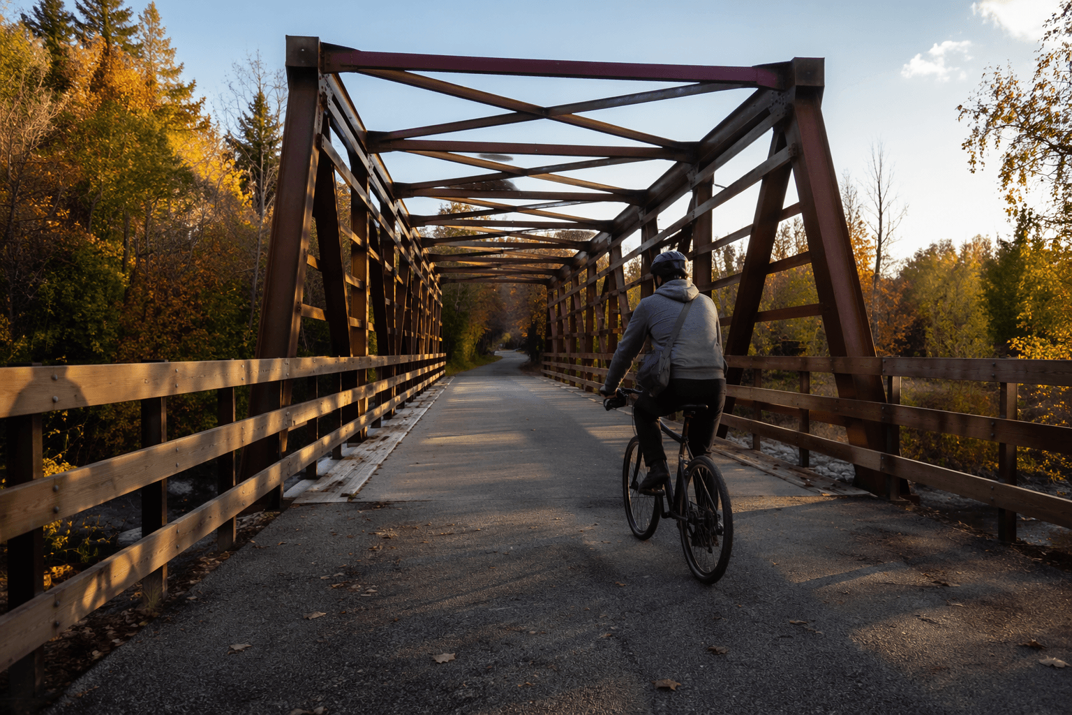
Located just south of Duluth near Carlton, Jay Cooke State Park is the region's most accessible introduction to genuine rugged terrain. The park's signature experience is the swinging suspension bridge over the St. Louis River gorge, where the river drops through a series of slate ledges before widening into its 12,000-acre estuary, North America's largest freshwater estuary. The Carlton Trail follows the river's south bank and connects to a broader network suited to hikers, horseback riders, mountain bikers, and cross-country skiers. The Willard Munger State Trail, which runs through the park's northern edge, is one of Minnesota's premier multi-use paved trails and draws cyclists touring between Duluth and Hinckley.
Day-use fee: $7 per vehicle. No annual Minnesota State Parks sticker is needed if you pay at the entrance, but frequent visitors to any state park in the system will save money with the annual vehicle permit. Spring melt is the biggest practical hazard here; the St. Louis River can rise dramatically in April and May, and some trails close or become dangerously slick. Check the Minnesota DNR state parks page before driving down.
The Superior Hiking Trail: 300-Plus Miles, 50-Plus Entry Points
The Superior Hiking Trail (SHT) is the county's most significant long-distance asset. The trail runs more than 300 miles along the rocky ridgeline above Lake Superior, from the Wisconsin-Minnesota border north toward the Canadian border, and it can be accessed from more than 50 trailheads, including multiple entry points inside Duluth, near Two Harbors, and throughout the North Shore state parks. The trail is built and maintained by the Superior Hiking Trail Association, a private nonprofit based in Two Harbors.
For weekend planners, the flexibility is the point. Day hikers can tackle a 4-mile ridge loop near Duluth without a permit or fee; thru-hikers can string together sections using 94 shared backcountry campsites spaced roughly every 5 to 8 miles outside the Duluth metro. Those campsites require no reservations, charge no fees, and are first-come, first-served; water is accessible at most sites but must be filtered. Note that the Martin Road Trailhead, a popular Duluth-area starting point, closes seasonally during spring thaw, so verify current status on the SHTA website before parking overnight.
Cell service is unreliable to nonexistent along much of the ridgeline, particularly between Two Harbors and Silver Bay. Download your GPS route before leaving pavement.
Duluth's Urban Trails: Lakewalk, Enger Park, and Spirit Mountain
Not every good trail requires a drive. Duluth's Lakewalk stretches nearly eight miles of paved pedestrian and bicycle trail from Canal Park to Brighton Beach at Kitchi Gammi Park, most of it running directly along the Lake Superior shore. Originally opened in 1986 as a half-mile path and expanded incrementally with support from the Friends of the Lakewalk, it is now the county's most ADA-accessible waterfront route and one of the most genuinely scenic urban paths in the upper Midwest. Parking is available at Canal Park, and the corridor connects to the Aerial Lift Bridge, the working ship canal, and a dense cluster of Canal Park restaurants and shops that benefit directly from trail foot traffic.
Enger Park, perched above the western hillside neighborhoods, offers a different vantage: the historic Enger Tower provides panoramic views of Duluth, the harbor, and the Wisconsin shoreline across the bay. The park is free to access and functions as a quiet alternative to the busier Lakewalk corridor.
Spirit Mountain, also on Duluth's western edge, has evolved well beyond its ski-hill identity. The off-road cycling infrastructure now includes a 2-mile adaptive equipment-accessible mountain bike loop, a Blue Jump Line for intermediate riders, and nine technical trail features including rollers and elevated skinnies. One-way directional routing on the bike trails reduces conflict between skill levels. Seasonal lift-accessed activities extend the venue's calendar beyond winter. Parking and lift fees apply depending on the activity; check the Spirit Mountain website for current rates and event closures before heading out.
Iron Range Lakes and the Mine-Pit Surprise
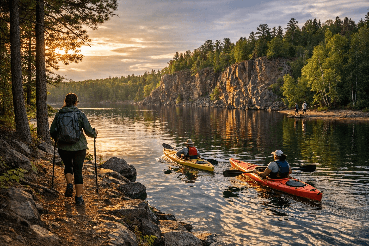
The Iron Range portion of St. Louis County is underused by Duluth-area residents and genuinely surprising to first-time visitors. The former open-pit iron mines, now filled with glacial spring water, produce lakes so clear and so intensely blue that the comparison to the Aegean is not entirely ironic. Redhead Mountain Recreation Area near Chisholm is the most developed of these venues, offering canoe and kayak rentals through the adjacent Minnesota Discovery Center. The Discovery Center is itself worth the stop as a regional history resource.
Beyond the mine pits, the Iron Range's county parks and state recreation areas provide the bulk of publicly accessible fishing water in the northern half of St. Louis County. Boat launch ramps on lakes holding walleye, northern pike, smallmouth bass, and panfish are distributed across the area; many launches are free or low-cost, though parking rules and seasonal hours vary by site. Confirm launch conditions and any posted parking limits with the managing agency before trailering a boat. Snowmobile and ATV designated corridors cover extensive ground in this region in winter; verify current trail status and corridor boundaries through the DNR or St. Louis County's official parks pages, as grooming schedules shift with snowpack.
Water Access, Permits, and the Rules Worth Knowing
Minnesota's boat registration requirements and mandatory life jacket rules apply at every public water access point in the county, including the informal shoreline pullouts along the St. Louis River corridor where restoration work is ongoing. Several North Shore access points have limited parking and no turnaround room for large trailers; check satellite views before arriving with a full-size rig.
For anyone venturing into the deep forest corridors adjacent to the Boundary Waters Canoe Area Wilderness, entry points require advance permits during the quota season, available through the USDA Forest Service's reservation system. Permit demand for popular entry points fills weeks in advance. The BWCA's interior has essentially no cell coverage; carry a satellite communicator and leave a detailed float plan, including expected return date and entry point, with someone at home.
Burn restrictions in St. Louis County can change within 24 to 48 hours during spring dry-out periods. The Minnesota DNR and St. Louis County emergency management pages post current fire restrictions; check them the morning of any backcountry trip.
Nearby Small Towns and Business Corridors
Each of these destinations feeds a local economy worth noting:
- Carlton and Wrenshall benefit from Jay Cooke State Park traffic, with a small cluster of outfitters and lodging on Highway 210.
- Two Harbors anchors the mid-North Shore economy and serves as the logical supply stop for SHT section hikers; its main street holds gear shops, a well-regarded brewpub, and short-term rental options.
- Canal Park in Duluth is the county's highest-traffic commercial corridor tied directly to outdoor recreation, with dozens of restaurants, outfitters, and lodging options within walking distance of the Lakewalk.
- Chisholm and Hibbing on the Iron Range serve Redhead-area visitors and are the closest full-service towns for fuel, groceries, and lodging.
Planning Resources and Emergency Contacts
For trail conditions, grooming reports, and water access updates, use the Minnesota DNR's state parks and trails pages, the Superior Hiking Trail Association's website, and Visit Duluth's event calendar for current closures and special permits. For emergencies on any trail in St. Louis County, call 911. Non-emergency ranger or land management questions go to the managing agency for the specific park or, for unincorporated county lands, to the St. Louis County Sheriff's Office.
Spring in northeastern Minnesota moves fast and unevenly. A trailhead that was snow-covered one weekend can be open and muddy the next, and flooded the one after that. The infrastructure is here; the conditions just require checking before you leave the driveway.
This article was produced by Prism’s automated news system from verified source data, official records, and press releases, then run through automated quality and moderation checks before publishing. The system is built and supervised by the people who set the standards it runs under. Read our full AI policy.
Did this article answer your question?