Southampton Pine Barrens wildfire plan follows Westhampton Pines fire lessons
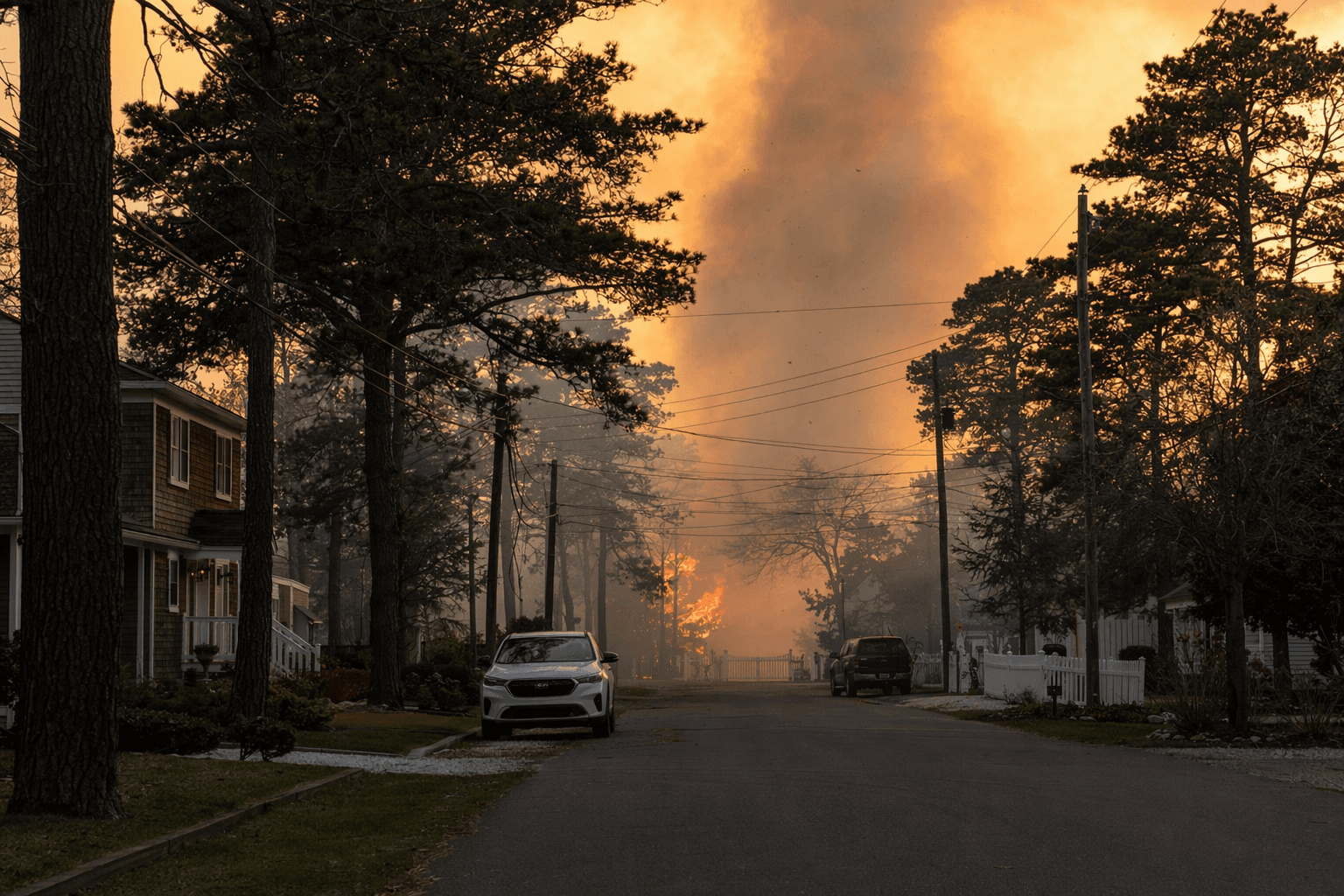
Embers from the Westhampton Pines fire pushed through East Moriches, Eastport and Westhampton, and that lesson is now driving a new Pine Barrens wildfire plan.
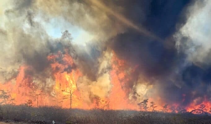
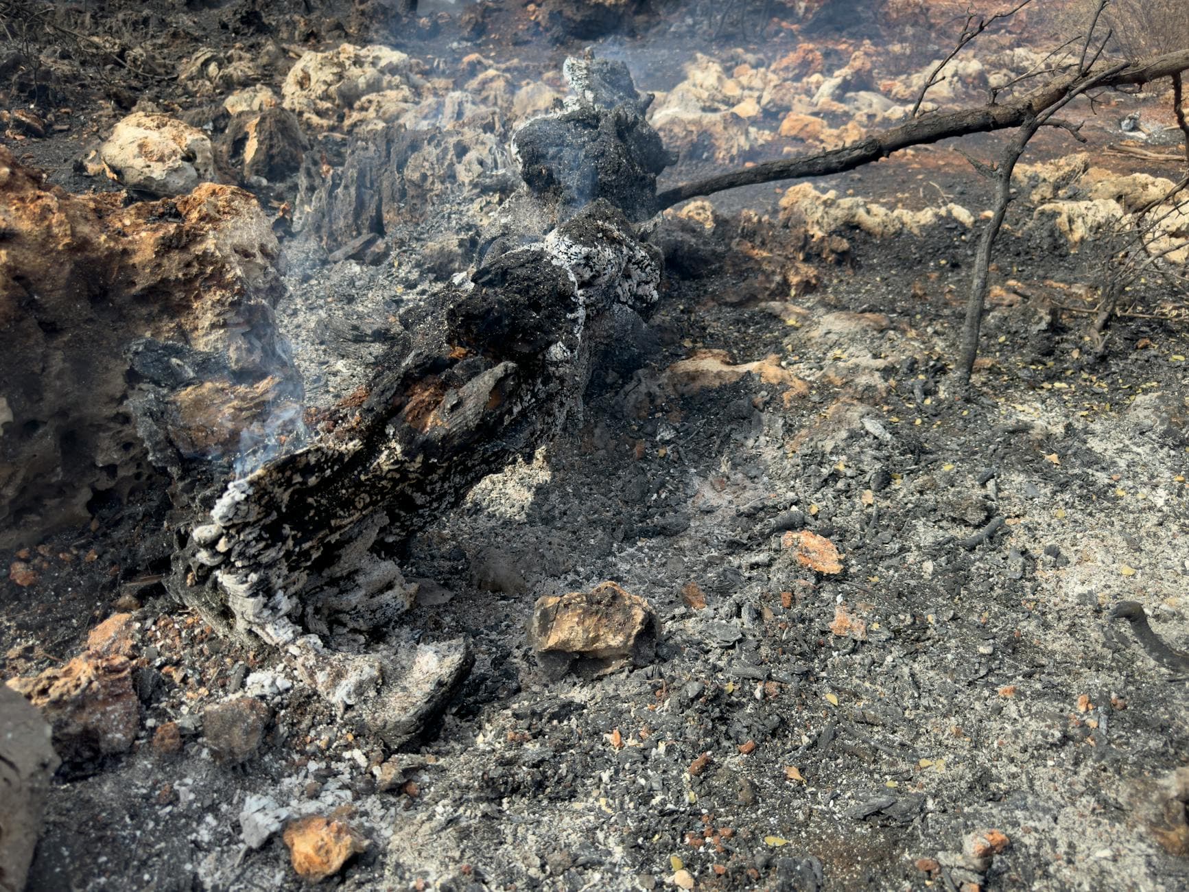
A backyard s’mores attempt in Manorville turned into the March 2025 Westhampton Pines fire, and the blaze’s spread through East Moriches, Eastport and Westhampton is now shaping how Southampton and the Central Pine Barrens prepare for the next one.
The new Community Wildfire Protection Plan covers about 29,000 acres from Eastport to Squiretown Road in Hampton Bays, stretching north to Riverside and Flanders and bounded on the south by Montauk Highway. That footprint puts homes, wooded lots and protected land side by side across a wide swath of central and western Suffolk, where a single fast-moving fire can threaten evacuation routes, smoke conditions and emergency access as much as it does structures.
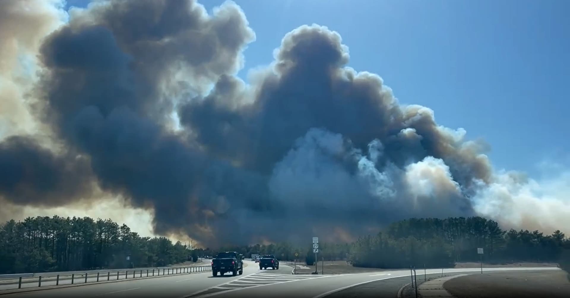
The Central Pine Barrens Joint Planning and Policy Commission said the effort grew out of lessons from the 600-acre Westhampton Pines fire and other recent wildfire scares. The commission says the region’s fire-dependent ecosystems have become more dangerous because decades of suppression allowed fuel to build up, while development into wooded land has created a wildland-urban interface where fires hit people hardest. Suffolk County already sees more than 800 brush fires a year on average during spring and summer.
Residents got their first look at the plan at an open house May 5 at the Flanders Community Center, where SWCA Environmental Consultants led small-group discussions and used idea boards to gather public input for the 2027 Southampton Pine Barrens CWPP. The commission’s public materials also pointed residents to a survey tied to the same plan, signaling that the document is still being shaped before it is finalized. Officials discussed how communities identify wildfire risk, reduce fuel loads and make homes less likely to ignite, a practical focus for neighborhoods where wooded lots sit close to driveways, roads and fire districts.
The project has financial backing from a $185,000 U.S. Forest Service Community Wildfire Defense Grant, and commission materials say it will be integrated with the existing Comprehensive Prescribed Fire Management Plan for the Central Pine Barrens. The wider fire-management strategy divides the 106,000-acre preserve into five units, giving fire officials a framework for both prescribed burning and emergency response.
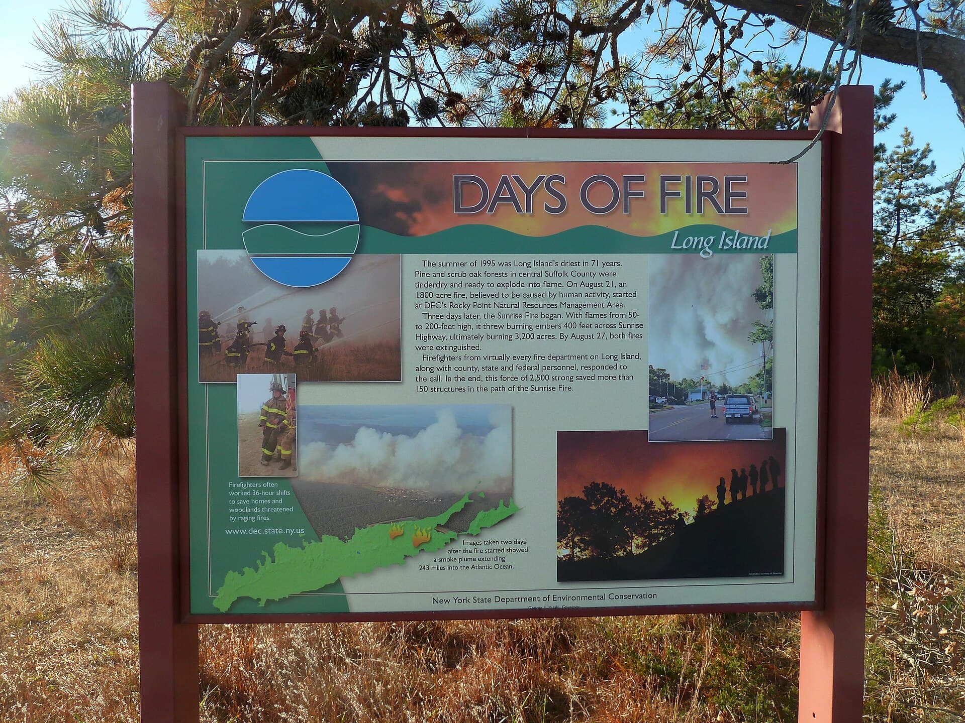
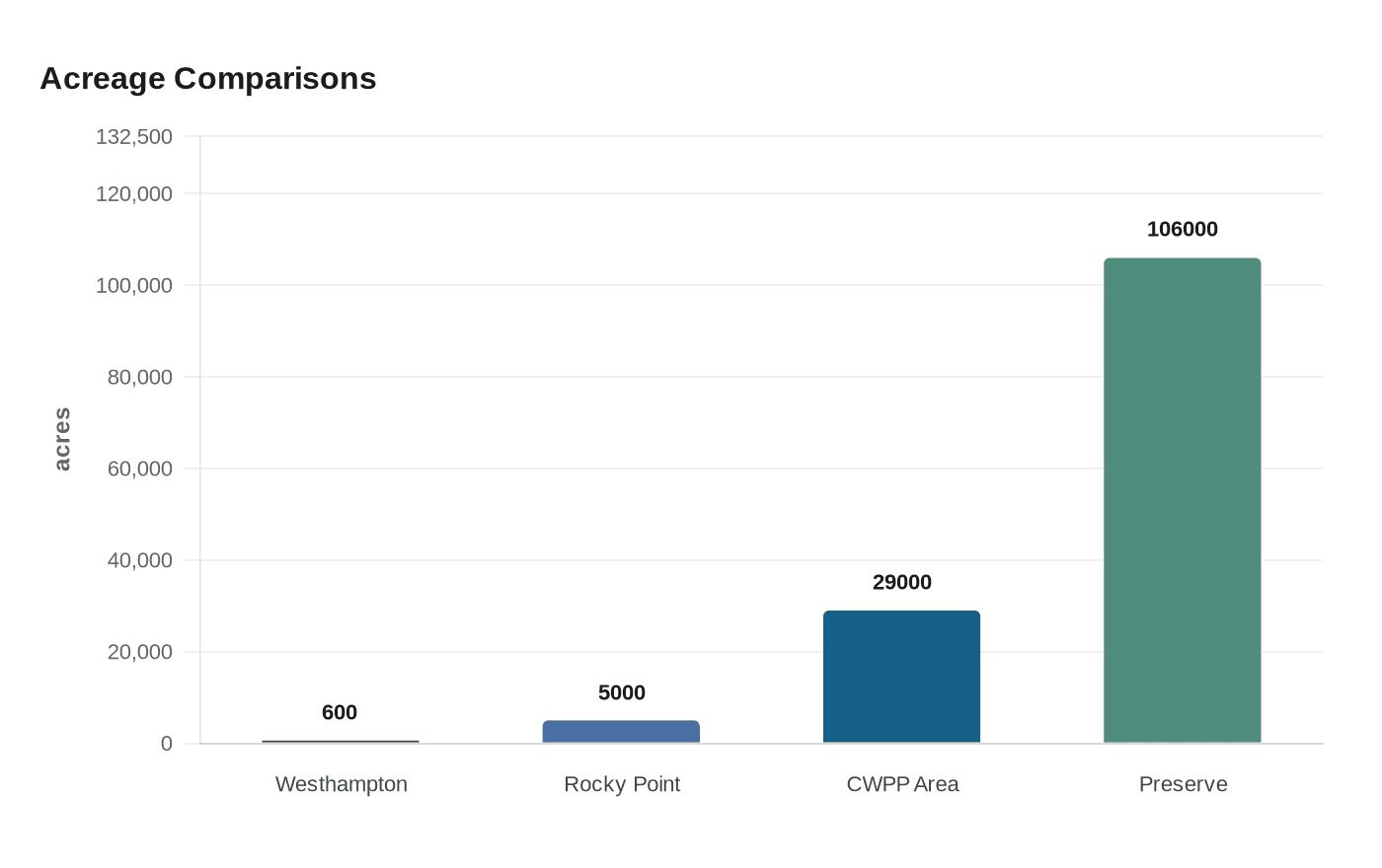
The stakes are not abstract. The commission says the 1995 Rocky Point and Sunrise fires burned more than 5,000 acres, triggered evacuations, shut down transportation and caused property and economic losses. Those fires led to the creation of the Wildfire Task Force, now a 41-agency network of land managers, firefighters and emergency responders. After the March 2025 fire, Governor Kathy Hochul ordered an immediate burn ban for Long Island, New York City and parts of the Hudson Valley, underscoring how quickly drought, wind and dry fuel can turn a small spark into a countywide hazard.
This article was produced by Prism’s automated news system from verified source data, official records, and press releases, then run through automated quality and moderation checks before publishing. The system is built and supervised by the people who set the standards it runs under. Read our full AI policy.
Did this article answer your question?